Wallabout Bay and the farming community in 1766 [19??]
Map No. B A-1766 (19--?).Fl
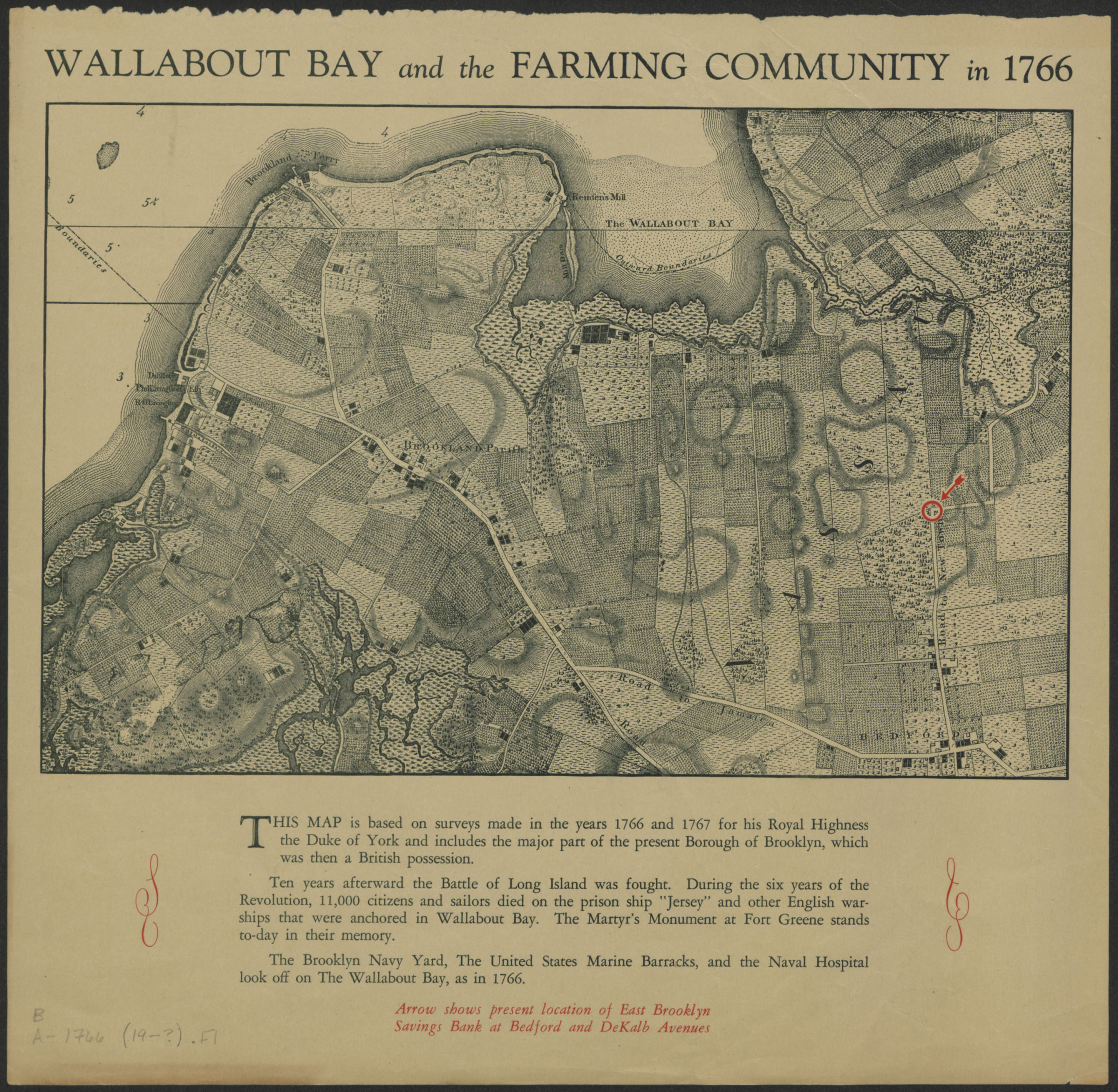
Covers Brooklyn north from Red Hook to Wallabout Bay and east to the Road to Newtown. Shows roads, landscape details, and the modern-day location of the East Brooklyn Savings Bank at Bedford and DeKalb Aves. Relief shown by hachures. Depths shown by soundings. “This map is based on surveys made in the years 1766 and 1767 …” Includes text.
Map area shown
Genre
Historical mapsRelation
Full catalog recordSize
19 × 29 cmDownload
Low Resolution Image
Creator
Ratzer, Bernard; East Brooklyn Savings Bank,Publisher
Brooklyn Historical SocietyCitation
Wallabout Bay and the farming community in 1766; [19??], Map Collection, B A-1766 (19--?).Fl; Brooklyn Historical Society.Scale
Scale not givenLoading zoom image... 