Wallabout Channel, New York Harbor, surveyed in pursuance of joint resolution of Congress approved June 16, 1898: under direction of Major H. M. Adams, Corps of Engineers, U.S.A. by J. A. Yates, surveyor 1898
Map No. B A-1898a.Fl
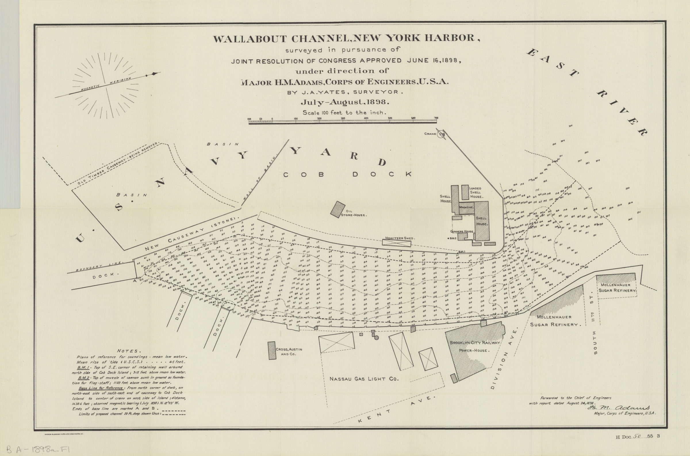
Bathymetric map shows Wallabout Channel. Map also shows some docks, a portion of the Brooklyn Navy Yard including some buildings, businesses, and causeways. Depth shown by soundings and isolines. Oriented with north to the right. “Forwarded to the Chief of Engineers with report dated April 24, 1898.” “H DOC 50 55 3”–lower right. Businesses shown: Cross, Austin and Co., Nassau Gas Light Co., Brooklyn City Railway Power House, and the Mollenhauer Sugar Refinery.
Map area shown
Genre
Bathymetric mapsRelation
Full catalog recordSize
36 × 55 cmDownload
Low Resolution Image
Creator
Yates, J. A.,Publisher
Brooklyn Historical SocietyCitation
Wallabout Channel, New York Harbor, surveyed in pursuance of joint resolution of Congress approved June 16, 1898: under direction of Major H. M. Adams, Corps of Engineers, U.S.A. by J. A. Yates, surveyor; 1898, Map Collection, B A-1898a.Fl; Brooklyn Historical Society.Scale
Scale 1:1200. 1 in to 100Loading zoom image... 