
Water shed of the Croton River April 1886
Map No. NYS-1886.Fl
Covers the Croton River Watershed north from approximately Quaker Bridge to Black Pond and east to the Connecticut border. Shows exisiting reservoirs, reservoirs to be built, proposed reservoirs, and proposed reservoir sites of 1858. Also shows dams, rivers, brooks, ponds, bridges, the line of the new aqueduct, county boundaries, and railroads. Relief shown by spot heights. Includes text and index.
Map area shown
Genre
Thematic mapsRelation
Full catalog recordSize
40 × 30 cmDownload
Low Resolution Image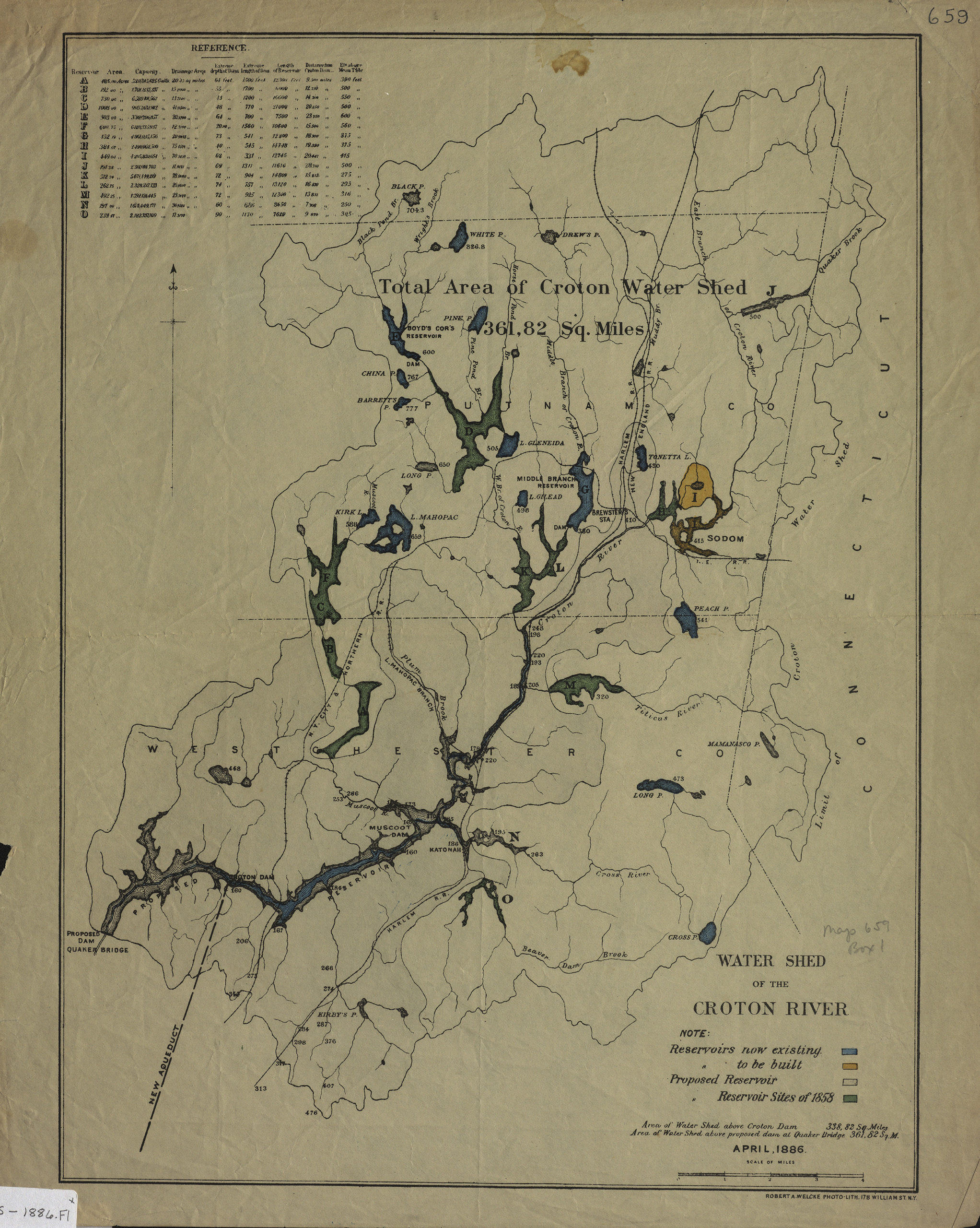
Creator
Welcke, Robert A.,Publisher
Brooklyn Historical SocietyCitation
Water shed of the Croton River; April 1886, Map Collection, NYS-1886.Fl; Brooklyn Historical Society.Scale
Scale [ca. 1:98,903]Loading zoom image... 