
Watson’s guide map to popular resorts around New York [ca. 1880]
Map No. NYC-1880.Fl
Covers the entirety of New York City as well as New Jersey north from Asbury Park to Blauveltville. Also covers Long Island east to Cold Spring and Westchester County north to Irvington. Shows political divisions, resorts and attractions, railroads, and ferry lines. Relief shown by hachures. “Copyright 1880 by Gaylord Watson.” “Special editions of this Map or parts of it supplied as desired.” “Deane Street Pump Co., 92–94 Liberty St., N.Y.” Includes advertisements on verso. Advertisements on verso of BHS copy partly obscured by linen backing.
Map area shown
Genre
Tourist mapsRelation
Full catalog recordSize
34 × 55 cmDownload
Low Resolution Image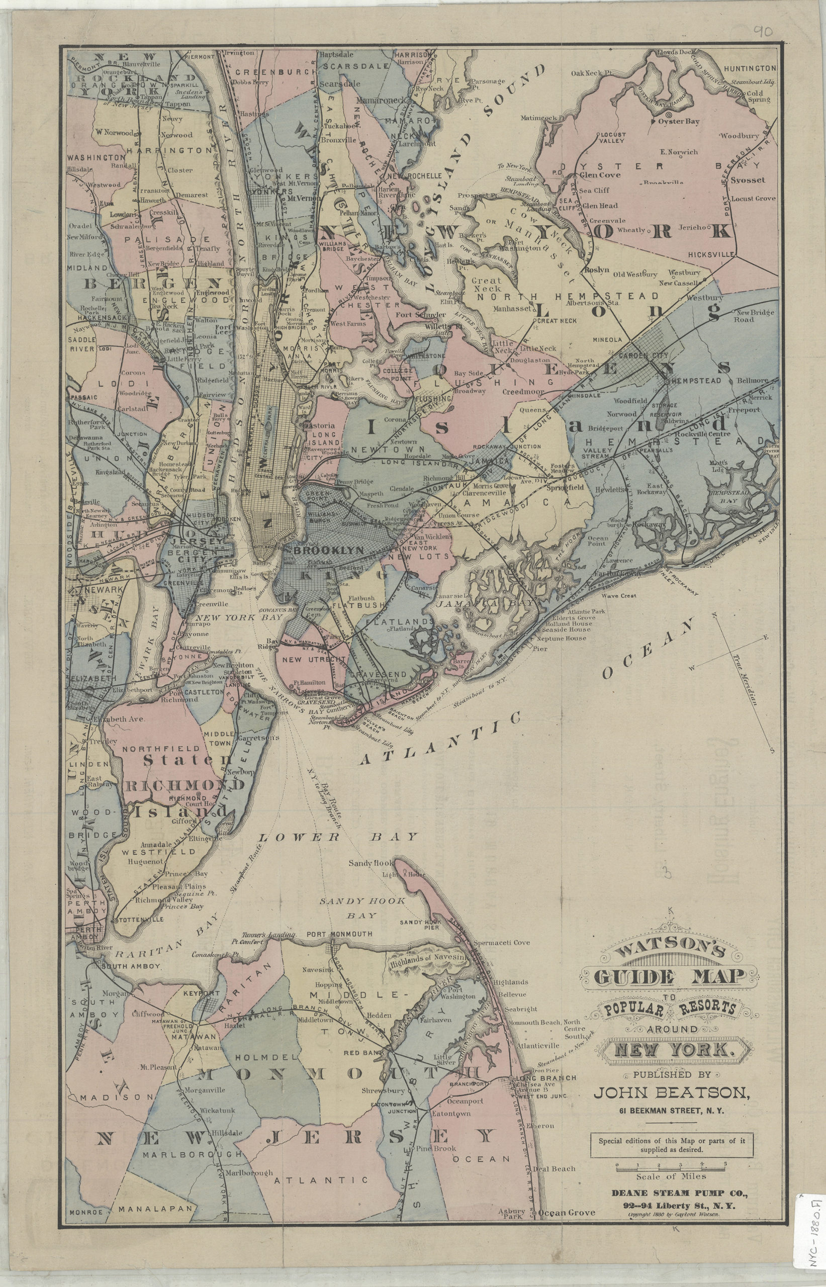
Creator
Watson, Gaylord,Publisher
Brooklyn Historical SocietyCitation
Watson’s guide map to popular resorts around New York; [ca. 1880], Map Collection, NYC-1880.Fl; Brooklyn Historical Society.Scale
Scale [ca. 1:158,400]Loading zoom image... 