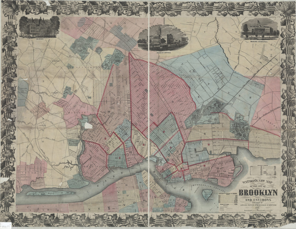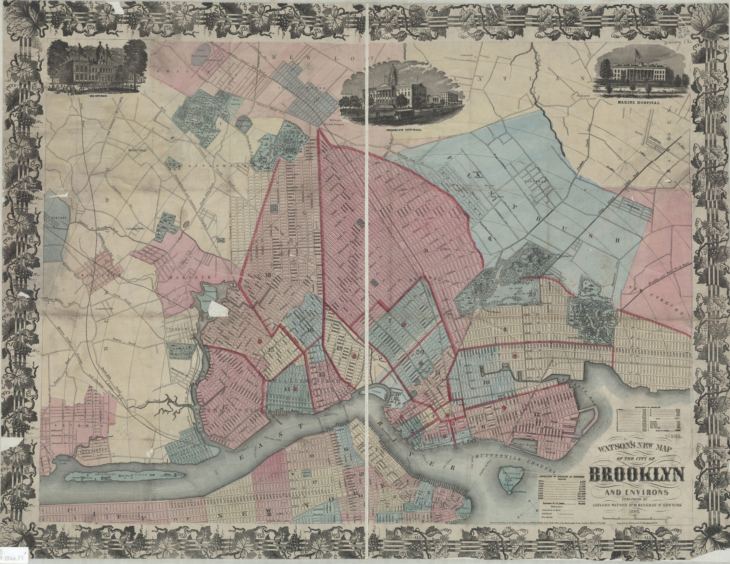
Watson’s new map of the city of Brooklyn and environs 1866; [ca. 1858]
Map No. B A-1866.Fl
Covers Brooklyn south to 60th St., north to Green Point, and east to the Cemetery of the Evergreens. Also shows portions of Flatbush, New Utrecht, Flatlands, New Lots, Gravesend, southern Queens and Lower Manhattan. Shows wards, ferry lines, and distances from City Hall [modernly known as Borough Hall]. Brooklyn wards outlined in red. Oriented with north to the lower left. “Entered according to Act of Congress in the year 1858 by H. Phelps in the Clerks Office of the District Court for the Southern district of New York.” Includes titled ill., decorative border, key, and Brooklyn population statistics. Titled ill.: The City-Hall — Brooklyn City-Hall — Marine Hospital.
Map area shown
Genre
Statistical mapsRelation
Full catalog recordSize
55 × 74 cmDownload
Low Resolution Image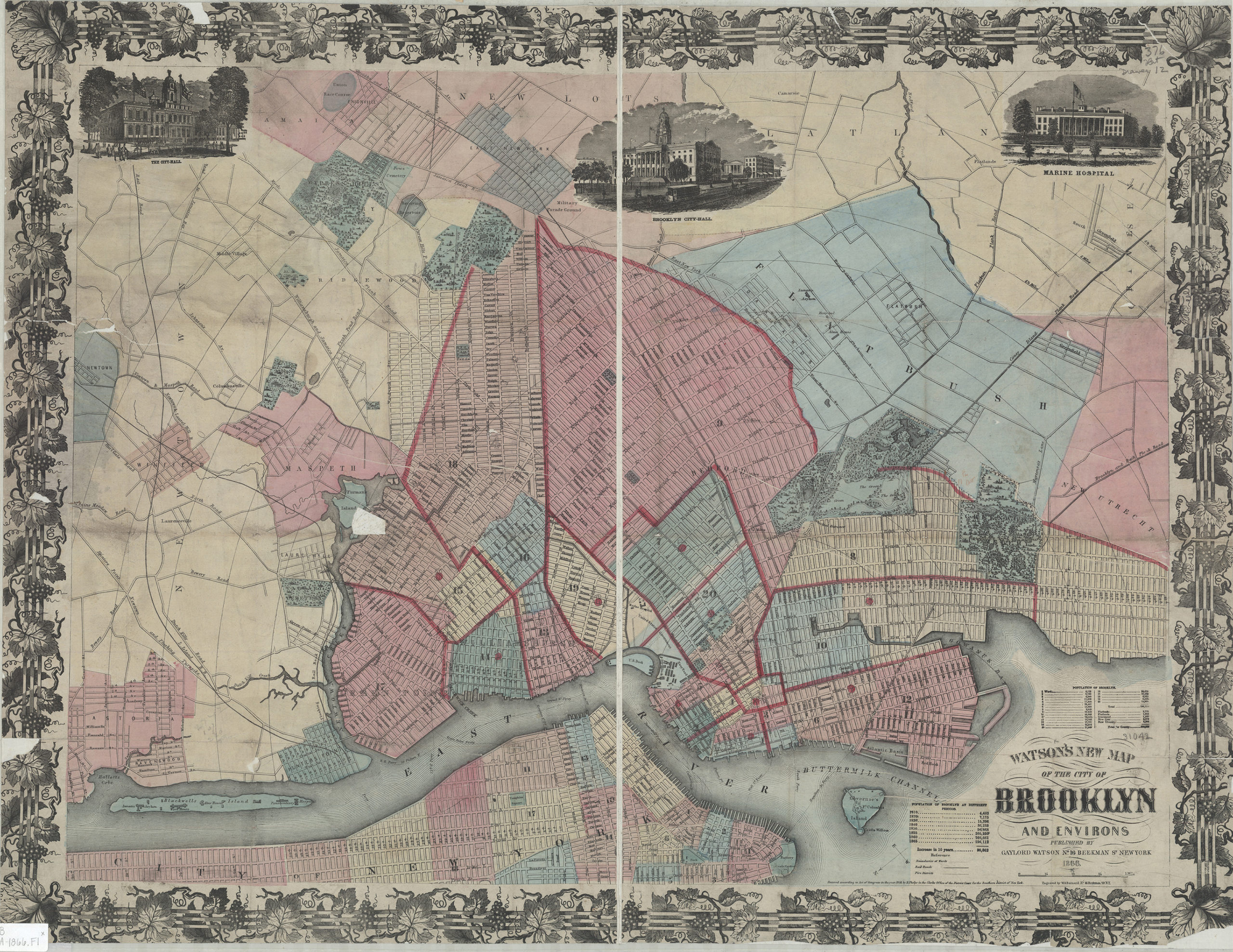
Creator
Watson, Gaylord,Publisher
Brooklyn Historical SocietyCitation
Watson’s new map of the city of Brooklyn and environs; 1866; [ca. 1858], Map Collection, B A-1866.Fl; Brooklyn Historical Society.Scale
Scale [ca. 1:21,602]Loading zoom image...