
Who lives where: cartography by Guenter Vollath & George Colbert ; [text by] Richard F. Shepard 1985
Map No. NYC-1985.Fl
Covers Manhattan, the Bronx, Brooklyn, Queens and Staten Island. Shows ethnic makeup of New York City neighborhoods. Extracted from: The world of New York / The New York Times. Nov. 3, 1985. p. 30-[31]. Oriented with north toward the upper right. “Staten Island is shown at reduced scale.” “Sources: 1980 U.S. Census and the New York City Department of City Planning.” Includes key. Unrelated text and col. ill. on verso.
Map area shown
Genre
Thematic mapsRelation
Full catalog recordSize
32 × 52 cmDownload
Low Resolution Image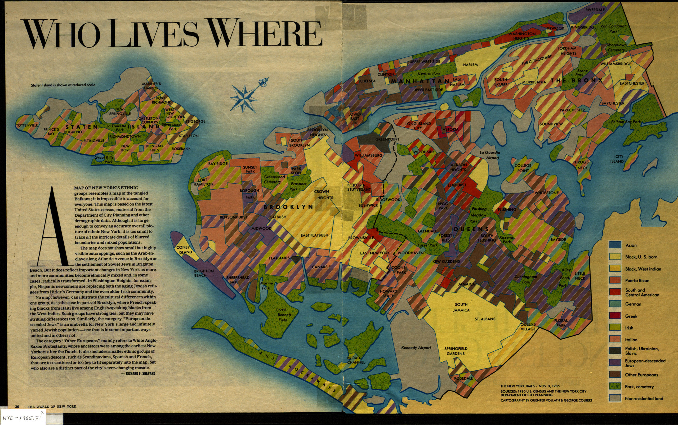
Creator
Vollath, Guenter,Publisher
Brooklyn Historical SocietyCitation
Who lives where: cartography by Guenter Vollath & George Colbert ; [text by] Richard F. Shepard; 1985, Map Collection, NYC-1985.Fl; Brooklyn Historical Society.Scale
Scale not givenLoading zoom image... 