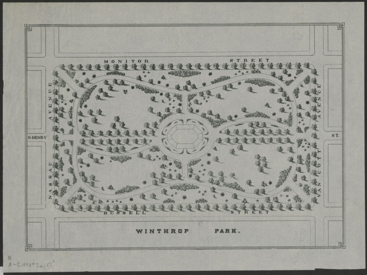
Winthrop Park [1893]
Map No. B A-[1893?]a.Fl
Shows Winthrop Park (renamed Monsignor Mcgolrick Park in 1941) and surrounding streets, including N. Henry St., Nassau Ave., Monitor St., Van Cott St., and Russell St. Place of publication and publisher based on similarities between item and the following map: Design for Bushwick Park in the city of Brooklyn. [N.Y.?] : Dept. of Parks, Jan. 1892. Date of publication conjectured from watermark. Watermark: Crane & Co. Dalton Mass. 1893 Bond No. 16. Includes ill.
Subjects
Places
Map area shown
Genre
Thematic mapsRelation
Full catalog recordSize
24 × 34 cmDownload
Low Resolution Image
Creator
New York (N.Y.).; Dept. of Parks,Publisher
Brooklyn Historical SocietyCitation
Winthrop Park; [1893], Map Collection, B A-[1893?]a.Fl; Brooklyn Historical Society.Scale
Scale [ca. 1:600]Loading zoom image...