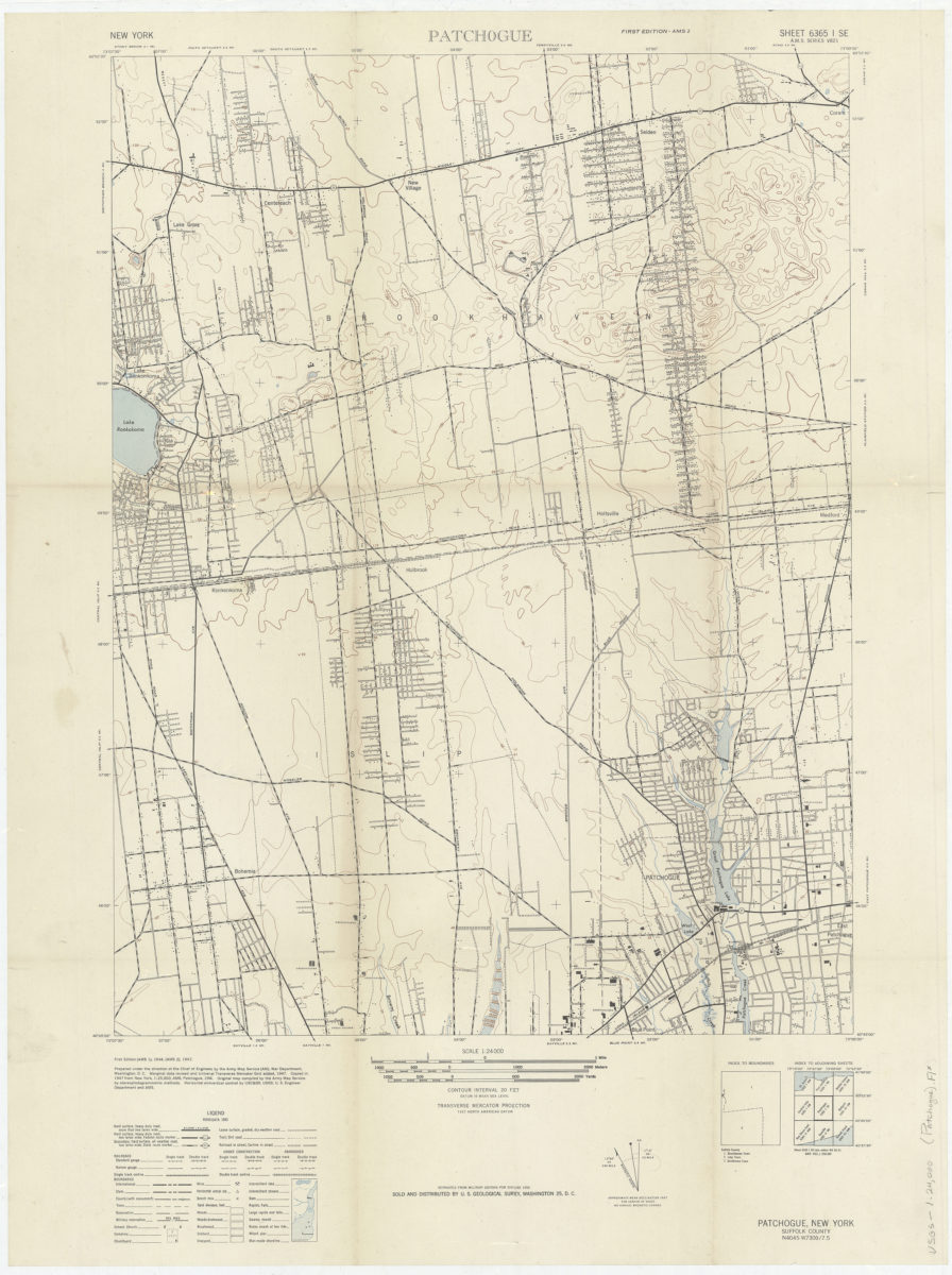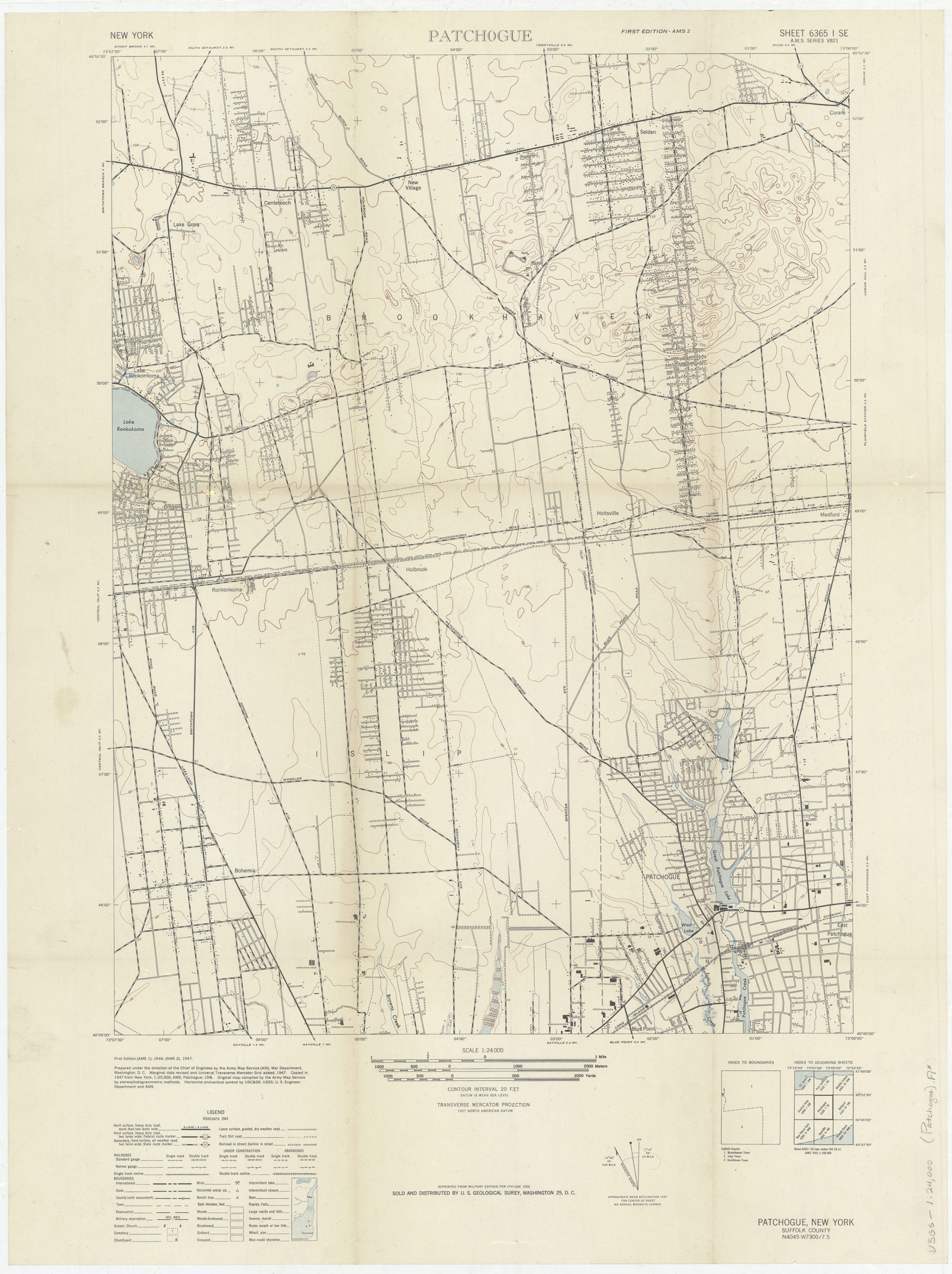
Patchogue: prepared under the direction of the Chief of Engineers by the Army Map Service (AM) 1947
Map No. USGS-1:24,000 (Patchogue).Fl
Shows portions of Brookhaven, Islip and Smithtown Townships. “Marginal data revised and Universal Transverse Mercator Grs added, 1947. Copied in 1947 from New York, 1:25,000 AMS, Patchogue, 1944.” Relief shown by contour lines and spot heights. “Reprinted from military edition for civil use, 1950. Sold and distributed by U.S. Geological Survey, Washington 25, D.C.” Includes index maps, metric conversion scales and declination diagram. “6365 I SE.”
Map area shown
Genre
Topographic mapsRelation
Full catalog recordSize
58 × 44 cmDownload
Low Resolution Image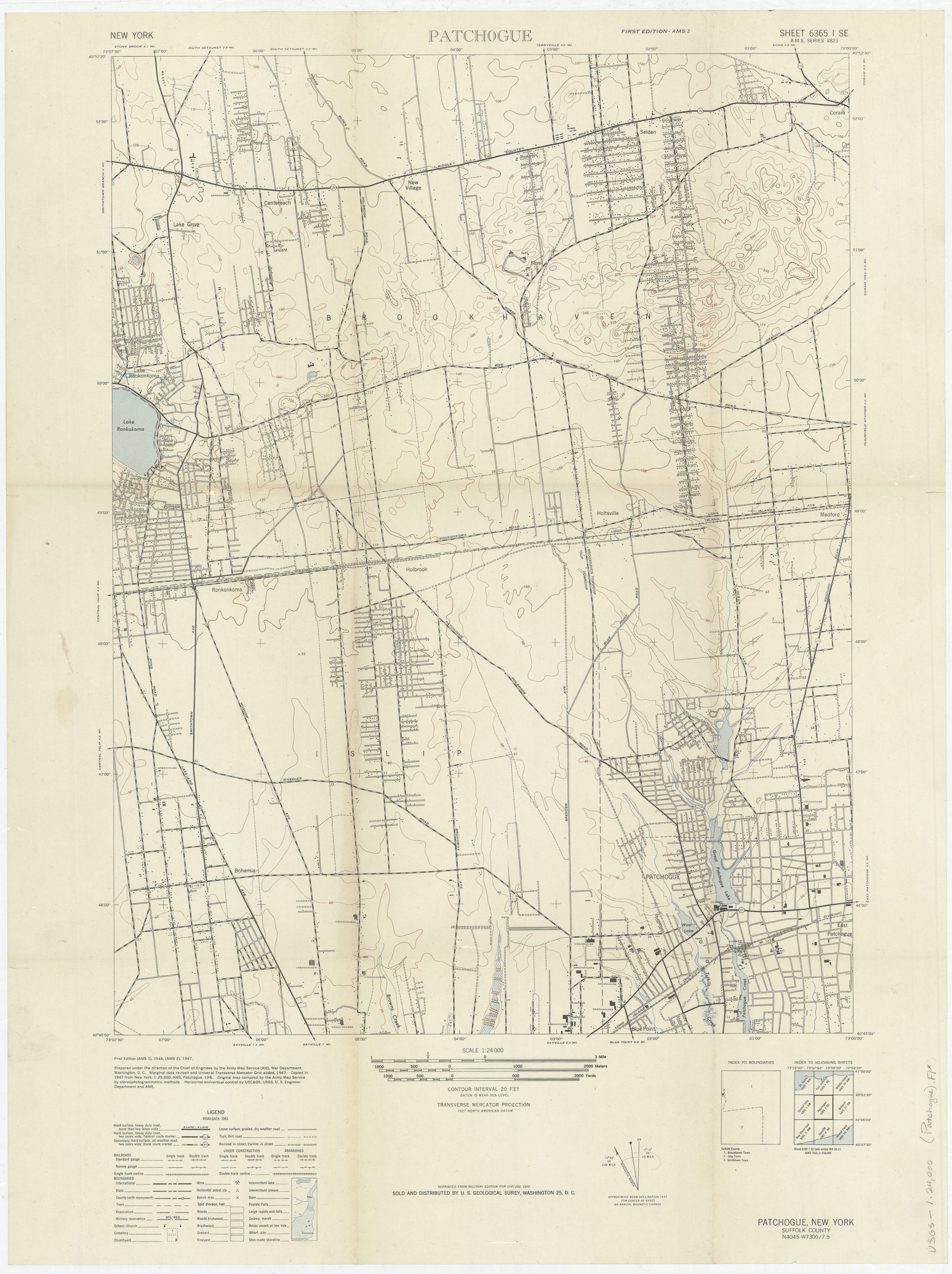
Creator
United States; Army Map Service,Publisher
Brooklyn Historical SocietyCitation
Patchogue: prepared under the direction of the Chief of Engineers by the Army Map Service (AM); 1947, Map Collection, USGS-1:24,000 (Patchogue).Fl; Brooklyn Historical Society.Scale
Scale 1:24,000Loading zoom image...