Center for Brooklyn History
Map Collections
Search
About
Othmer Library & Archives
Submit search query
Refine 4 records
Clear filter
1
Location
Babylon (N.Y. : Town)
2
Brookhaven (N.Y. : Town)
3
Huntington (N.Y.)
7
Islip (N.Y.)
5
Long Island (N.Y.)
197
Smithtown (N.Y. : Town)
4
Suffolk County (N.Y.)
43
Subject
Landowners
434
Real property
619
Roads
117
Date
19th Century
945
20th Century
469
or enter range:
from
to
Genres
Cadastral maps
597
Road maps
83
Topographic maps
70
Sort by:
Date (earliest)
Date (most recent)
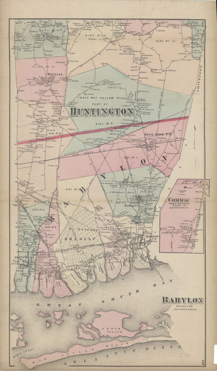
Babylon, Suffolk Co
Babylon, Suffolk Co
[1873]
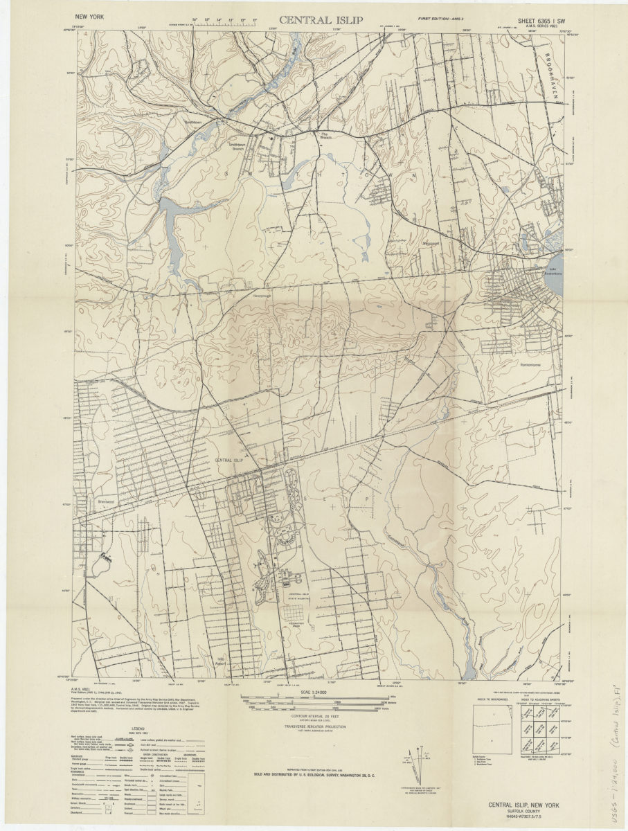
Central Islip/: prepared under the direction of the Chief of Engineers by the Army Map Service (AM)
Central Islip/: prepared under the direction of the Chief of Engineers by the Army Map Service (AM)
1947
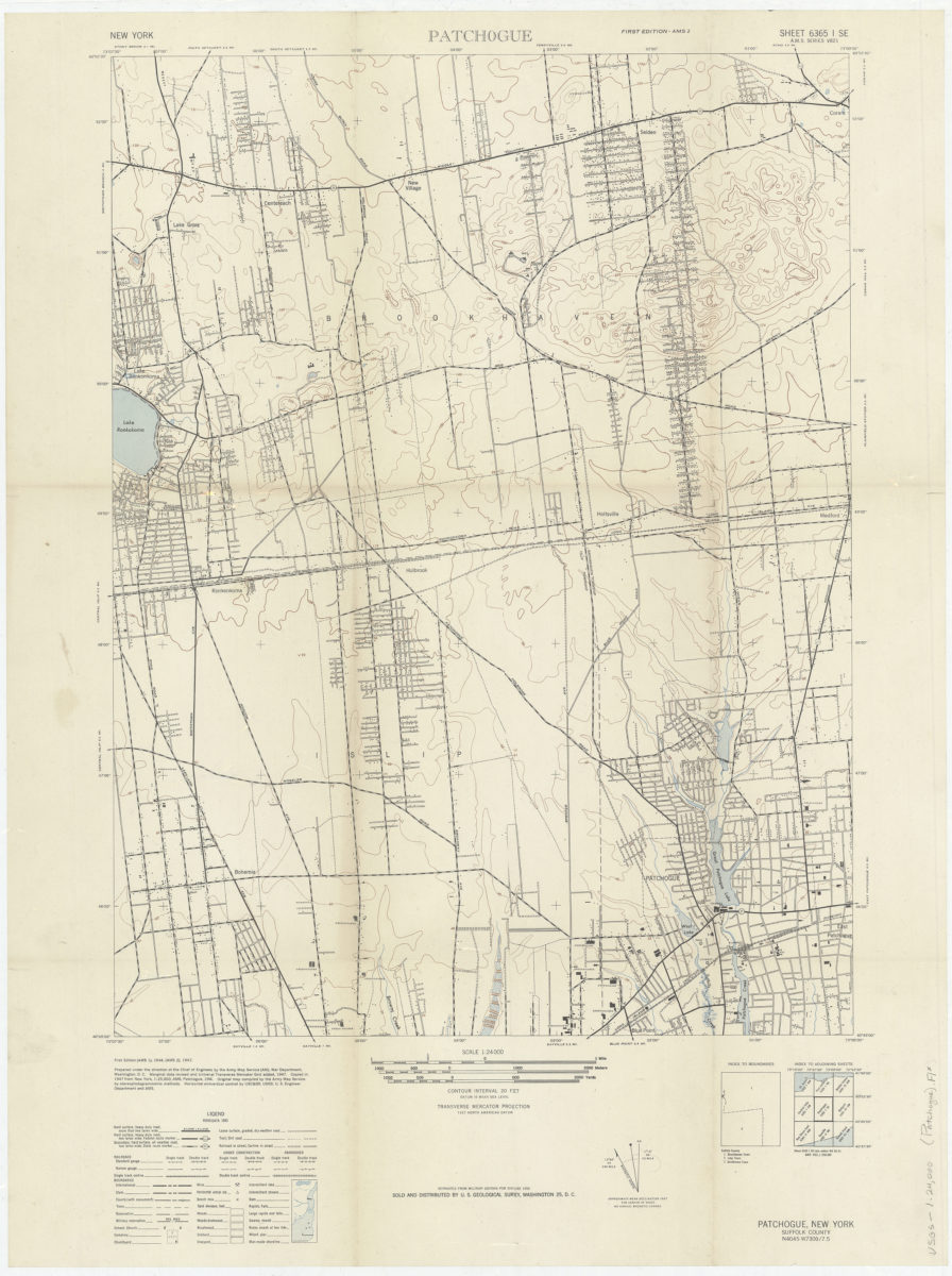
Patchogue: prepared under the direction of the Chief of Engineers by the Army Map Service (AM)
Patchogue: prepared under the direction of the Chief of Engineers by the Army Map Service (AM)
1947
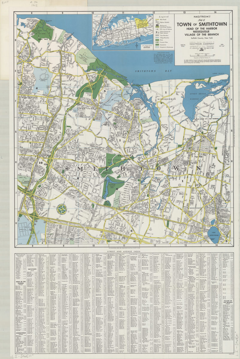
Hagstrom’s map of town of Smithtown, Head of the Harbor, Nissequgue [sic], Village of the Branch, Suffolk County, New York: compiled, printed, and published by Hagstrom Company Incorporated
Hagstrom’s map of town of Smithtown, Head of the Harbor, Nissequgue [sic], Village of the Branch, Suffolk County, New York: compiled, printed, and published by Hagstrom Company Incorporated
[1968]