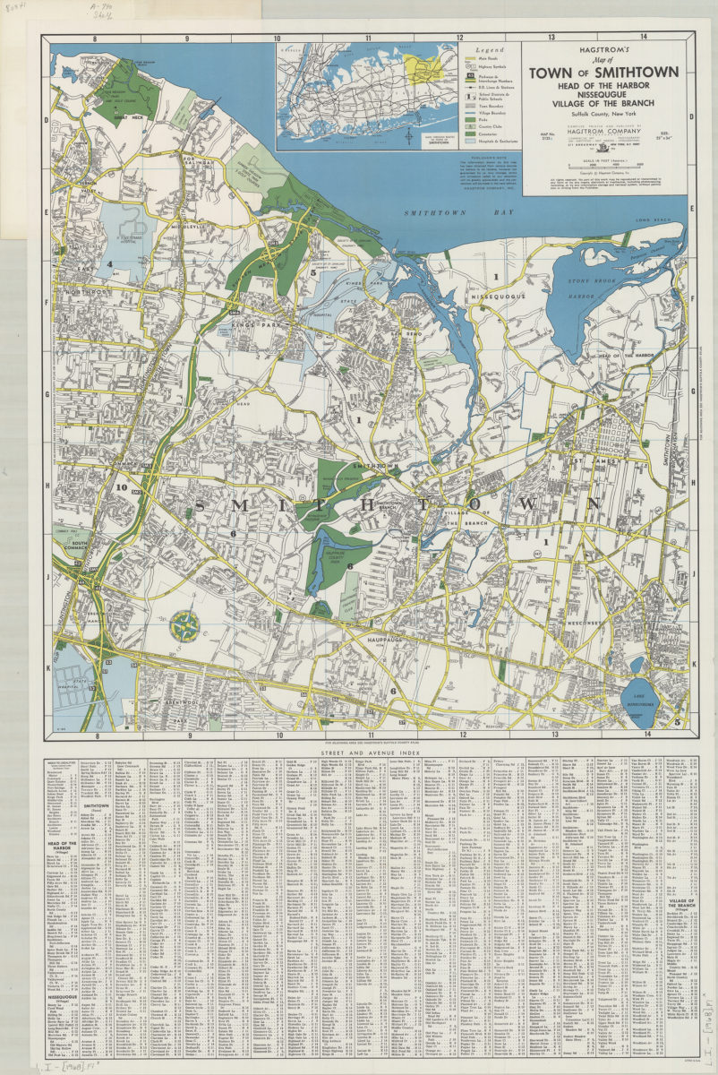
Hagstrom’s map of town of Smithtown, Head of the Harbor, Nissequgue [sic], Village of the Branch, Suffolk County, New York: compiled, printed, and published by Hagstrom Company Incorporated [1968]
Map No. L.I.-[1968].Fl
Shows railroads and stations, school districts, town and village boundaries, parks, country clubs, cemeteries, and hostpitals and sanitariums. Publication date derived from code: H-RM. Includes note, key, index, and location map. Location map: Main through routes to town of Smithtown. “Map No. 2135A.”
Map area shown
Genre
Road mapsRelation
Full catalog recordSize
86 × 57 cmDownload
Low Resolution Image
Creator
Hagstrom Company,Publisher
Brooklyn Historical SocietyCitation
Hagstrom’s map of town of Smithtown, Head of the Harbor, Nissequgue [sic], Village of the Branch, Suffolk County, New York: compiled, printed, and published by Hagstrom Company Incorporated; [1968], Map Collection, L.I.-[1968].Fl; Brooklyn Historical Society.Scale
Scale [ca. 1:32,000]Loading zoom image...