Center for Brooklyn History
Map Collections
Search
About
Othmer Library & Archives
Submit search query
Refine 197 records
Clear filter
1
Location
Babylon (N.Y. : Town)
2
Block Island (R.I. : Island)
2
Bridgehampton (N.Y.)
1
Brightwaters (N.Y.)
1
Brookhaven (N.Y. : Town)
3
Brookhaven (N.Y.)
2
Brooklyn (New York, N.Y.)
891
Cold Spring Harbor (N.Y.)
1
Connecticut
7
East Hampton (N.Y.)
1
East Patchogue (N.Y.)
1
Elmont (N.Y.)
1
Fairfield County (Conn.)
5
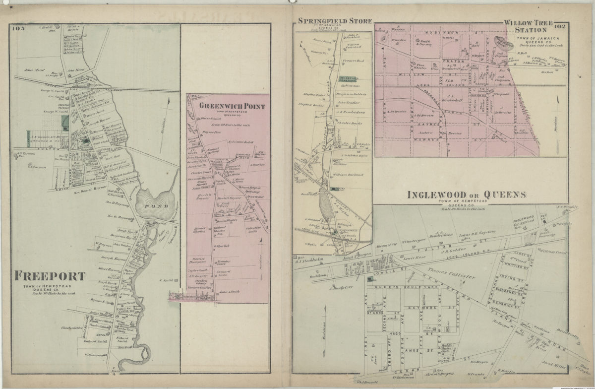
Freeport (N.Y.)
1
Glen Cove (N.Y.)
1
Great Neck (N.Y.)
3
Greenport (N.Y.)
1
Hempstead (N.Y.)
13
Hicksville (N.Y.)
1
Huntington (N.Y.)
7
Islip (N.Y.)
5
Jamaica (New York, N.Y.)
8
Lakeland (N.Y.)
1
Lawrence Beach (N.Y.)
1
Lloyd Harbor (N.Y.)
1
Long Island (N.Y.)
197
Long Island Sound (N.Y. and Conn.)
12
Manhattan (New York, N.Y.)
120
Mattituck (N.Y.)
1
Miller Place (N.Y.)
1
Mineola (N.Y.)
1
Montauk (N.Y.)
4
Napeague Bay (N.Y.)
1
Nassau County (N.Y.)
24
New Jersey
27
New York (N.Y.)
164
New York (State)
95
New York Metropolitan Area
40
North Hempstead (N.Y. : Town)
4
Northport Bay (N.Y. : Bay)
1
Noyack (N.Y.)
1
Ocean Beach (N.Y.)
1
Orient (N.Y.)
1
Oyster Bay (N.Y.)
9
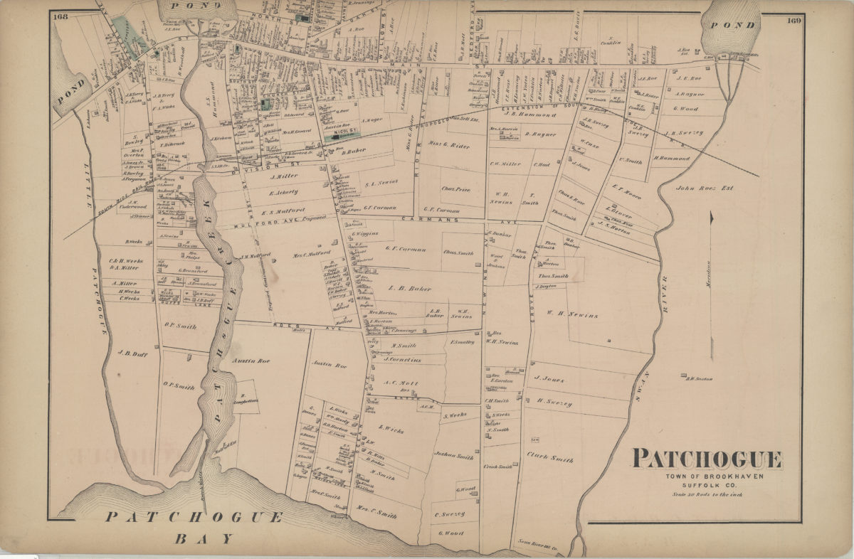
Patchogue (N.Y.)
2
Pearsalls (N.Y.)
1
Port Jefferson (N.Y.)
1
Port Washington (N.Y.)
1
Queens (New York, N.Y.)
83
Quiogue (N.Y.)
1
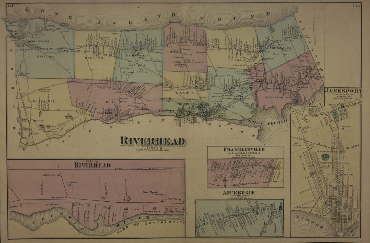
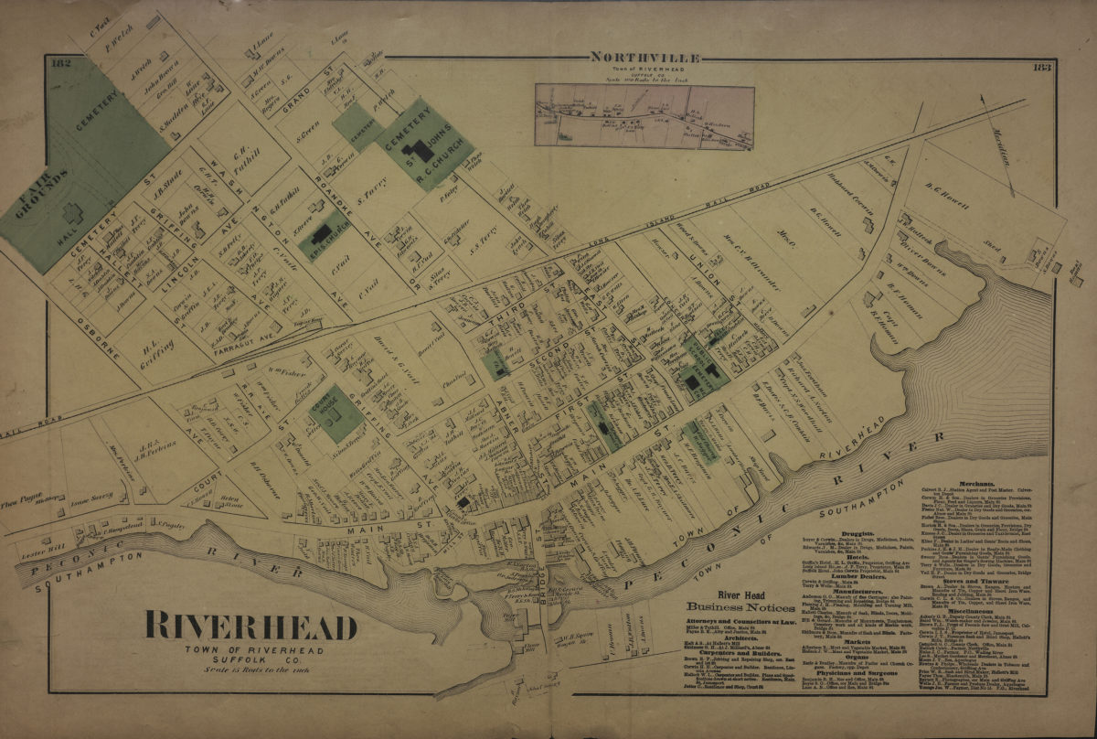
Riverhead (N.Y.)
3
Rockville Centre (N.Y.)
2
Rosevale (N.Y.)
2
Roslyn (N.Y.)
3
Roslyn Harbor (N.Y.)
1
Roslyn Highlands (N.Y.)
1
Sag Harbor (N.Y.)
2
Saltaire (N.Y.)
1
Sayville (N.Y.)
1
Sea Cliff (N.Y.)
1
Shelter Island (N.Y.)
2
Smithtown (N.Y. : Town)
4
Southampton (N.Y.)
5
Southold (N.Y.)
4
Stony Brook (N.Y.)
1
Suffolk (N.Y.)
1
Suffolk County (N.Y.)
43
United States
10
Westchester County (N.Y.)
11
Westhampton Beach (N.Y.)
1
Woodhaven (New York, N.Y.)
1
Yaphank (N.Y.)
1
Show 52 more
Subject
African Americans
1
Auctions
32
Automobile racing
1
Bays
5
Bicycle trails
17
Canals
15
Coasts
4
Country clubs
1
Election districts
36
Electric railroads
5
ferries
32
Fortification
7
Golf courses
2
Golf resorts
1
Harbors
11
Historic sites
3
Ice sheets
1
Indian land transfers
1
Indians of North America
6
Land titles
1
Landowners
434
Long Island, Battle of, New York, N.Y. , 1776
7
Names, Personal
1
Nautical charts
14
Parishes
1
Railroads
72
Real property
619
Recreation
5
Riparian rights
13
Road maps
2
Roads
117
Steamboat lines
4
Street addresses
11
Streets
46
Submerged lands
17
Trials
1
Waterworks
5
Wells
2
Yacht clubs
1
Zip codes
4
Show 20 more
Date
18th Century
12
19th Century
945
20th Century
469
21th Century
66
or enter range:
from
to
Genres
Advertisements
30
Bathymetric maps
94
Broadsides
33
Cadastral maps
597
Early maps
35
Historical maps
53
History
2
Manuscript maps
365
Map
191
Military maps
23
Nautical charts
30
Pictorial maps
38
Public utility maps
15
Road
1
Road maps
83
Statistical maps
8
Thematic maps
60
Topographic maps
70
Tourist maps
55
Transportation maps
120
Zoning maps
55
Show 1 more
Sort by:
Date (earliest)
Date (most recent)
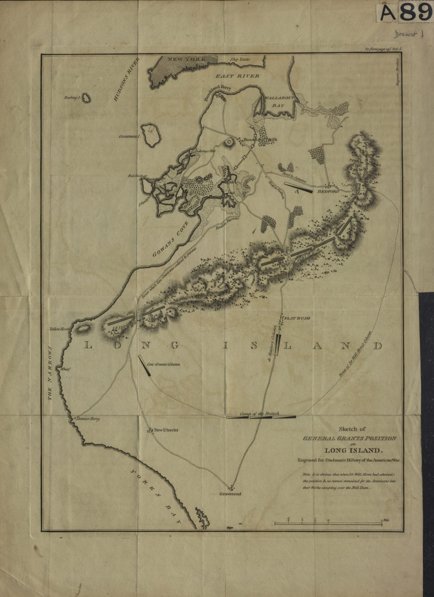
Sketch of General Grants [sic] position on Long Island: engraved for Stedman’s History of the American war
Sketch of General Grants [sic] position on Long Island: engraved for Stedman’s History of the American war
[1793]
[Map of Long Island covering area east from Brooklyn to Springfield and north from Flatlands to Flushing]
[Map of Long Island covering area east from Brooklyn to Springfield and north from Flatlands to Flushing]
[18??]
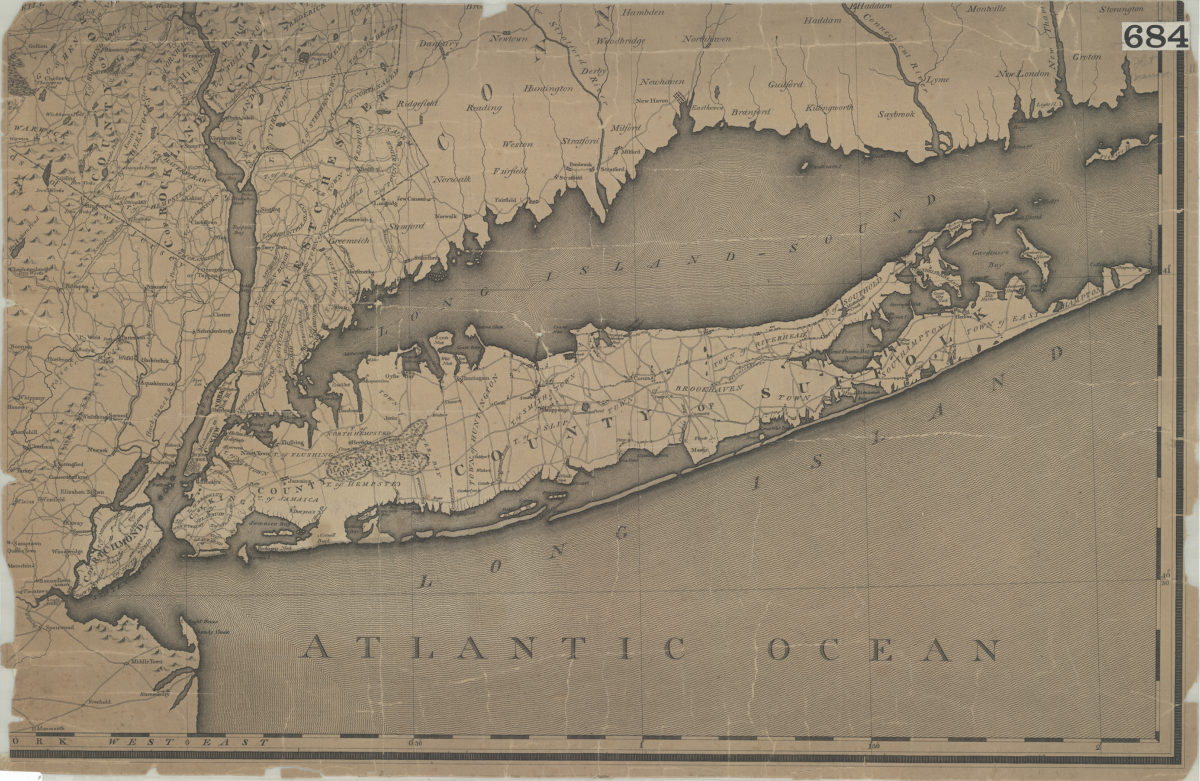
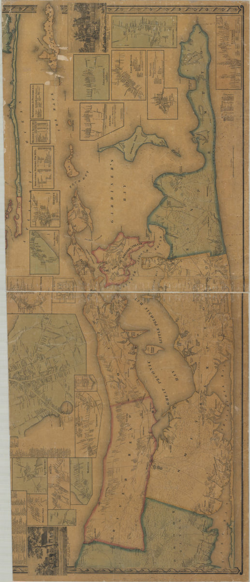
[Map of Long Island, the New York Metropolitan Area, and the southern coast of Connecticut]
[Map of Long Island, the New York Metropolitan Area, and the southern coast of Connecticut]
[18??]
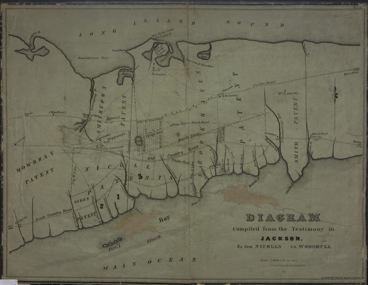
Diagram compiled from the testimony in Jackson, ex dem Nicolls vs. Woodhull
Diagram compiled from the testimony in Jackson, ex dem Nicolls vs. Woodhull
[18??]
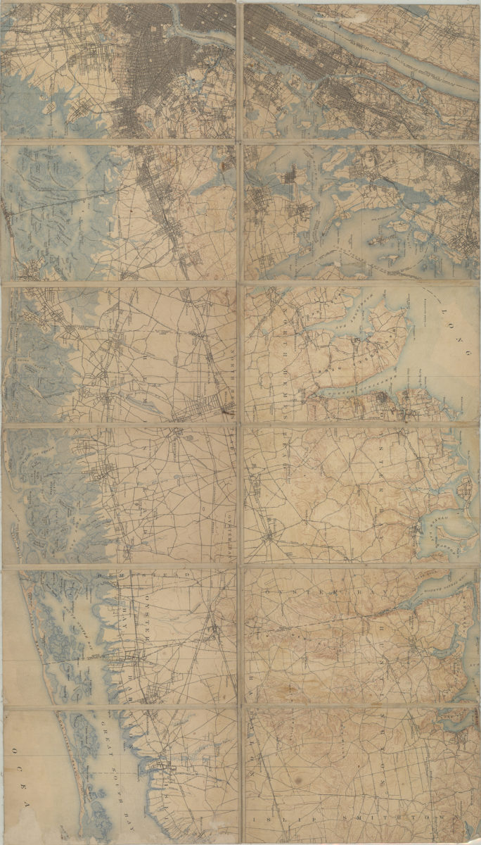
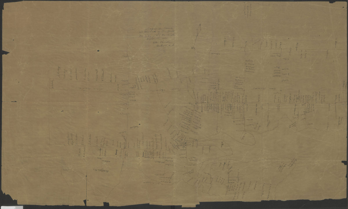
[Map of Long Island, from Greenwood Cemetery to Brentwood]
[Map of Long Island, from Greenwood Cemetery to Brentwood]
[18??]
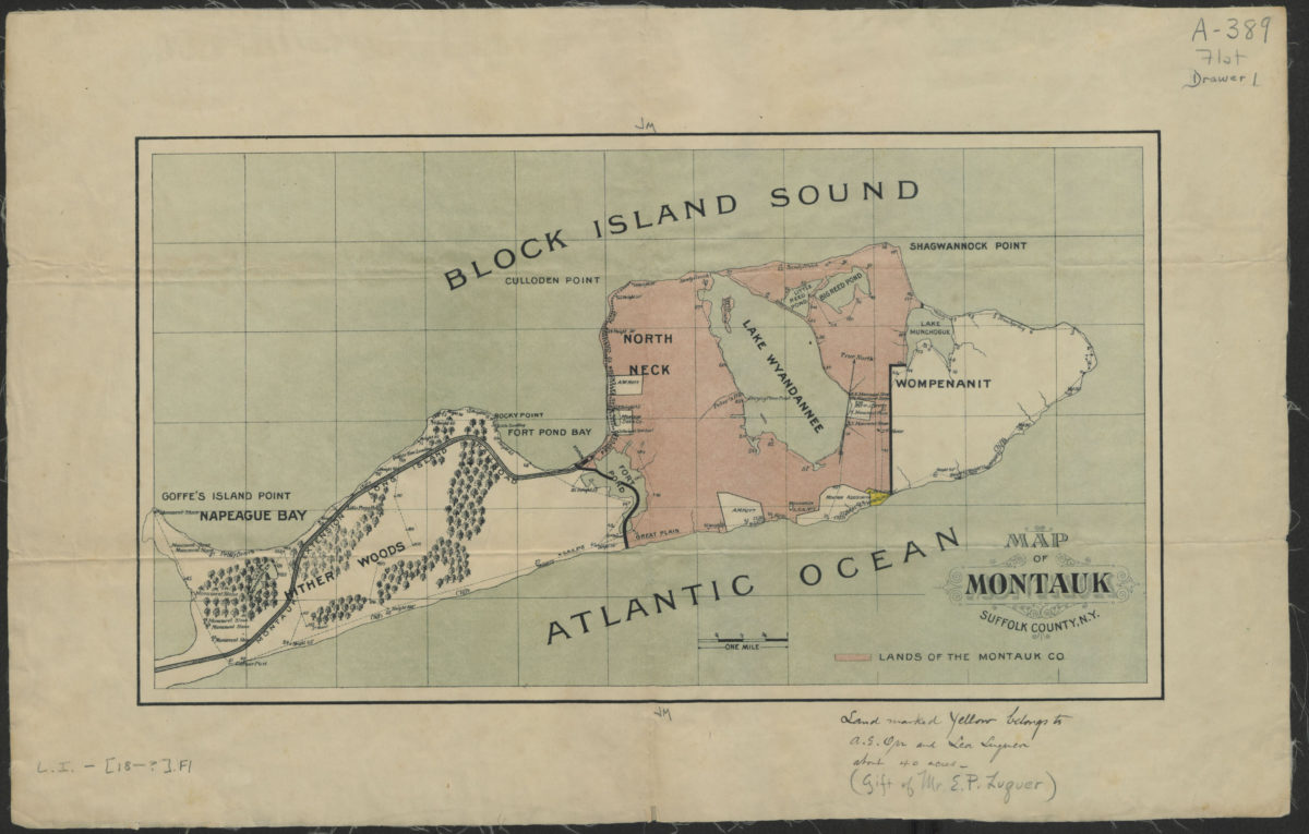
Map of Montauk, Suffolk County, N.Y.
Map of Montauk, Suffolk County, N.Y.
[18??]
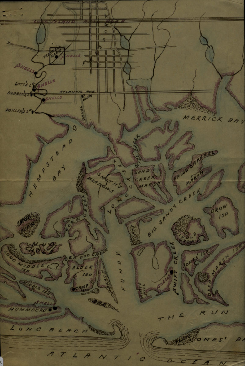
[Map of Hempstead Bay]
[Map of Hempstead Bay]
[18??]
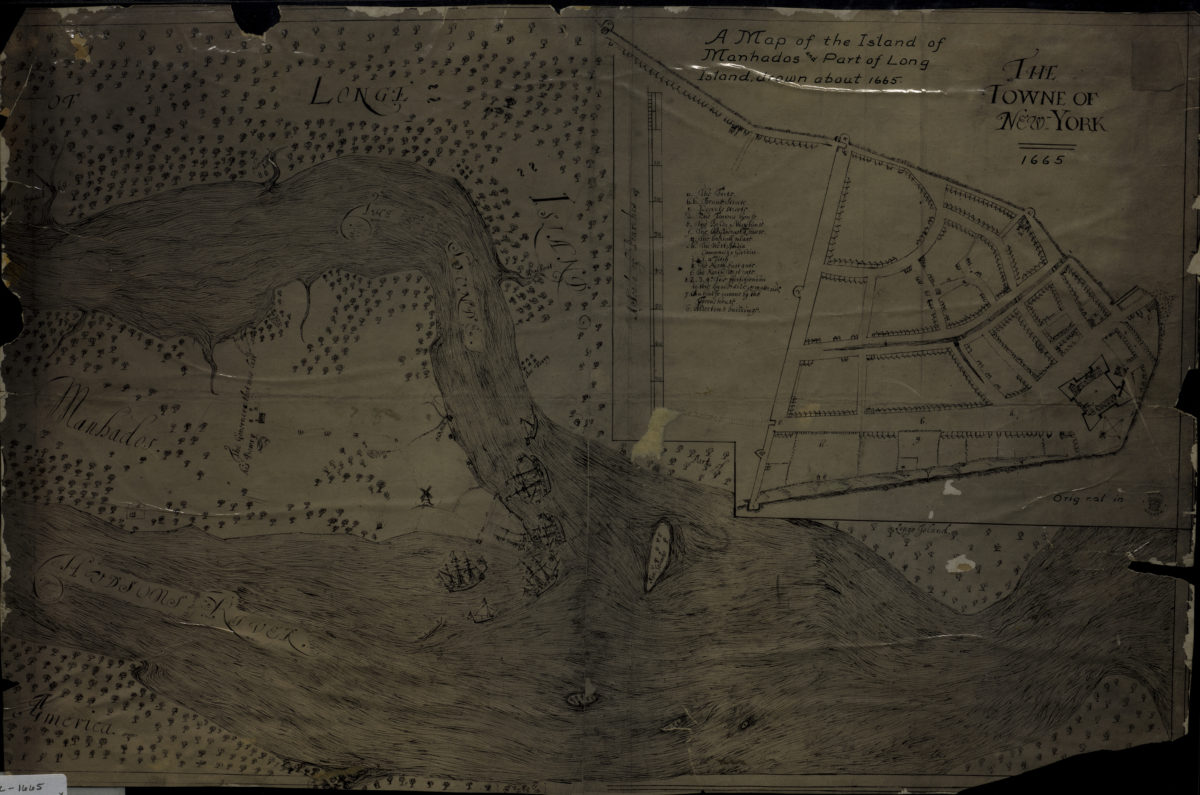
A map of the island of Manhados and part of Long Island, drawn about 1665
A map of the island of Manhados and part of Long Island, drawn about 1665
[18??]
Plan of the Battle of Long Island and of the Brooklyn defences, August 27th, 1776: compiled by Henry P. Johnston ; F. von Egloffstein, del
Plan of the Battle of Long Island and of the Brooklyn defences, August 27th, 1776: compiled by Henry P. Johnston ; F. von Egloffstein, del
[18??]
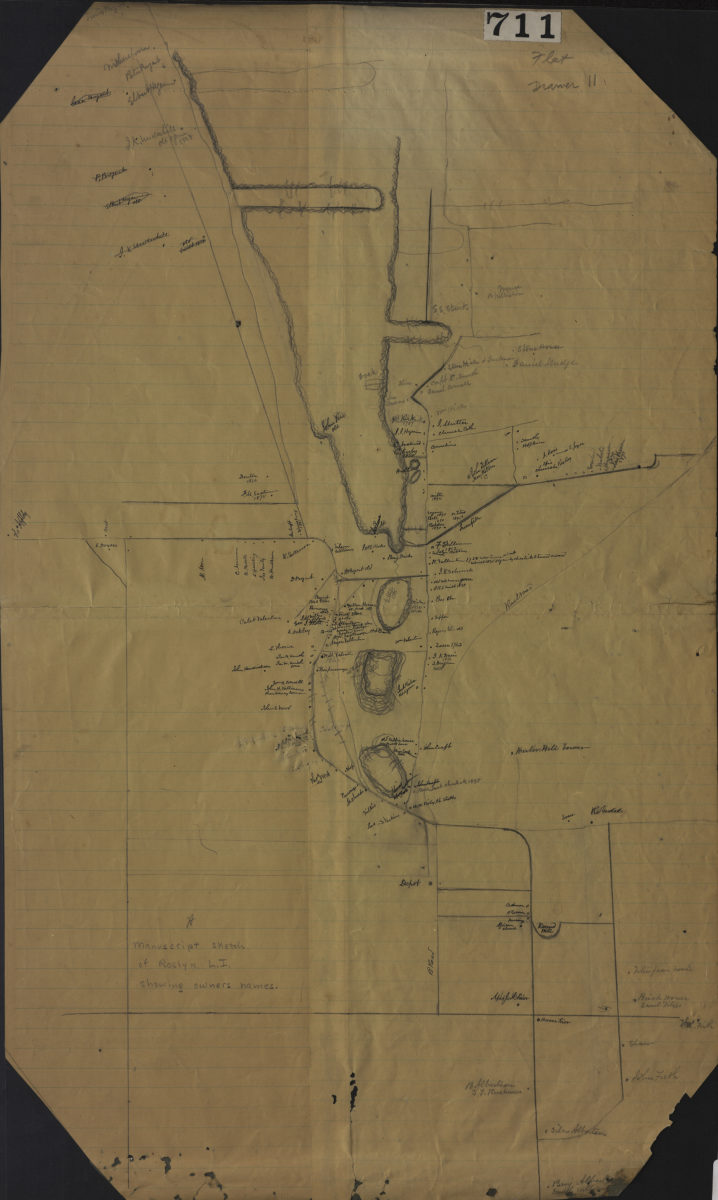
Manuscript sketch of Roslyn L.I. showing owners names
Manuscript sketch of Roslyn L.I. showing owners names
[18??]
[Map of Long Island]
[Map of Long Island]
[184?]
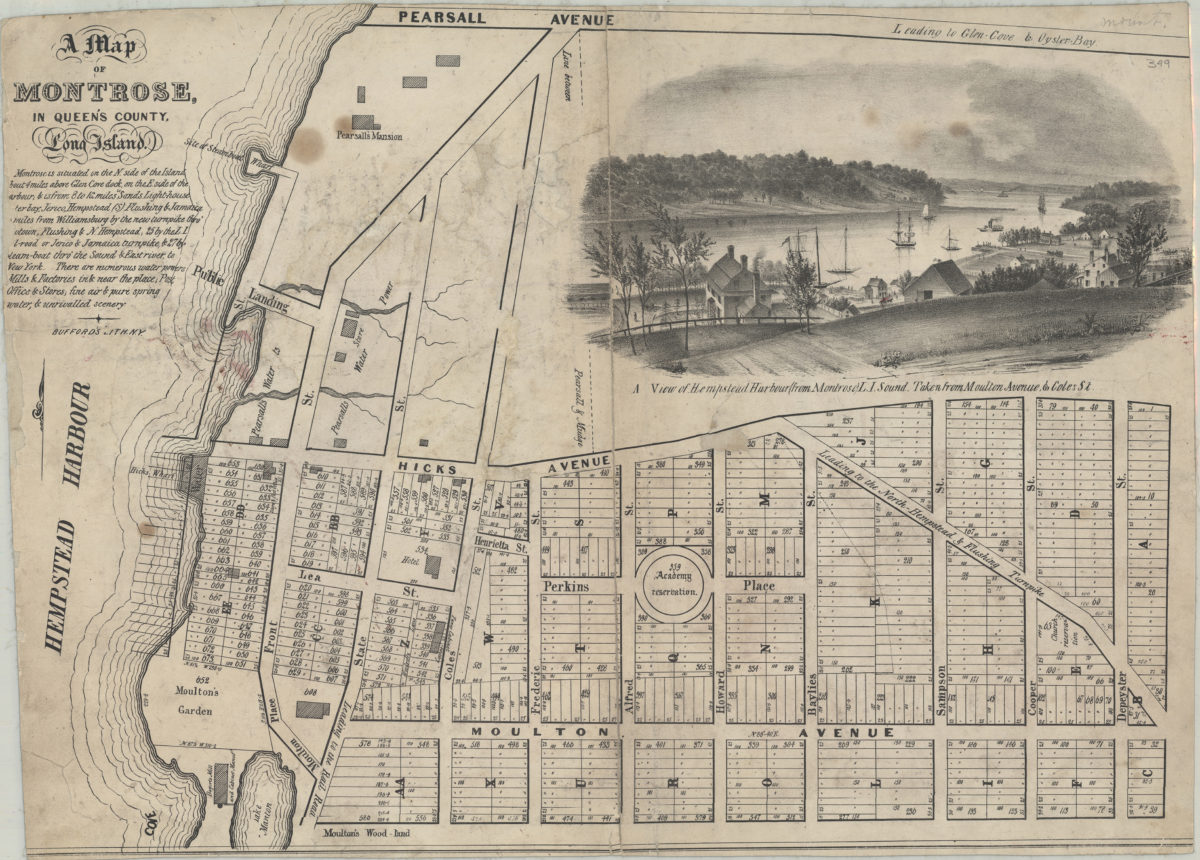
Map of Montrose in Queen’s County, Long Island
Map of Montrose in Queen’s County, Long Island
[184?]
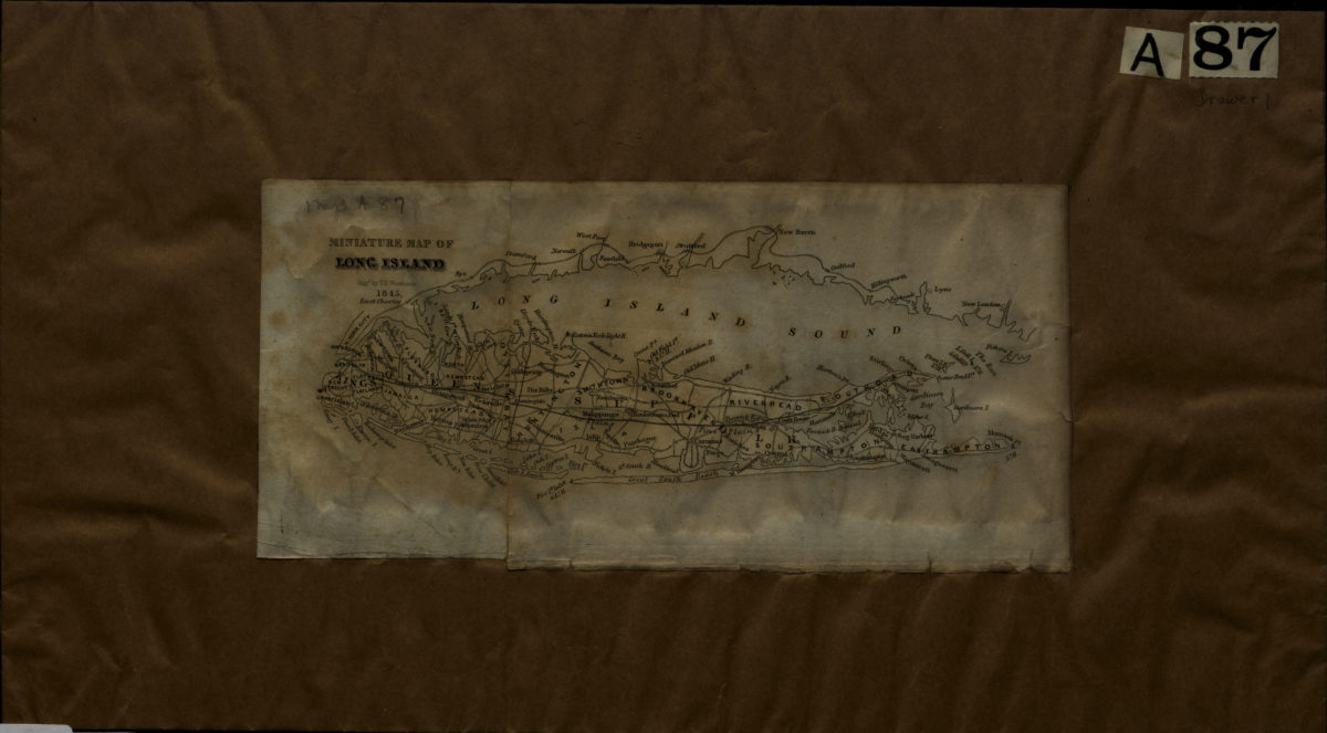
Miniature map of Long Island: engd. by T.S. Woodcock
Miniature map of Long Island: engd. by T.S. Woodcock
1845
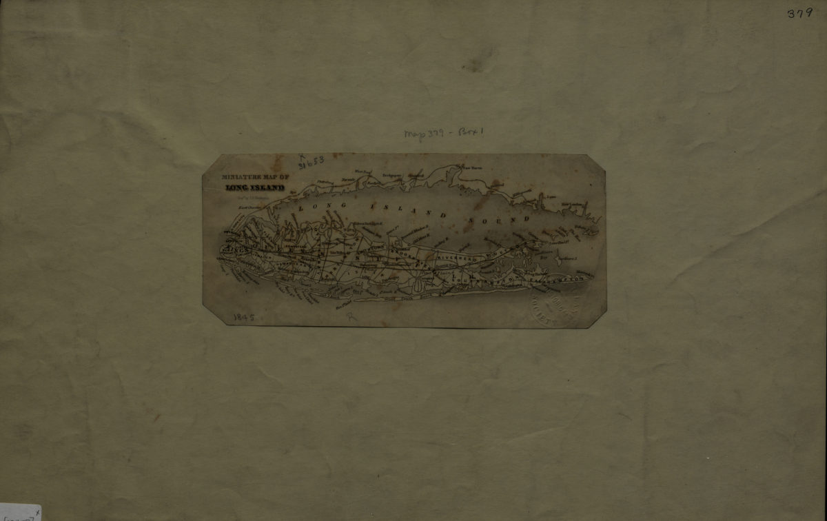
Miniature map of Long Island: engd. by T.S. Woodcock
Miniature map of Long Island: engd. by T.S. Woodcock
[1845]
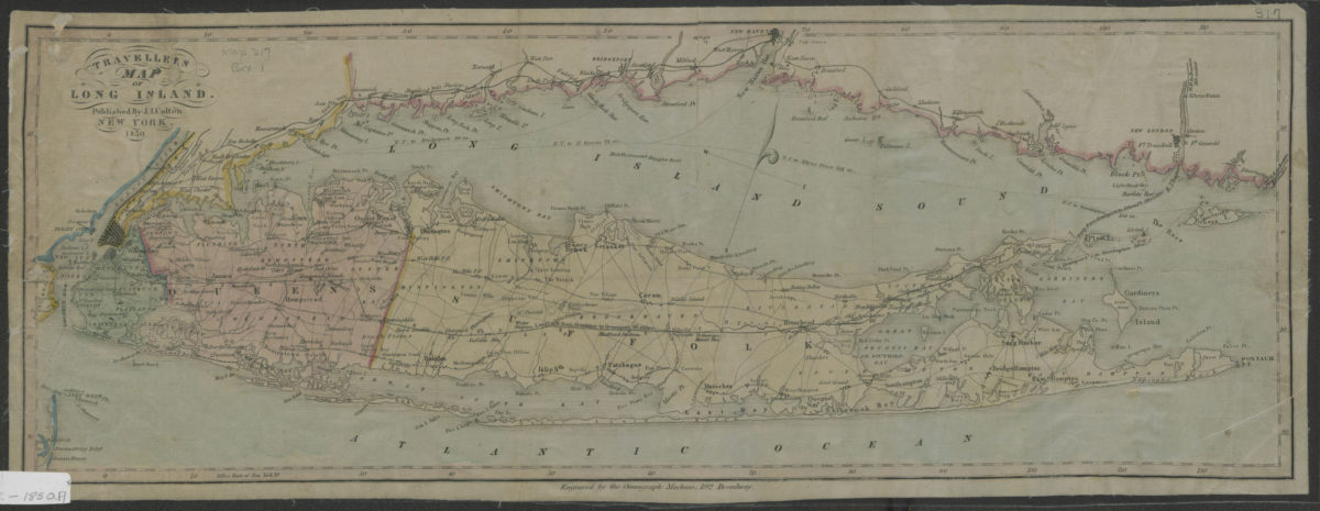
Traveller’s map of Long Island
Traveller’s map of Long Island
1850
Map of property situated at Roslyn (formerly Hempstead Harbor), Queens County, L.I., being known as “Patterson’s Landing” and referred to as such in the deeds: by G.A. Smith, surveyor
Map of property situated at Roslyn (formerly Hempstead Harbor), Queens County, L.I., being known as “Patterson’s Landing” and referred to as such in the deeds: by G.A. Smith, surveyor
September 27, 1851
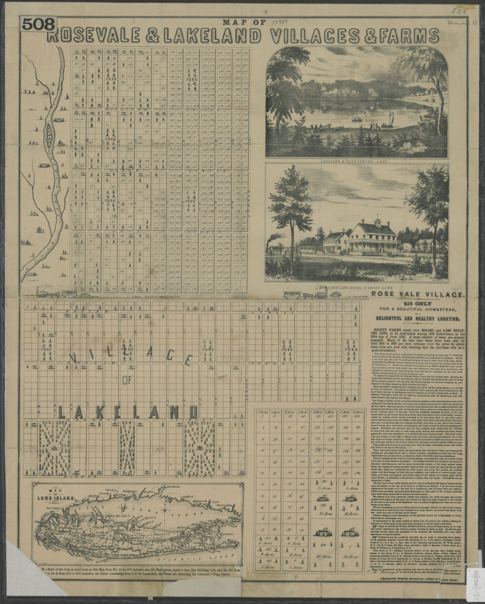
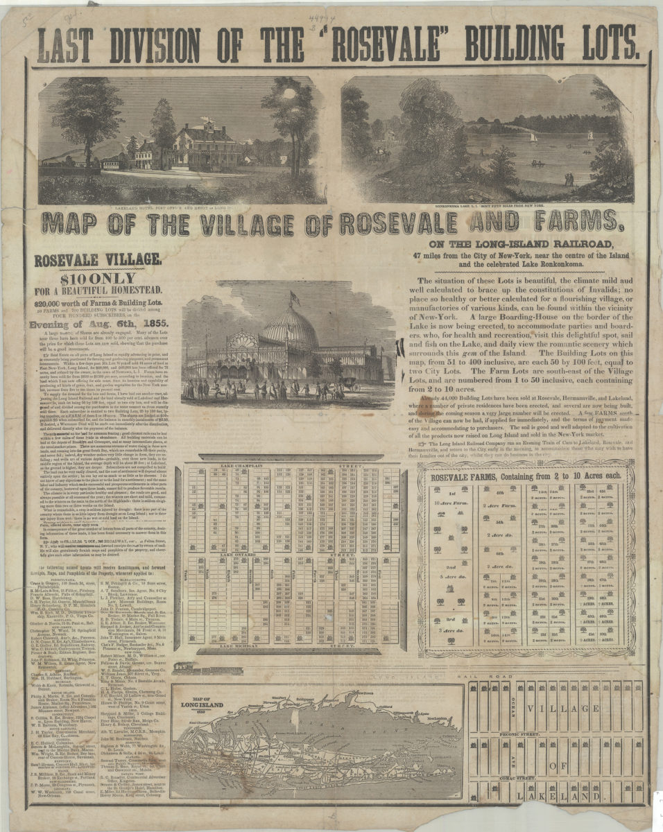
Map of Rosevale & Lakeland villages & farms
Map of Rosevale & Lakeland villages & farms
[1853]
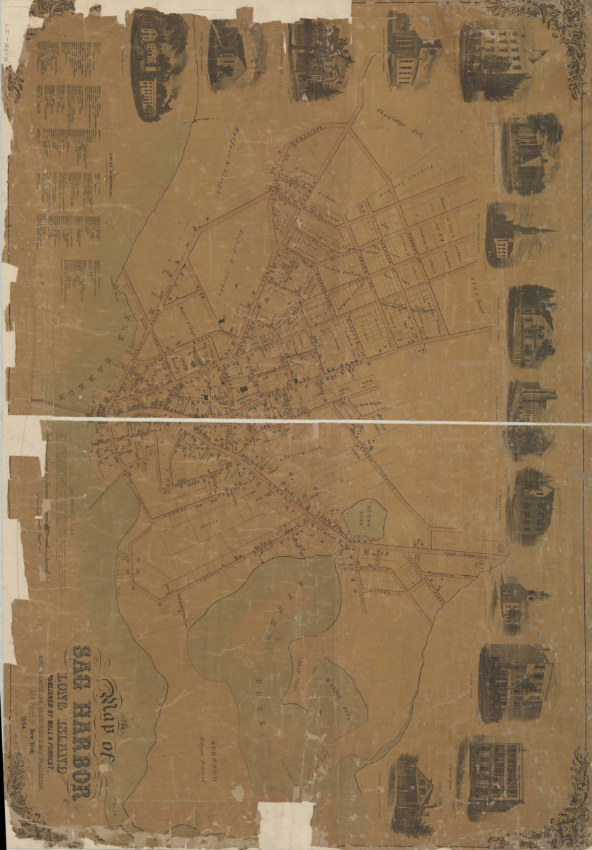
Map of Sag Harbor, Long Island
Map of Sag Harbor, Long Island
1854
Map of the village of Rosevale and farms on the Long Island Railroad, 47 miles from the city of New York, near the centre of the Island and the celebrated Lake Ronkonkoma
Map of the village of Rosevale and farms on the Long Island Railroad, 47 miles from the city of New York, near the centre of the Island and the celebrated Lake Ronkonkoma
[1855]
Map of Suffolk Co., L.I., New York: from actual surveys: by J. Chace Junr
Map of Suffolk Co., L.I., New York: from actual surveys: by J. Chace Junr
[1858]
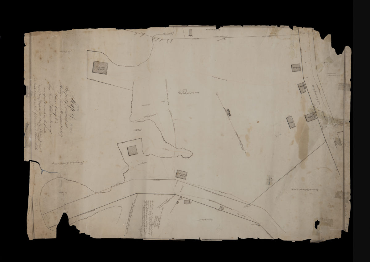
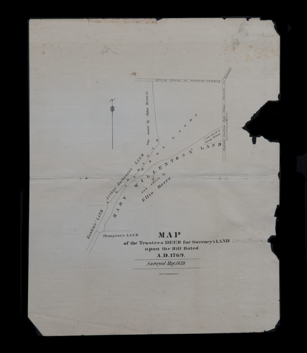
Map of the trustees deed for Sweeney’s land upon the hill dated A.D. 1769
Map of the trustees deed for Sweeney’s land upon the hill dated A.D. 1769
[1859]
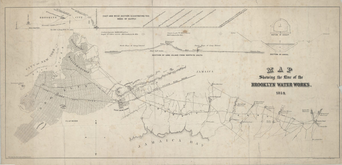
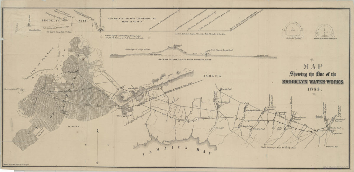
Map showing the line of the Brooklyn Water Works: drawn by Bernhard Essroger
Map showing the line of the Brooklyn Water Works: drawn by Bernhard Essroger
1859
Hempstead Harbor, Long Island: from a trigonometrical survey under the direction of F.R. Hassler and A.D. Bache, superintendents of the Survey of the Coast of the United States
Hempstead Harbor, Long Island: from a trigonometrical survey under the direction of F.R. Hassler and A.D. Bache, superintendents of the Survey of the Coast of the United States
1859
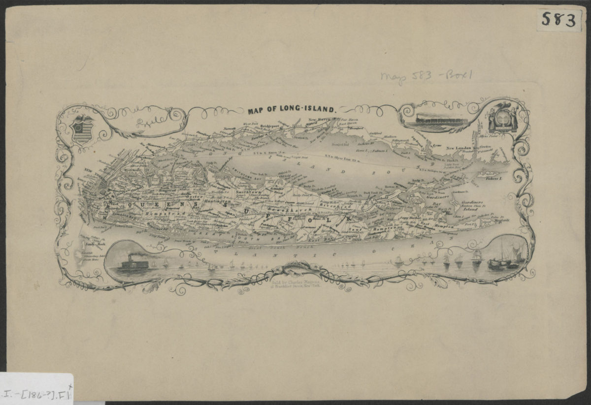
Map of Long Island
Map of Long Island
[186?]
Map of the parish at the end of the first ten years of my pastorate: Epher Whitaker, Southold, L.I.
Map of the parish at the end of the first ten years of my pastorate: Epher Whitaker, Southold, L.I.
September 1861
Map showing the line of the Brooklyn Water Works: drawn by Bernhard Essroger
Map showing the line of the Brooklyn Water Works: drawn by Bernhard Essroger
1864
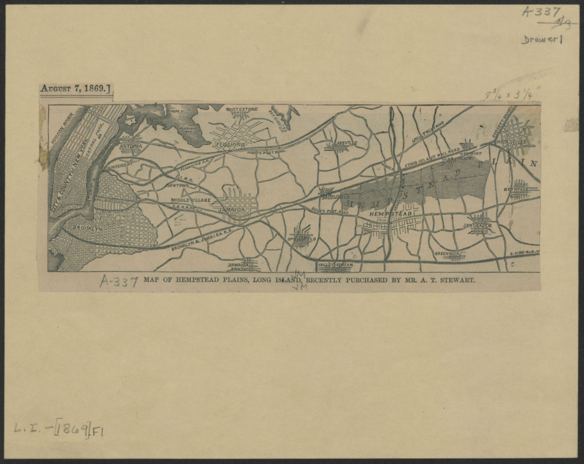
Map of Hempstead Plains, Long Island, recently purchased by Mr. A.T. Stewart
Map of Hempstead Plains, Long Island, recently purchased by Mr. A.T. Stewart
[1869]
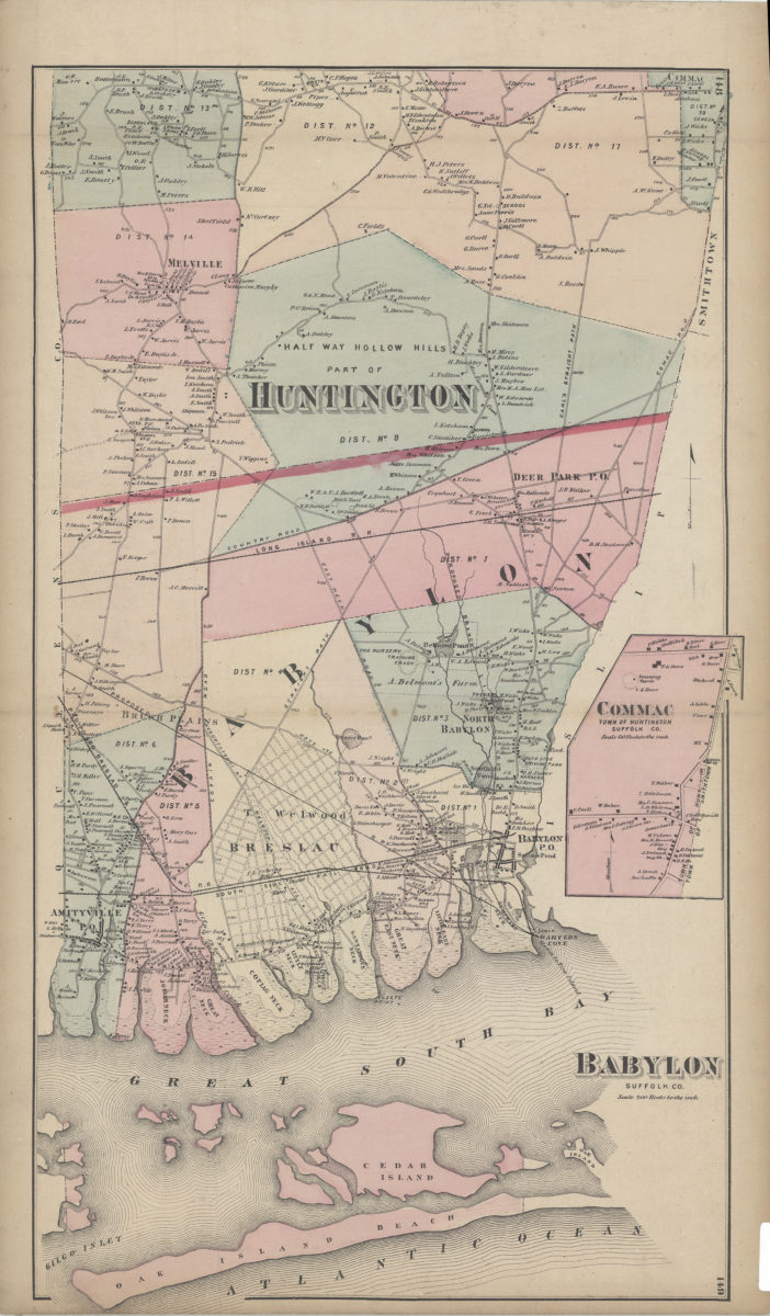
Babylon, Suffolk Co
Babylon, Suffolk Co
[1873]
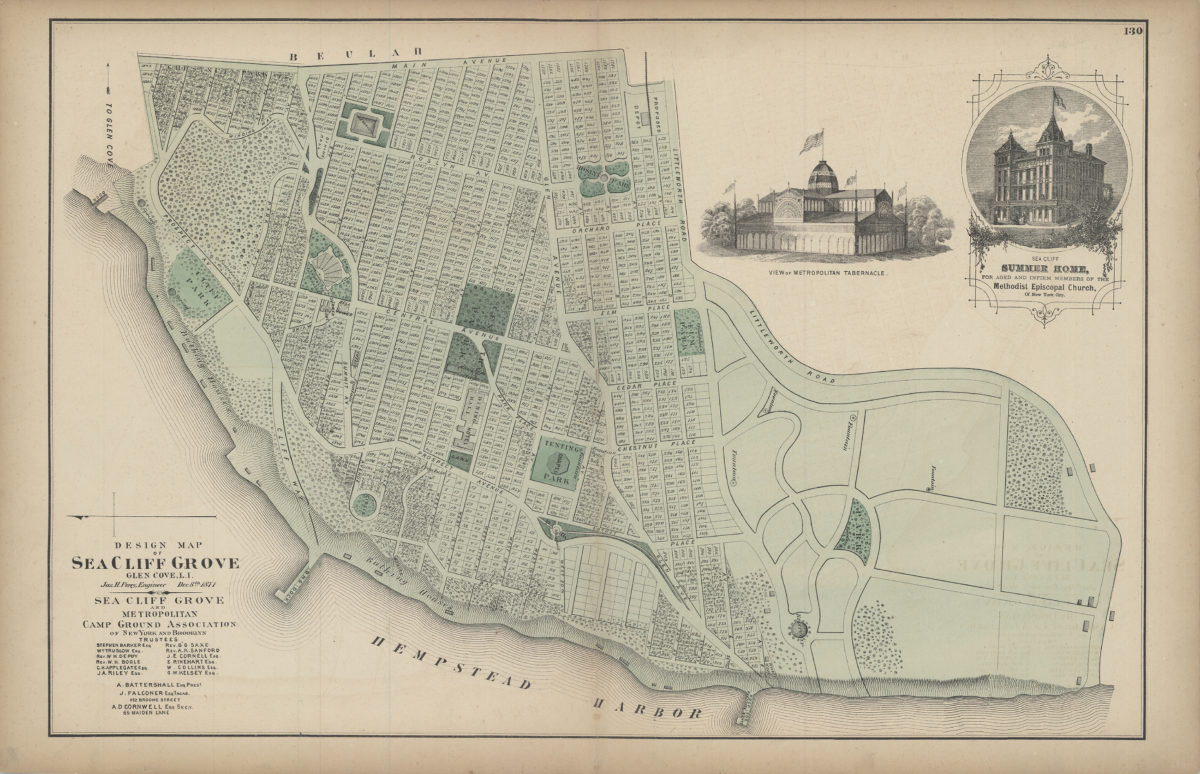
Design map of Sea Cliff Grove, Glen Cove, L.I.: Jas. H. Perry, Dec. 8th, 1871
Design map of Sea Cliff Grove, Glen Cove, L.I.: Jas. H. Perry, Dec. 8th, 1871
[1873]
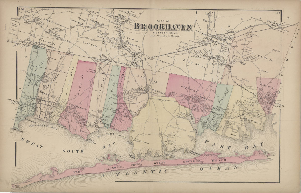
Part of Brookhaven, Suffolk Co., L.I.
Part of Brookhaven, Suffolk Co., L.I.
[1873]
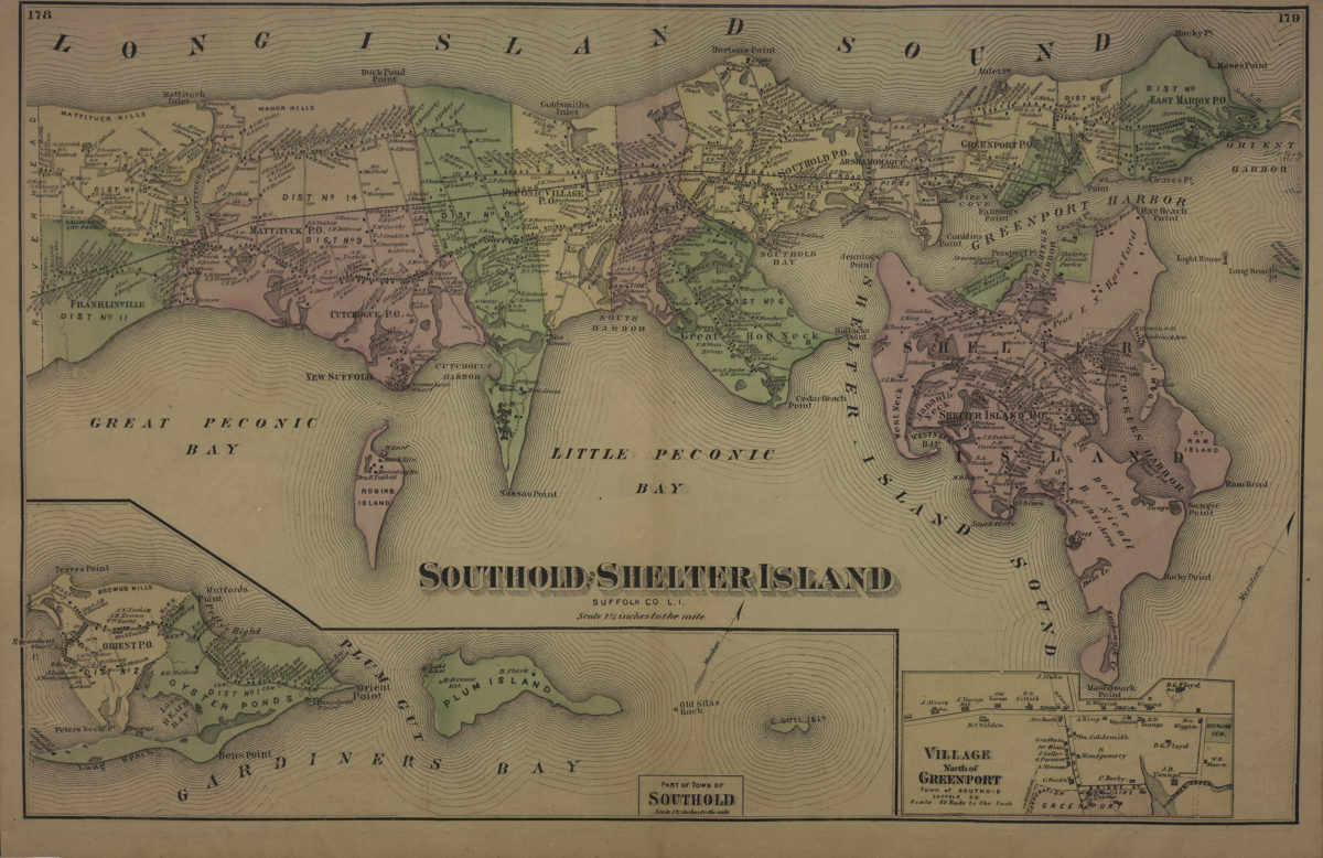
Southold and Shelter Island, Suffolk Co., L.I.
Southold and Shelter Island, Suffolk Co., L.I.
[1873]
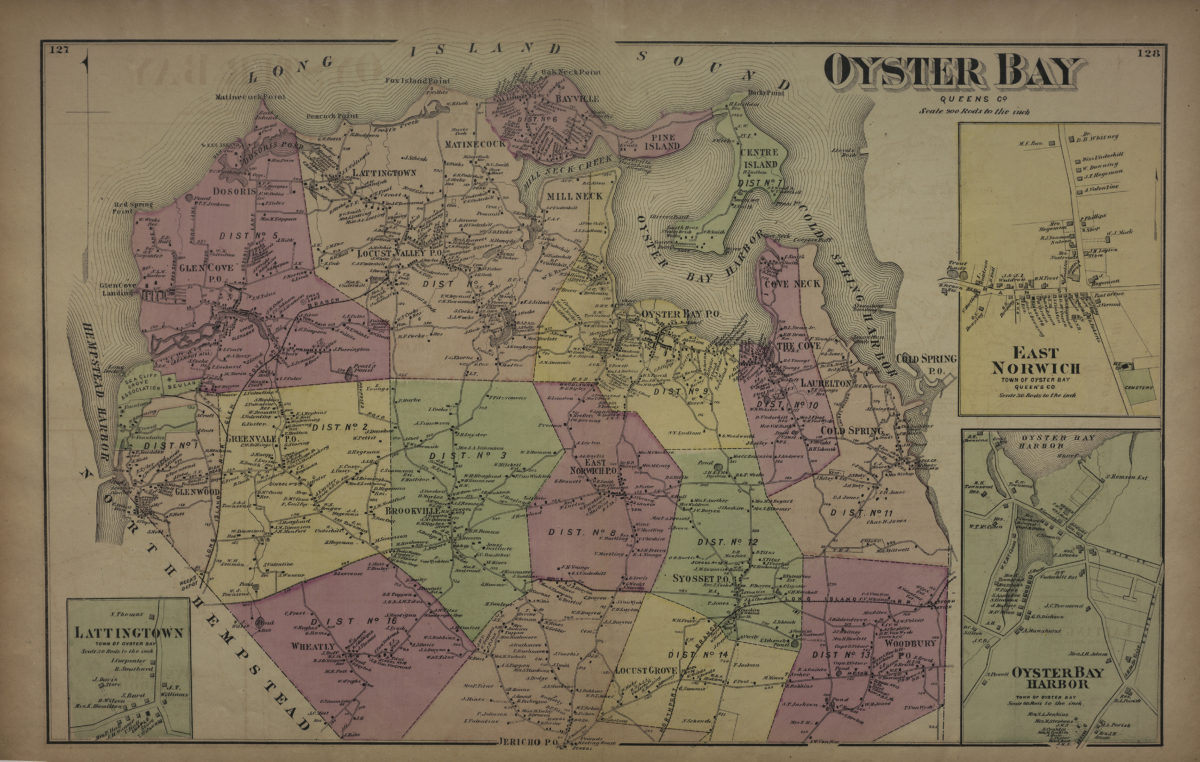
Oyster Bay, Queens Co
Oyster Bay, Queens Co
[1873]
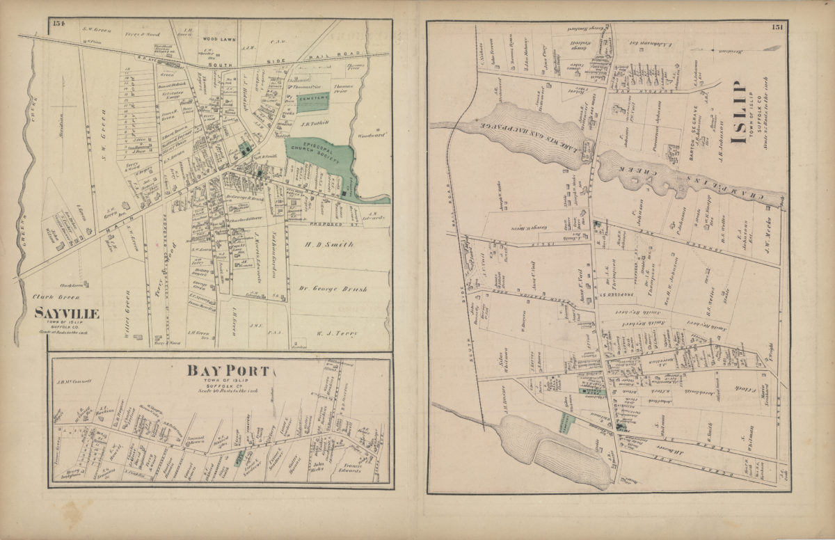
Islip, Suffolk County
Islip, Suffolk County
[1873]
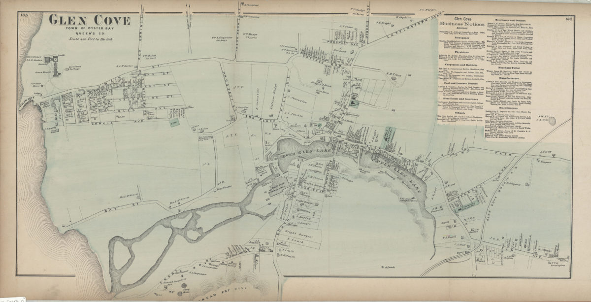
Glen Cove, town of Oyster Bay, Queen’s Co
Glen Cove, town of Oyster Bay, Queen’s Co
[1873]
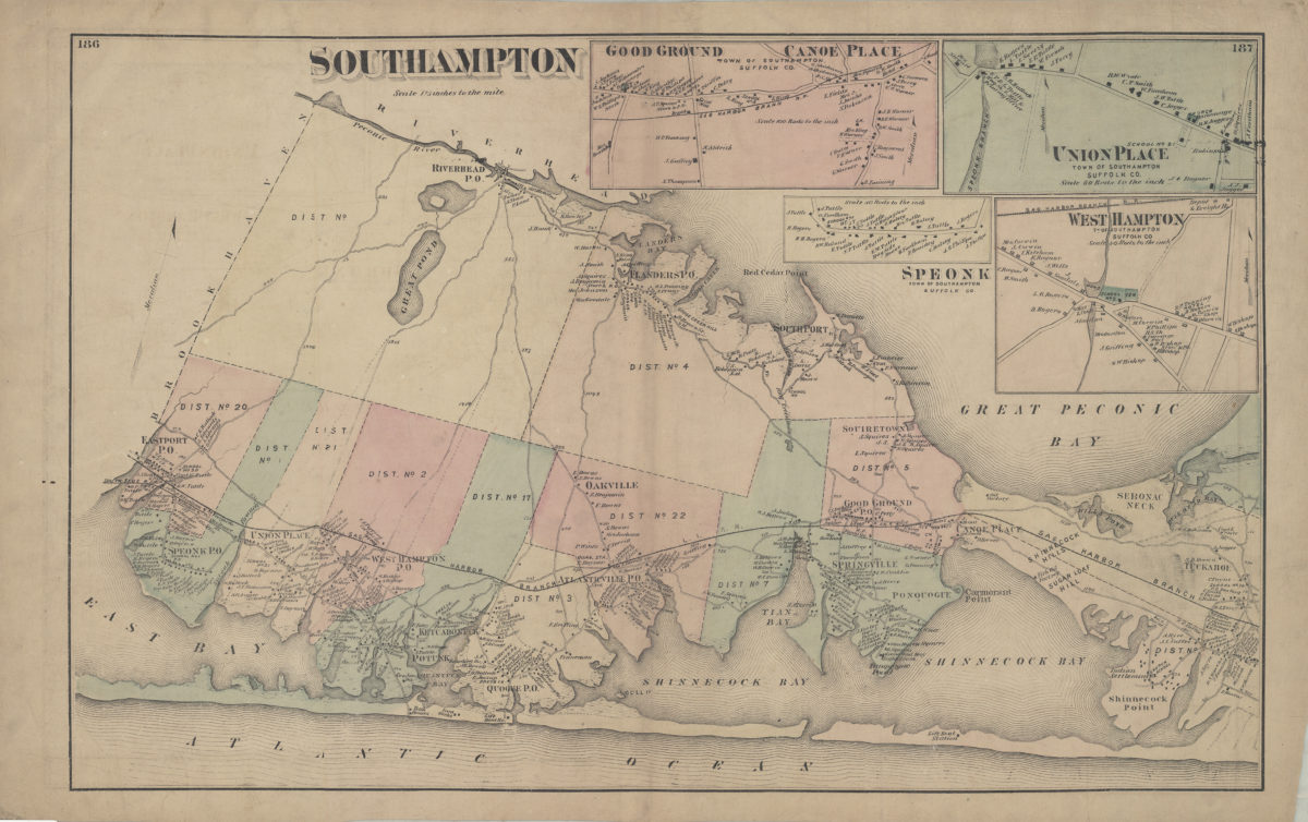
Southampton
Southampton
[1873]
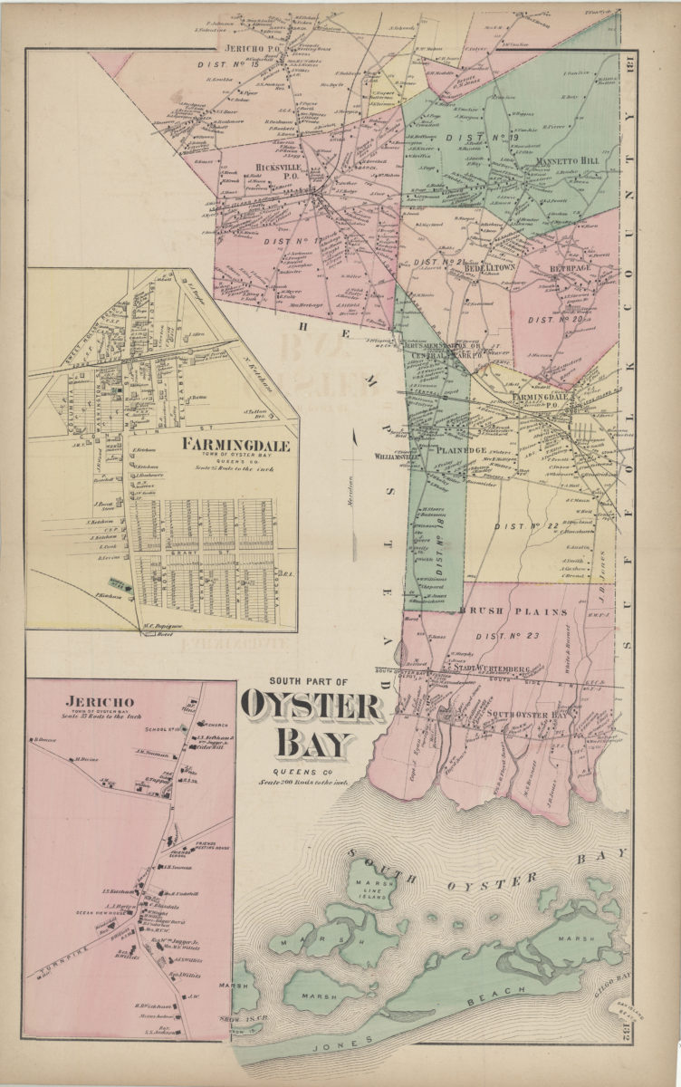
South part of Oyster Bay, Queens Co
South part of Oyster Bay, Queens Co
[1873]
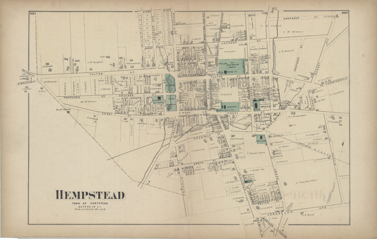
Hempstead, town of Hempstead, Queens Co., L.I.
Hempstead, town of Hempstead, Queens Co., L.I.
[1873]
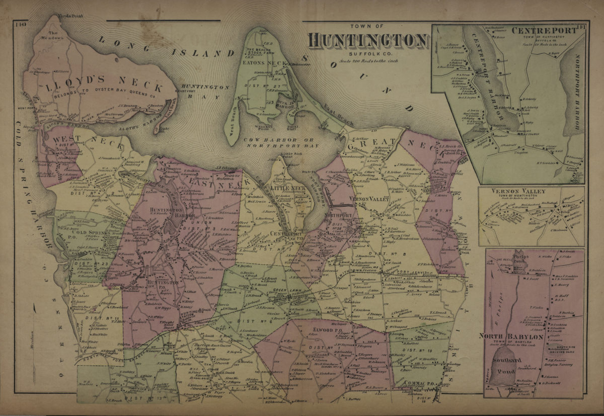
Town of Huntington, Suffolk Co
Town of Huntington, Suffolk Co
[1873]
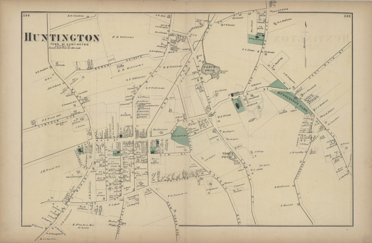
Huntington, town of Huntington, Suffolk Co
Huntington, town of Huntington, Suffolk Co
[1873]
Woodhaven, town of Jamaica, Queens Co
Woodhaven, town of Jamaica, Queens Co
[1873]
Riverhead, Suffolk Co
Riverhead, Suffolk Co
[1873]
Patchogue, town of Brookhaven, Suffolk Co
Patchogue, town of Brookhaven, Suffolk Co
[1873]
Riverhead, town of Riverhead, Suffolk Co
Riverhead, town of Riverhead, Suffolk Co
[1873]
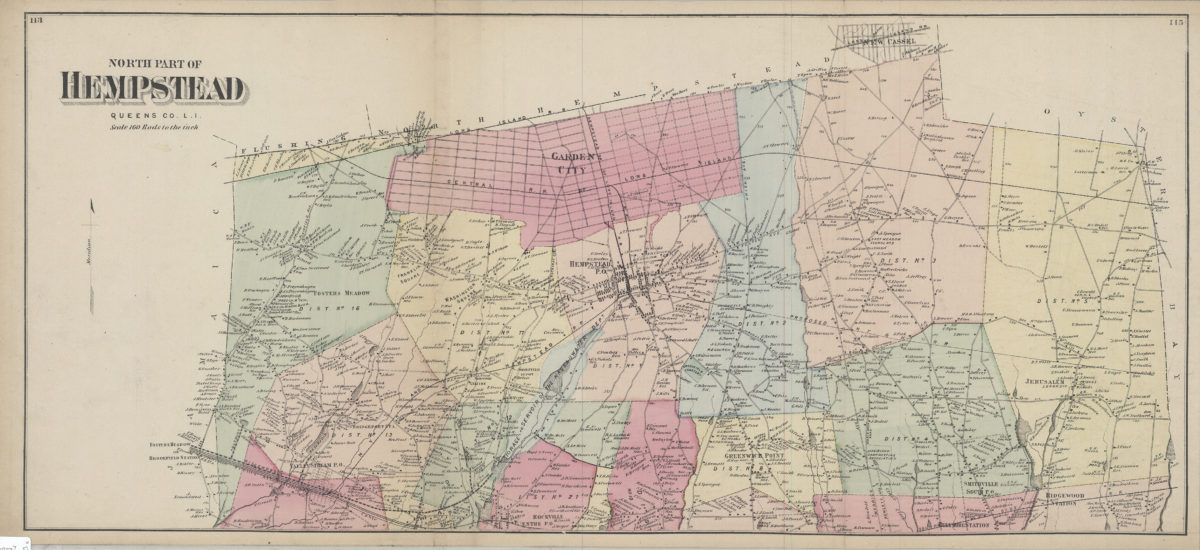
North part of Hempstead, Queens Co., L.I.
North part of Hempstead, Queens Co., L.I.
[1873]
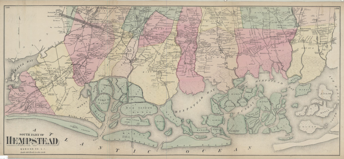
South part of Hempstead, Queens Co., L.I.
South part of Hempstead, Queens Co., L.I.
[1873]
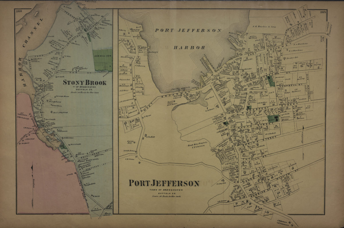
Port Jefferson, town of Brookhaven, Suffolk Co. ; Stony Brook, tn. of Brookhaven, Suffolk Co
Port Jefferson, town of Brookhaven, Suffolk Co. ; Stony Brook, tn. of Brookhaven, Suffolk Co
[1873]
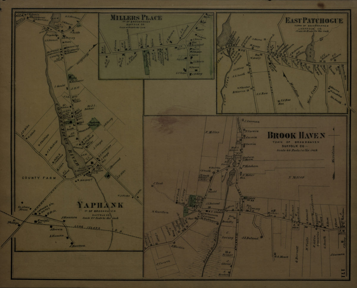
Brookhaven, town of Brookhaven, Suffolk Co. ; Yaphank, tn. of Brookhaven, Suffolk Co. ; Millers [i.e. Miller] Place, tn. of Brookhaven, Suffolk Co. ; East Patchogue, town of Brookhaven, Suffolk Co
Brookhaven, town of Brookhaven, Suffolk Co. ; Yaphank, tn. of Brookhaven, Suffolk Co. ; Millers [i.e. Miller] Place, tn. of Brookhaven, Suffolk Co. ; East Patchogue, town of Brookhaven, Suffolk Co
[1873]
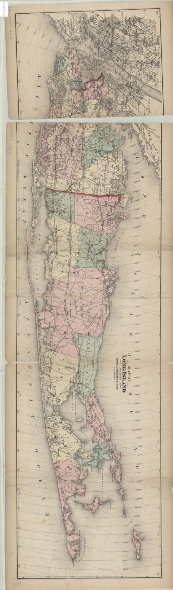
Map of Long Island
Map of Long Island
[1873]
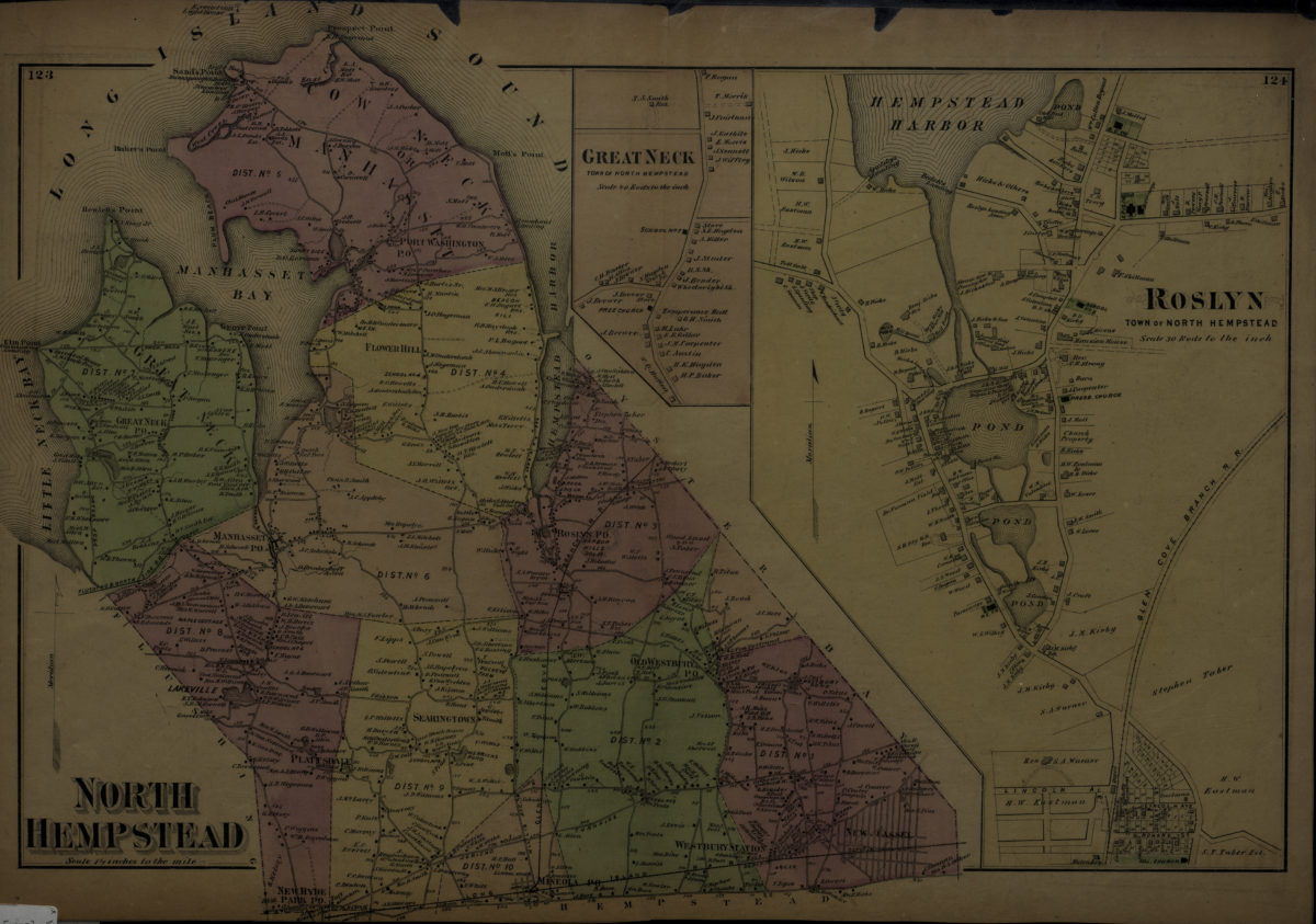
North Hempstead ; Roslyn, town of North Hempstead
North Hempstead ; Roslyn, town of North Hempstead
[1873]
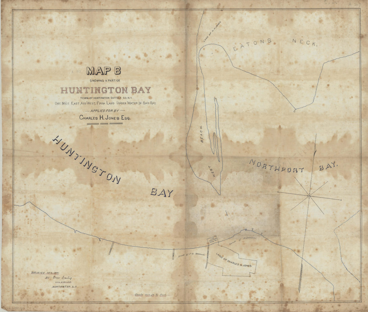
Map B showing a part of Huntington Bay: town of Huntington, Suffolk Co., N.Y., one mile east and west from land under water in said bay, applied for by Charles H. Jones, Esq.: surveyed Dec. 1877 by Oscar Darling, civil engineer, Huntington L.I.
Map B showing a part of Huntington Bay: town of Huntington, Suffolk Co., N.Y., one mile east and west from land under water in said bay, applied for by Charles H. Jones, Esq.: surveyed Dec. 1877 by Oscar Darling, civil engineer, Huntington L.I.
December 1877
1
2
3
4
Next