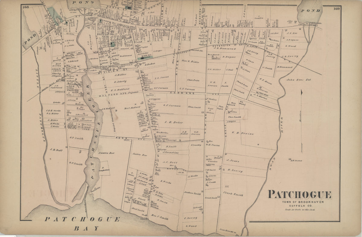
Patchogue, town of Brookhaven, Suffolk Co [1873]
Map No. L.I.-[1873]i.Fl
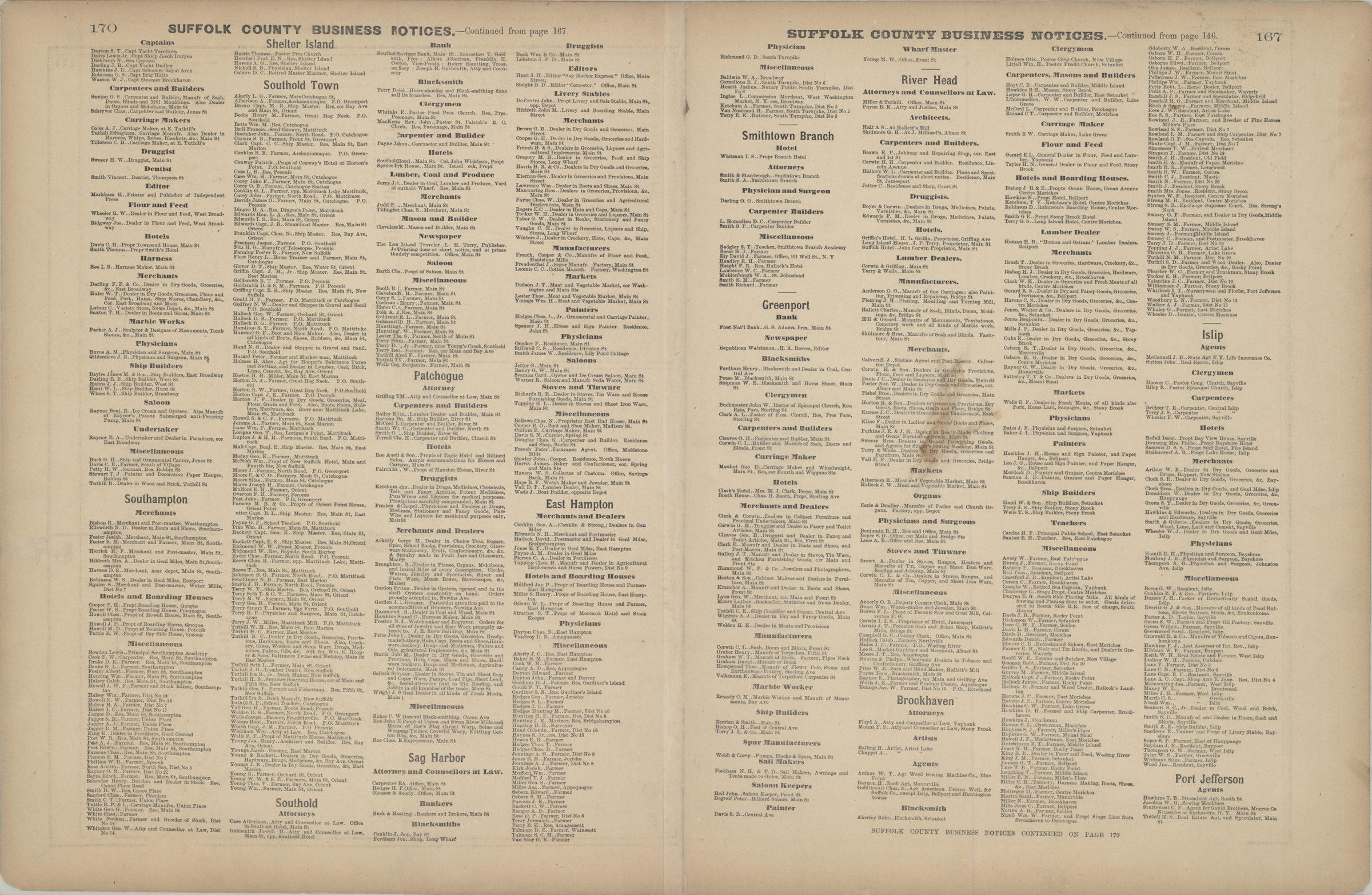
Cadastral map. Covers area north from Patchogue Bay to North St. and east from the Little Patchogue River to Swan River. Shows property (including lots and buildings), names of landowners, churches, businesses, and railroads. Extracted from: Atlas of Long Island, New York. New York : Beers, Comstock & Cline, 1873, p. 167-170. On verso: Suffolk County business notices.
Map area shown
Genre
Cadastral mapsRelation
Full catalog recordSize
40 × 54 cmDownload
Low Resolution Image
Creator
Beers, F. W.; Beers, Comstock & Cline,Publisher
Brooklyn Historical SocietyCitation
Patchogue, town of Brookhaven, Suffolk Co; [1873], Map Collection, L.I.-[1873]i.Fl; Brooklyn Historical Society.Scale
Scale [1:5,940] 1 in to 3Loading zoom image...