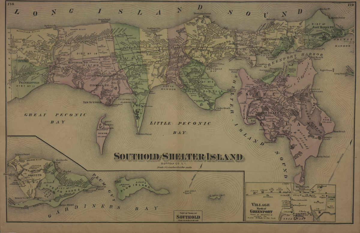
Southold and Shelter Island, Suffolk Co., L.I. [1873]
Cadastral map. Shows property (including buildings), names of landowners, administrative divisions, and railroads. Extracted from: Atlas of Long Island, New York. New York : Beers, Comstock & Cline, 1873, p. 177-180. Oriented with north to the upper right. Includes 2 insets. Insets: Part of town of Southold (Scale [1:52,800]. 1 1/5 in. to the mile) — Village north of Greenport, town of Southold, Suffolk Co. (Scale [1:11,880]. 60 rods to the in.). On verso: 6 ancillary maps and Southold business notices. Ancillary maps: New Suffolk, town of Suffolk, Suffolk Co. (Scale [1:7,920]. 40 rods to the in.) — Village adjoining Southold, tn. of Southold, Suffolk Co. (Scale [1:15,840]. 80 rods to the in.) — East Marion, town of Southold, Suffolk Co. (Scale [1:11,880]. 60 rods to the in.) — Orient, town of Southold (Scale [1:6,930]. 35 rods to the in.) — Cutchogue, town of Southold, Suffolk Co. (Scale [1:14,850]. 75 rods to the in.) — Peconic Village, town of Southold, Suffolk Co. (Scale [1:7,920]. 40 rods to the in.).
Map area shown
Genre
Cadastral mapsRelation
Full catalog recordSize
35 × 55 cmDownload
Low Resolution Image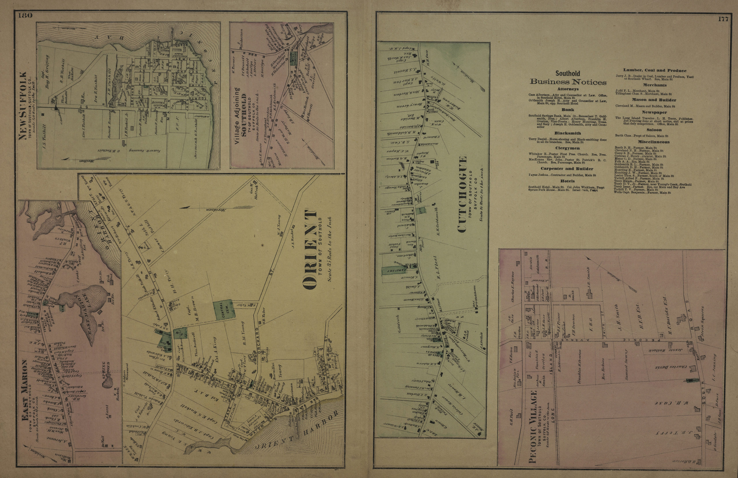
Creator
Beers, F. W.; Beers, Comstock & Cline,Publisher
Brooklyn Historical SocietyCitation
Southold and Shelter Island, Suffolk Co., L.I.; [1873], Map Collection, L.I.-[1873]s.Fl; Brooklyn Historical Society.Scale
Scale [1:52,800] 1 1/5 in