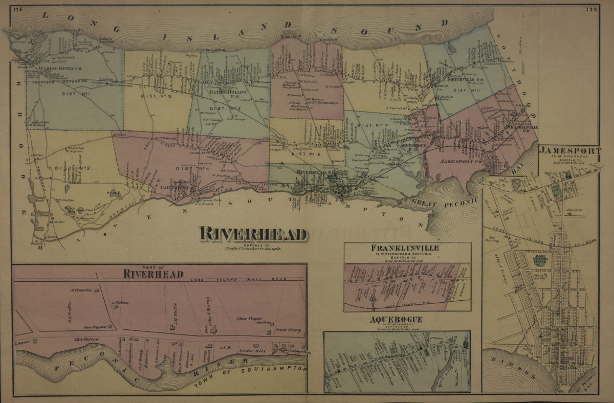
Riverhead, Suffolk Co [1873]
Map No. L.I.-[1873]f.Fl
Cadastral map. Shows names of landowners, administrative divisions, and railroads. Extracted from: Atlas of Long Island, New York. New York : Beers, Comstock & Cline, 1873, p. 174-175. Includes 4 insets. Insets: Part of Riverhead — Franklinville, ts. of Riverhead & Southold, Suffolk Co. (Scale [1:19,800]. 100 rods to the in.) — Aquebogue, tn. of Riverhead, Suffolk Co. (Scale [1:19,800]. 100 rods to the in.) — Jamesport, tn. of Riverhead, Suffolk Co. (Scale [1:4,800]. 400 ft. to the in.).
Map area shown
Genre
Cadastral mapsRelation
Full catalog recordSize
36 × 55 cmDownload
Low Resolution Image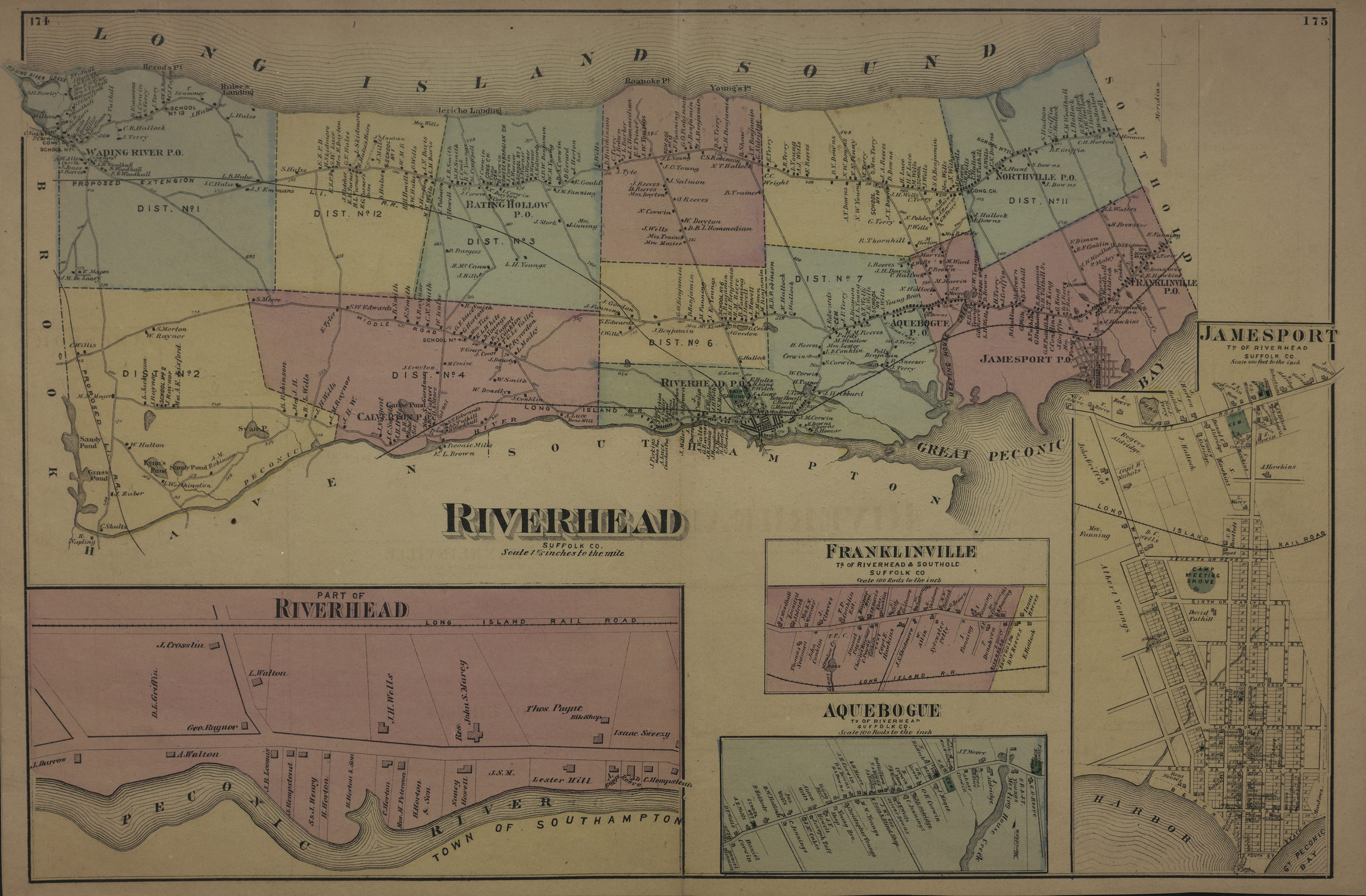
Creator
Beers, F. W.; Beers, Comstock & Cline,Publisher
Brooklyn Historical SocietyCitation
Riverhead, Suffolk Co; [1873], Map Collection, L.I.-[1873]f.Fl; Brooklyn Historical Society.Scale
Scale [1:52,800] 1 1/5 inLoading zoom image...