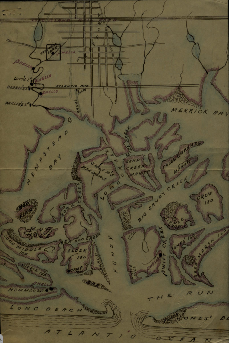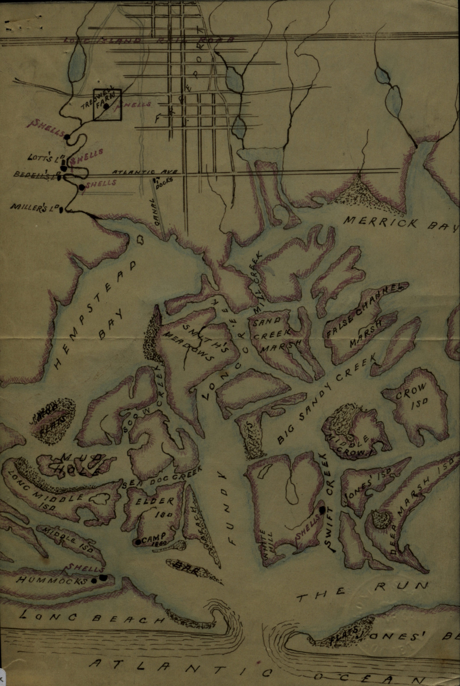
[Map of Hempstead Bay] [18??]
Map No. L.I.-[18--?]i.Fl
Also shows marshland, creeks, and islands.
Map area shown
Genre
Manuscript mapsRelation
Full catalog recordSize
24 × 16 cmDownload
Low Resolution Image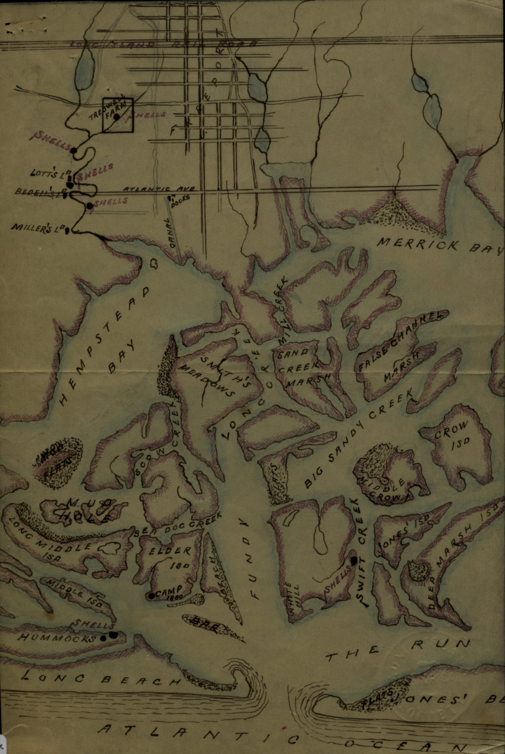
Creator
Publisher
Brooklyn Historical SocietyCitation
[Map of Hempstead Bay]; [18??], Map Collection, L.I.-[18--?]i.Fl; Brooklyn Historical Society.Scale
Scale not givenLoading zoom image...