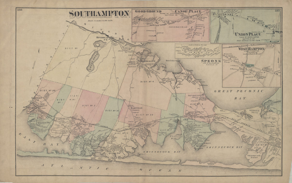
Southampton [1873]
Cadastral map. Shows property (including buildings), names of landowners, administrative divisions, and railroads. Extracted from: Atlas of Long Island, New York. New York : Beers, Comstock & Cline, 1873, p. 185-188. Oriented with north to the upper right. Includes 4 insets. Insets: Good Ground, Canoe Place, town of Southampton, Suffolk Co. — Union Place, town of Southampton, Suffolk Co. (Scale [1:11,880]. 60 rods to the in.) — Speonk, town of Southampton, Suffolk Co. (Scale [1:15,840]. 80 rods to the in.) — West Hampton, tn. of Southampton, Suffolk Co. (Scale [1:7,920]. 40 rods to the in.). On verso: 3 ancillary maps and Southampton business notices. Ancillary maps: Part of town of Southampton (Scale [1:52,800]. 1 1/5 in. to the mile) — Southampton, town of Southampton, Suffolk Co. (Scale [1:5,940]. 30 rods to the in.) — Flanders, town of Southampton, Suffolk Co. (Scale [1:19,880]. 100 rods to the in.).
Map area shown
Genre
Cadastral mapsRelation
Full catalog recordSize
34 × 55 cmDownload
Low Resolution Image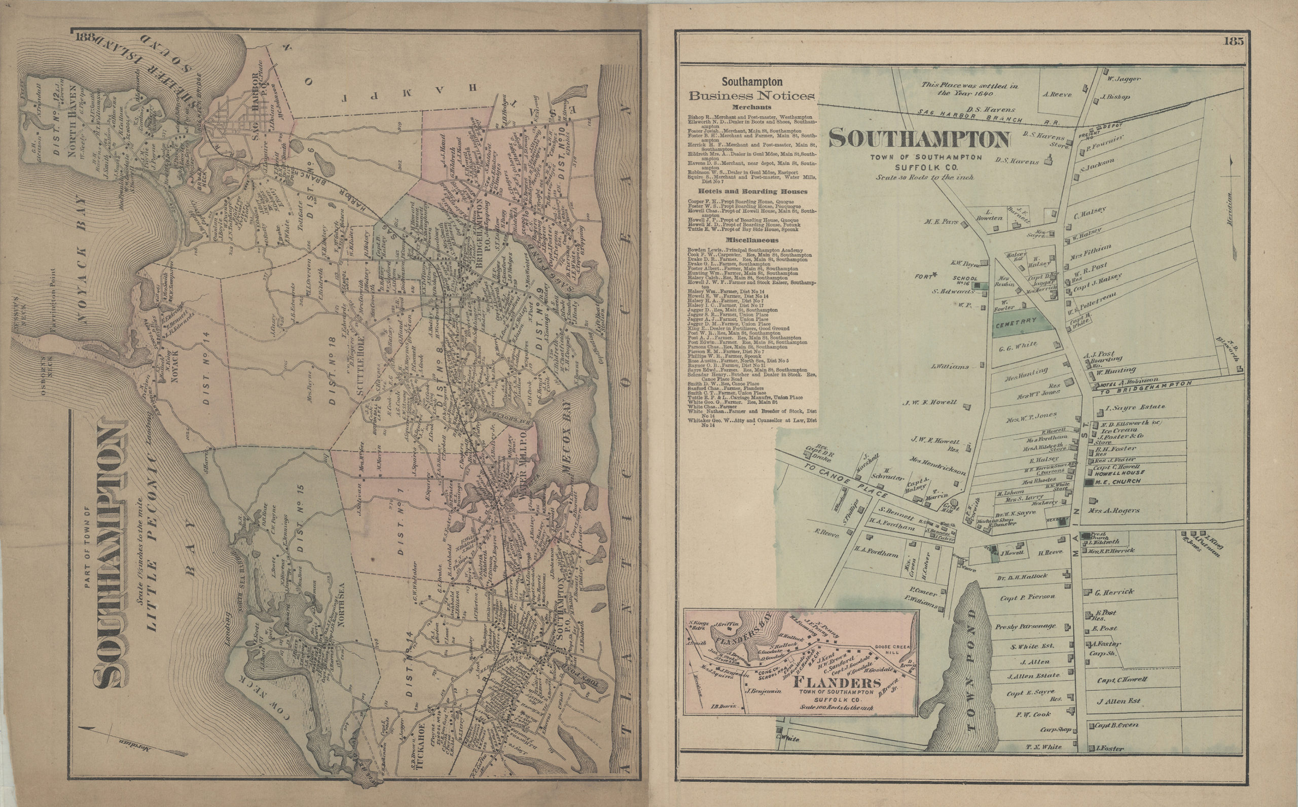
Creator
Beers, F. W.; Beers, Comstock & Cline,Publisher
Brooklyn Historical SocietyCitation
Southampton; [1873], Map Collection, L.I.-[1873]l.Fl c.2;L.I.-[1873]l.Fl; Brooklyn Historical Society.Scale
Scale [1:52,800] 1 1/5 in