
[Map of Long Island] [19??]
Map No. L.I.-[19--?]d.Fl
Covers Long Island, New York City, Westchester County and Rockland County in New York. Shows towns and railroad lines. Title devised by cataloger. Section of an unidentified larger map. BHS copy annotated in red ink and typescript, detailing journey of an unidentified person from South Hempstead to modern-day Glen Cove between April 21 and April 24, 1790.
Places
Map area shown
Genre
MapRelation
Full catalog recordSize
25 × 47 cmDownload
Low Resolution Image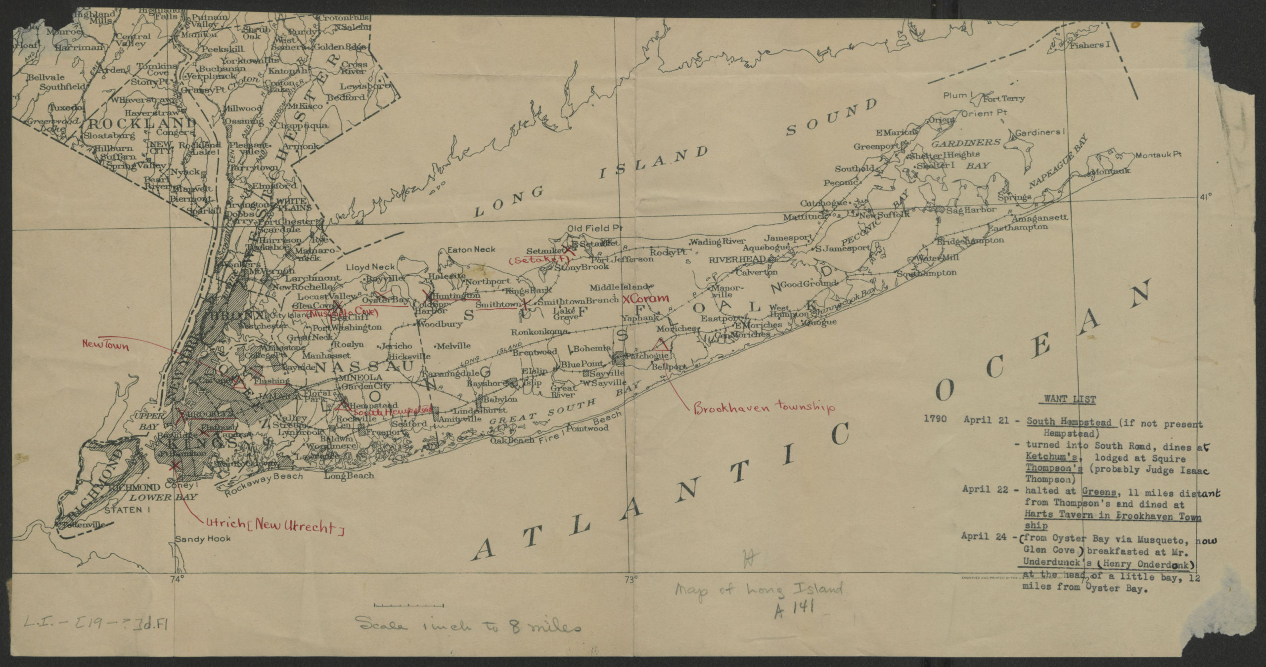
Creator
Publisher
Brooklyn Historical SocietyCitation
[Map of Long Island]; [19??], Map Collection, L.I.-[19--?]d.Fl; Brooklyn Historical Society.Scale
Scale 1:506,880. 1 in toLoading zoom image... 