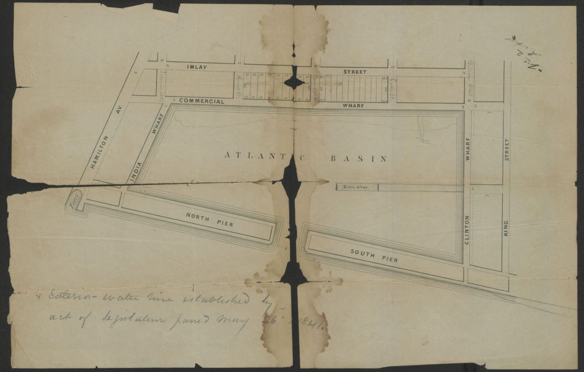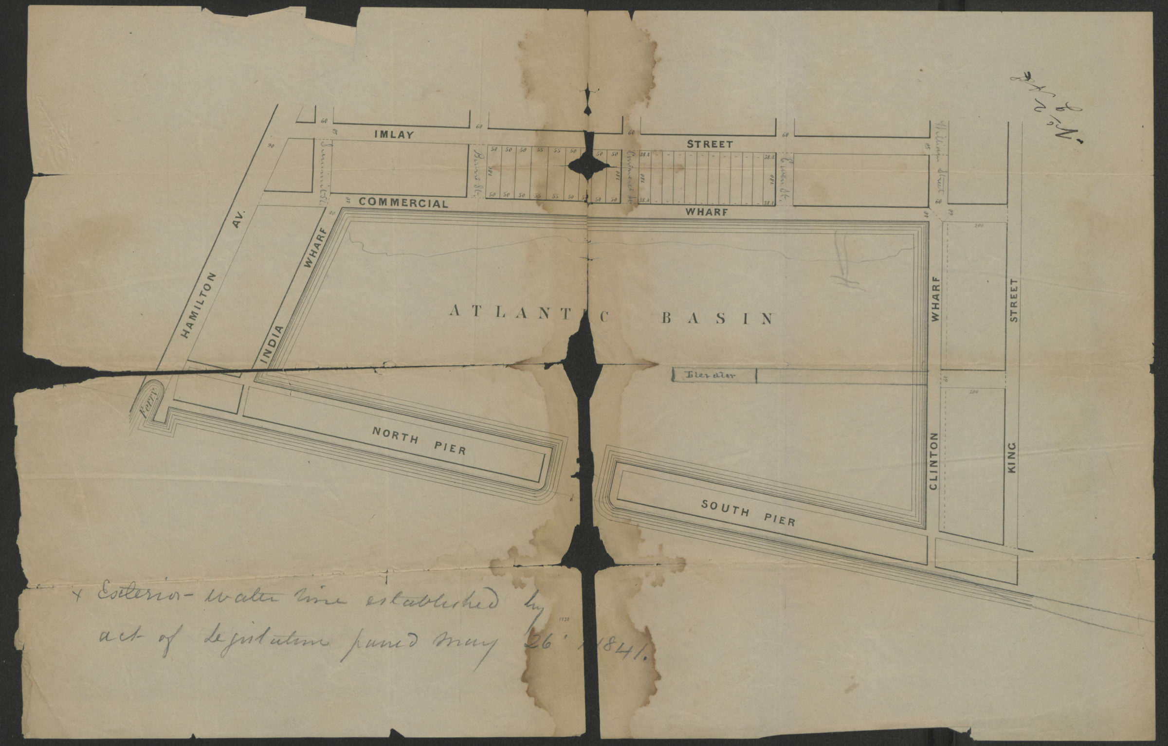
[Map of Atlantic Basin and surrounding blocks] [1841]
Map No. B A-[1841?].Fl
Cadastral map covers Atlantic Basin and immediate blocks in modern-day Red Hook. Shows lots and dimensions on 2 blocks between Imlay Street and Commerce Street. TItle devised by cataloger. Map found among the Brooklyn, N.Y., Department of Law, Corporation Counsel records at Brooklyn Historical Society.
Subjects
Places
Map area shown
Genre
Cadastral mapsRelation
Full catalog recordSize
28 × 42 cmDownload
Low Resolution Image
Creator
Publisher
Brooklyn Historical SocietyCitation
[Map of Atlantic Basin and surrounding blocks]; [1841], Map Collection, B A-[1841?].Fl; Brooklyn Historical Society.Scale
Scale not givenLoading zoom image...