Center for Brooklyn History
Map Collections
Search
About
Othmer Library & Archives
Submit search query
Refine 19 records
Clear filter
1
Location
Atlantic Basin (New York, N.Y.)
3
Bay Ridge (New York, N.Y.)
108
Bedford-Stuyvesant (New York, N.Y.)
67
Boerum Hill (New York, N.Y.)
6
Brooklyn (New York, N.Y.)
891
Brooklyn Heights (New York, N.Y.)
76
Brooklyn-Queens Expressway (New York, N.Y.)
3
Buttermilk Channel (New York, N.Y.)
1
Carroll Gardens (New York, N.Y.)
21
Clinton Hill (New York, N.Y.)
10
Cobble Hill (New York, N.Y.)
7
Columbia Street Waterfront District (New York, N.Y.)
3
Crown Heights (New York, N.Y.)
25
Downtown Brooklyn (New York, N.Y.)
29
East River (N.Y.)
3
Erie Basin (New York, N.Y.)
2
Fort Greene (New York, N.Y.)
22
Gowanus (New York, N.Y.)
12
Gowanus Bay (New York, N.Y.)
1
Gowanus Canal (New York, N.Y.)
5
Greenpoint (New York, N.Y.)
38
Park Slope (New York, N.Y.)
16
Prospect Heights (New York, N.Y.)
16
Red Hook (New York, N.Y.)
19
Sunset Park (New York, N.Y.)
53
Upper Bay (N.Y. and N.J.)
4
Williamsburg (New York, N.Y.)
36
Show 7 more
Subject
Election districts
36
Express highways
3
Harbors
11
Landowners
434
Marine terminals
2
Piers
25
Real property
619
Streets
46
Watersheds
5
Date
19th Century
945
20th Century
469
or enter range:
from
to
Genres
Cadastral maps
597
Manuscript maps
365
Map
191
Road maps
83
Transportation maps
120
Zoning maps
55
Sort by:
Date (earliest)
Date (most recent)
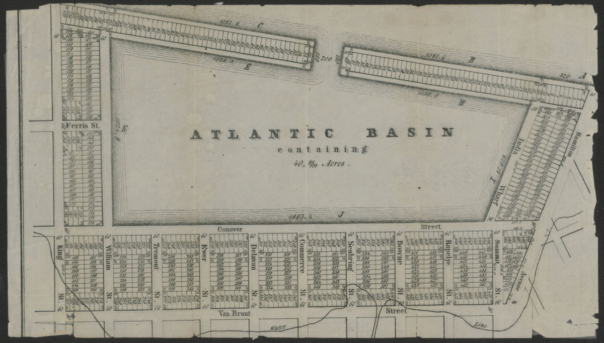
Atlantic Basin containing 40” 86/100 acres
Atlantic Basin containing 40” 86/100 acres
[18??]
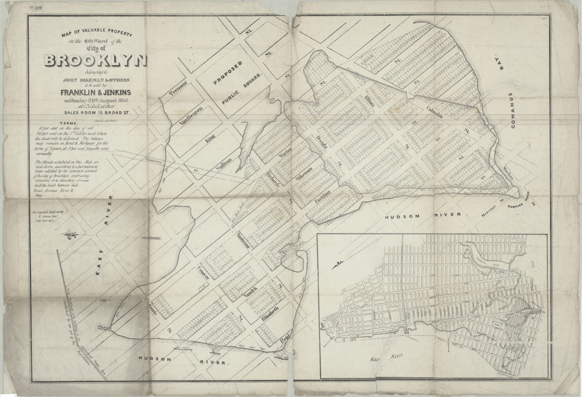
Map of valuable property in the 6th ward of the city of Brooklyn: belonging to John Dikeman & others to be sold by Franklin & Jenkins on Monday, 29th August, 1836 at 12 o’clock at their sales room, 15 Broad St.: surveyed & laid out by R. Graves
Map of valuable property in the 6th ward of the city of Brooklyn: belonging to John Dikeman & others to be sold by Franklin & Jenkins on Monday, 29th August, 1836 at 12 o’clock at their sales room, 15 Broad St.: surveyed & laid out by R. Graves
[1836]
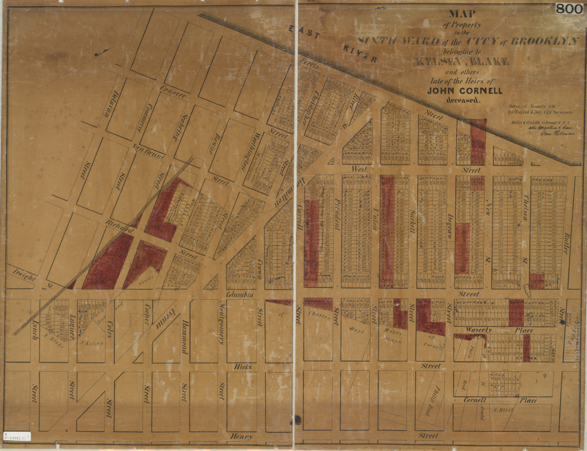
Map of property in the Sixth Ward of the city of Brooklyn belonging to Kelsey, Blake and others late of the heirs of John Cornell, deceased: surveyed, January 1838 by Tolford & Day, city surveyors
Map of property in the Sixth Ward of the city of Brooklyn belonging to Kelsey, Blake and others late of the heirs of John Cornell, deceased: surveyed, January 1838 by Tolford & Day, city surveyors
[1838]
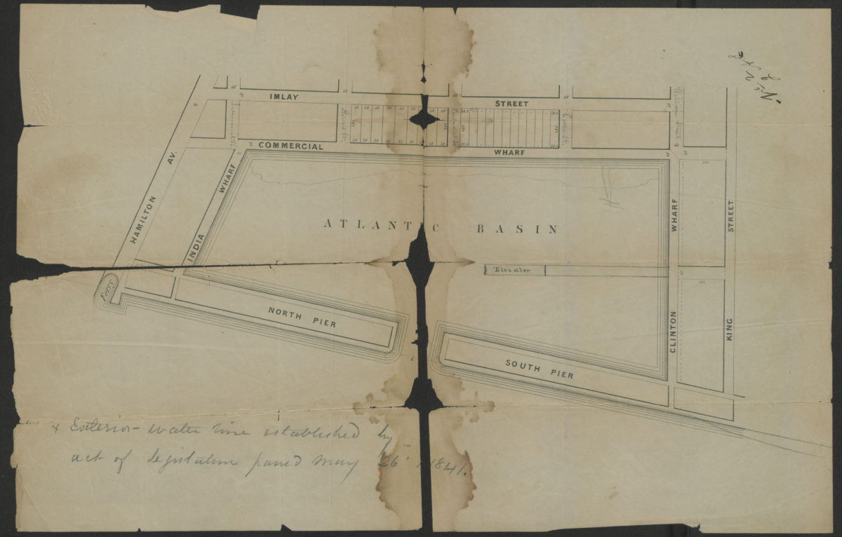
[Map of Atlantic Basin and surrounding blocks]
[Map of Atlantic Basin and surrounding blocks]
[1841]
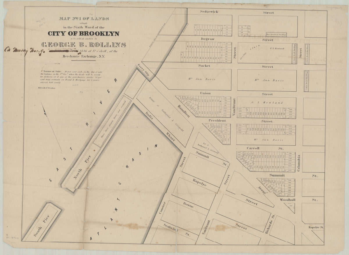
Map no. 1 of lands situate[d] in the Sixth Ward of the city of Brooklyn, to be sold at auction by George B. Rollins on Friday, 23rd Oct., 1846, at 12 o’clock at the Merchants’ Exchange, N.Y.
Map no. 1 of lands situate[d] in the Sixth Ward of the city of Brooklyn, to be sold at auction by George B. Rollins on Friday, 23rd Oct., 1846, at 12 o’clock at the Merchants’ Exchange, N.Y.
1846
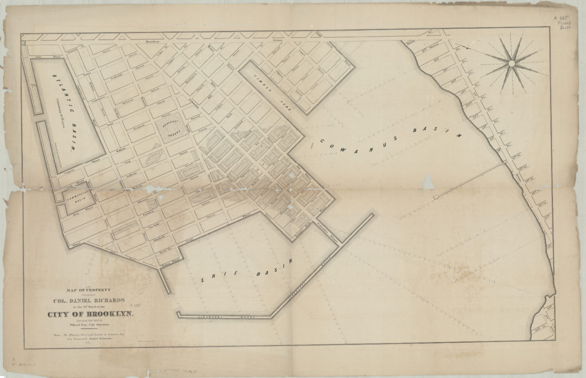
Map of property belonging to Col. Daniel Richards in the 6th Ward of the city of Brooklyn: surveyed Feby. 1847 by Willard Day, city surveyor
Map of property belonging to Col. Daniel Richards in the 6th Ward of the city of Brooklyn: surveyed Feby. 1847 by Willard Day, city surveyor
1847
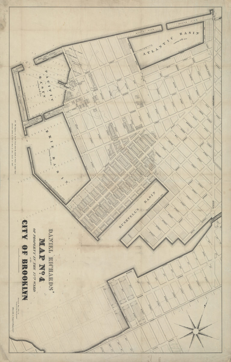
Daniel Richards’ map no. 2 of property in the 6th Ward, Brooklyn
Daniel Richards’ map no. 2 of property in the 6th Ward, Brooklyn
1852
Daniel Richards’ map no. 4 of property in the 12th Ward of the city of Brooklyn: surveyed May, 1855, by George H. Day, city surveyor
Daniel Richards’ map no. 4 of property in the 12th Ward of the city of Brooklyn: surveyed May, 1855, by George H. Day, city surveyor
[1855]
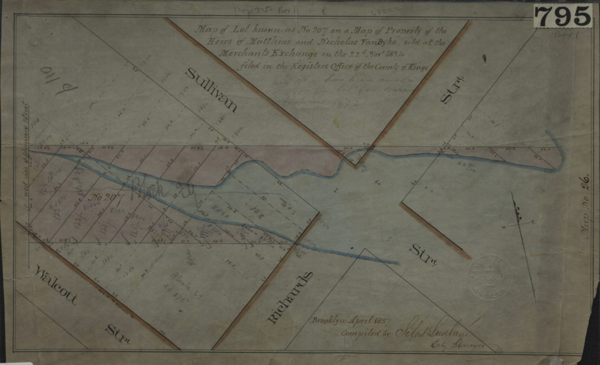
Map of lot known as No. 207 on a Map of property of the heirs of Matthias and Nicholas Van Byke, sold at the Merchants Exchange on the 22d Novr. 1834, filed in the Register’s Office of the County of Kings: compiled by Silas Ludlam, city surveyor
Map of lot known as No. 207 on a Map of property of the heirs of Matthias and Nicholas Van Byke, sold at the Merchants Exchange on the 22d Novr. 1834, filed in the Register’s Office of the County of Kings: compiled by Silas Ludlam, city surveyor
April 1857
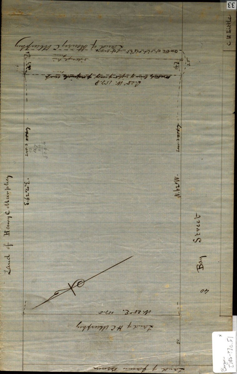
[Map of Bay St.].
[Map of Bay St.].
[186?]
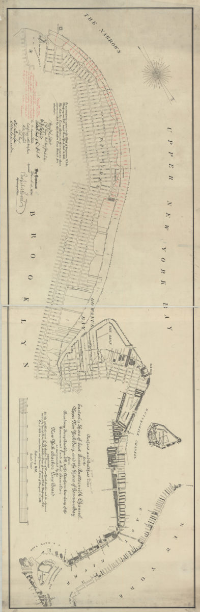
Pierhead and bulkhead lines for the easterly shore of East River, Buttermilk Channel, Upper New York Bay, and the shores of Gowanus Bay, from Broadway Ferry Brooklyn, E.D., to the northern boundary of the government land at Fort Hamilton
Pierhead and bulkhead lines for the easterly shore of East River, Buttermilk Channel, Upper New York Bay, and the shores of Gowanus Bay, from Broadway Ferry Brooklyn, E.D., to the northern boundary of the government land at Fort Hamilton
February 1890
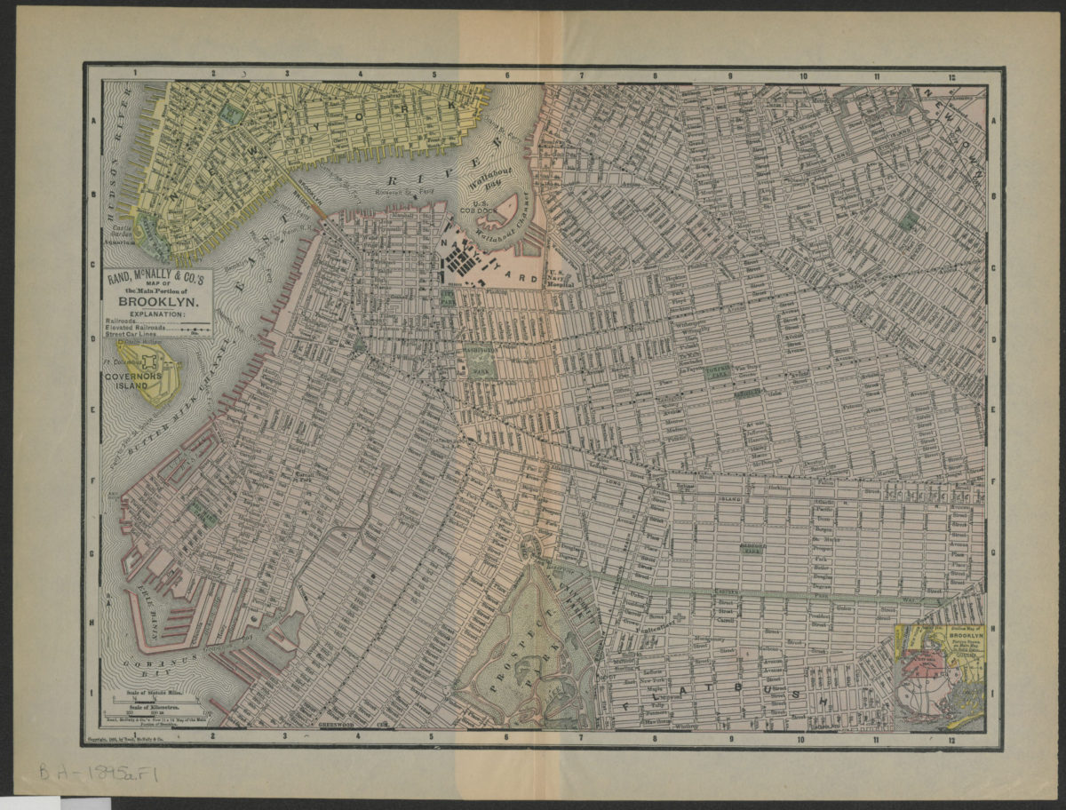
Rand, McNally & Co.’s map of the main portion of Brooklyn
Rand, McNally & Co.’s map of the main portion of Brooklyn
[1895; 1895]
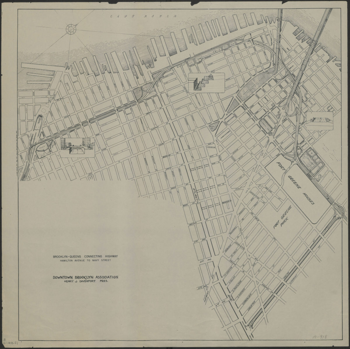
Brooklyn-Queens connecting highway: Hamilton Avenue to Navy Street: Downtown Brooklyn Association
Brooklyn-Queens connecting highway: Hamilton Avenue to Navy Street: Downtown Brooklyn Association
[1943]
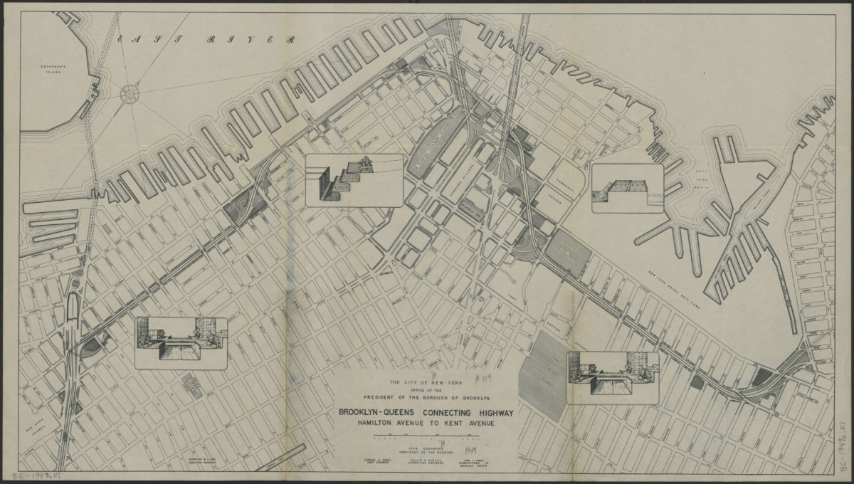
Brooklyn-Queens connecting highway: Hamilton Avenue to Kent Avenue
Brooklyn-Queens connecting highway: Hamilton Avenue to Kent Avenue
[1949]
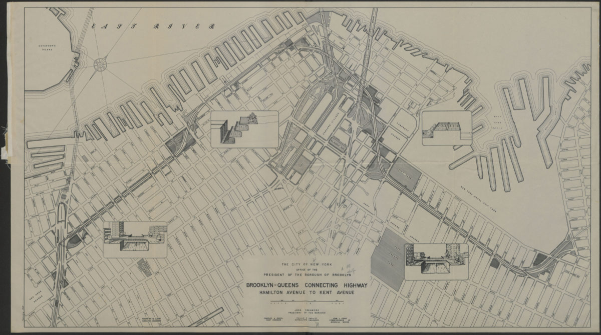
Brooklyn-Queens connecting highway: Hamilton Avenue to Kent Avenue
Brooklyn-Queens connecting highway: Hamilton Avenue to Kent Avenue
1949
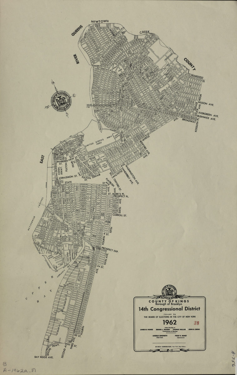
County of Kings, Borough of Brooklyn, 14th Congressional District: issued by the Board of Elections in the City of New York
County of Kings, Borough of Brooklyn, 14th Congressional District: issued by the Board of Elections in the City of New York
1962
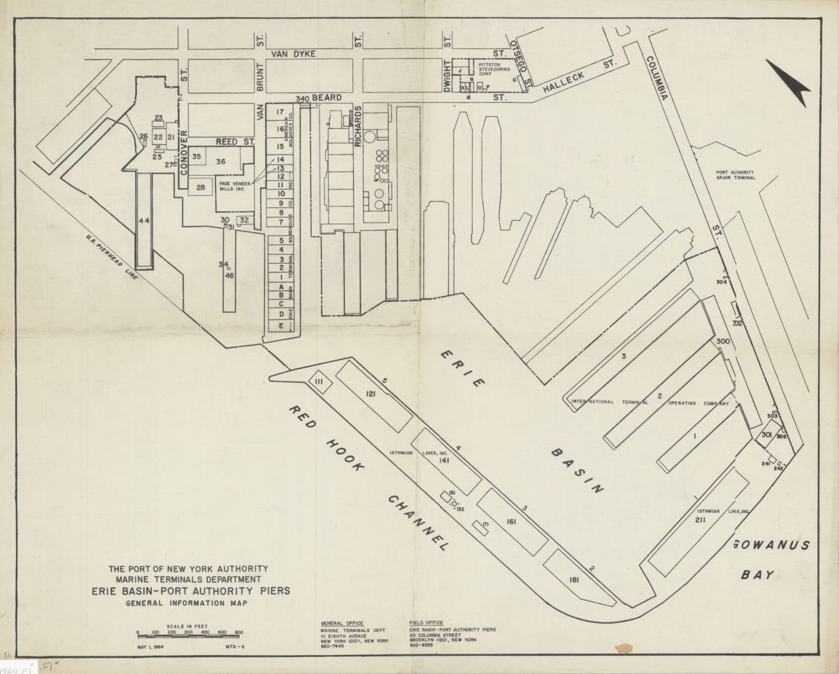
Erie Basin-Port Authority piers: general information map
Erie Basin-Port Authority piers: general information map
1964
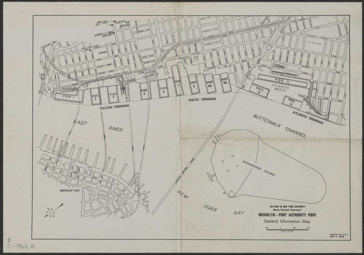
Brooklyn-Port Authority piers: general information map
Brooklyn-Port Authority piers: general information map
1964
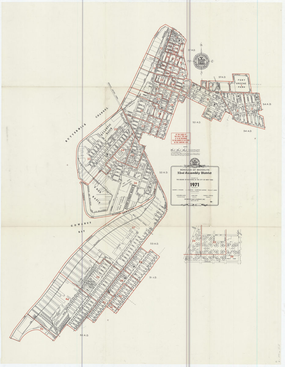
Borough of Brooklyn 52nd Assembly District, 1971: issued by the Board of Elections in the City of New York
Borough of Brooklyn 52nd Assembly District, 1971: issued by the Board of Elections in the City of New York
1971