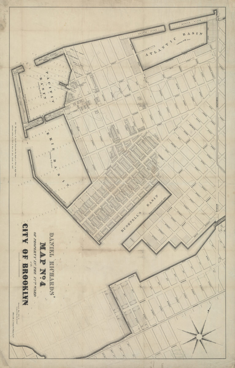
Daniel Richards’ map no. 4 of property in the 12th Ward of the city of Brooklyn: surveyed May, 1855, by George H. Day, city surveyor [1855]
Map No. B P-[1855]a.Fl
Cadastral map covering area north from the Gowanus Bay to the Atlantic Basin and east to Hamilton Ave. (modern-day Red Hook). Shows property (including lot numbers and dimensions), names of landowners, ferry slips, piers, basins, and the Gowanus Canal. Oriented with north to the upper left. Includes note. “2510”–Lower center margin.
Subjects
Places
Map area shown
Genre
Cadastral mapsRelation
Full catalog recordSize
62 × 70 cmDownload
Low Resolution Image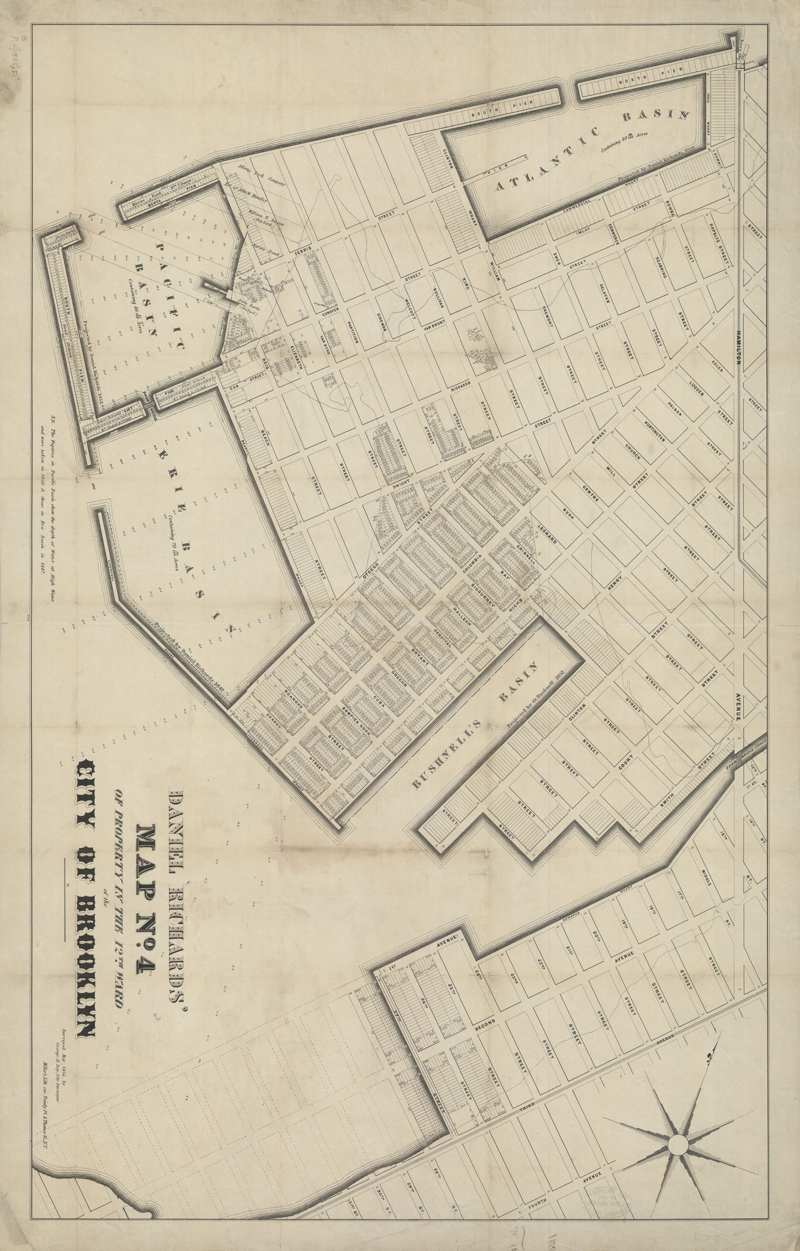
Creator
Day, George H.,Publisher
Brooklyn Historical SocietyCitation
Daniel Richards’ map no. 4 of property in the 12th Ward of the city of Brooklyn: surveyed May, 1855, by George H. Day, city surveyor; [1855], Map Collection, B P-[1855]a.Fl; Brooklyn Historical Society.Scale
Scale not givenLoading zoom image...