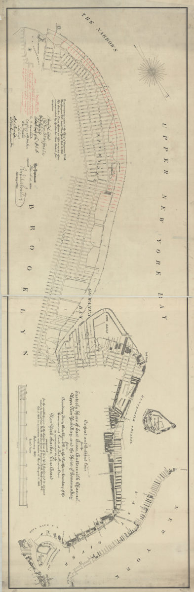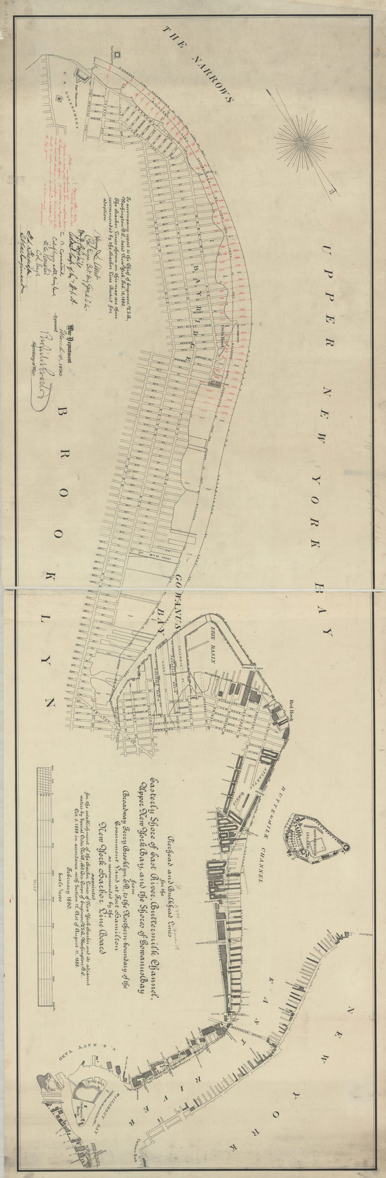
Pierhead and bulkhead lines for the easterly shore of East River, Buttermilk Channel, Upper New York Bay, and the shores of Gowanus Bay, from Broadway Ferry Brooklyn, E.D., to the northern boundary of the government land at Fort Hamilton February 1890
Map No. B A-1890.Fl
Covers Brooklyn north from the Narrows to Wallabout Bay (including portions of modern-day Bay Ridge, Gowanus, Red Hook, the Columbia Street Waterfront District, Brooklyn Heights, and DUMBO). Also covers Governors Island and part of Lower Manhattan. Shows piers, basins, and buildings. “To accompany report to the Chief of Engineers, U.S.A., Washington D.C., dated New York, Feb. 18, 1890. The harbor lines shown on this map are those recommended by the Harbor Line Board for adoption.” Includes note and signatures of the Board members and the Secretary of War.
Subjects
Places
Map area shown
Genre
MapRelation
Full catalog recordSize
41 × 132 cmDownload
Low Resolution Image
Creator
United States; Army.; Corps of Engineers.; New York Harbor Line Board,Publisher
Brooklyn Historical SocietyCitation
Pierhead and bulkhead lines for the easterly shore of East River, Buttermilk Channel, Upper New York Bay, and the shores of Gowanus Bay, from Broadway Ferry Brooklyn, E.D., to the northern boundary of the government land at Fort Hamilton; February 1890, Map Collection, B A-1890.Fl; Brooklyn Historical Society.Scale
Scale 1:10,000Loading zoom image...