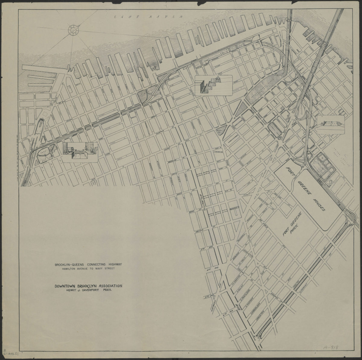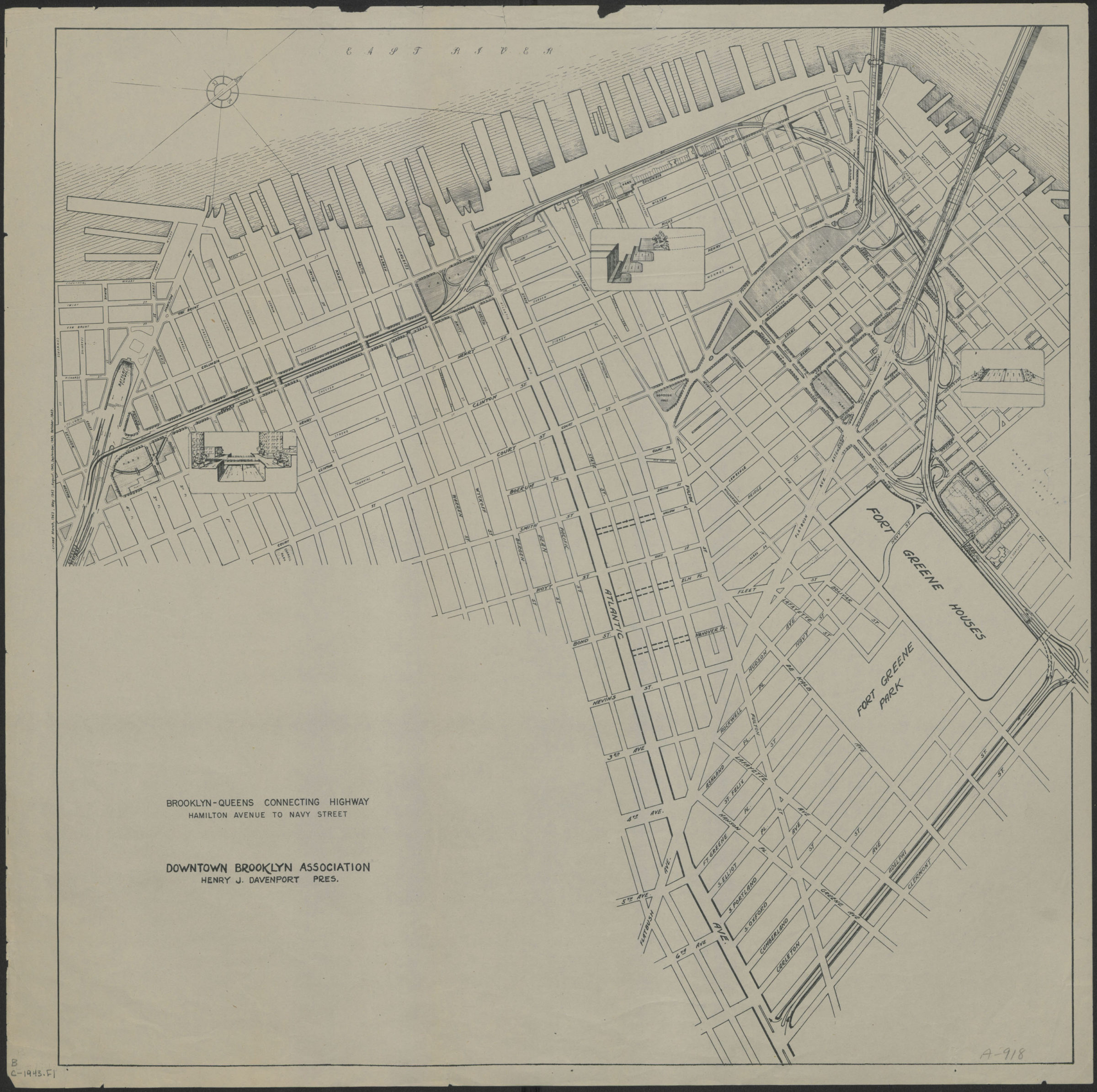
Brooklyn-Queens connecting highway: Hamilton Avenue to Navy Street: Downtown Brooklyn Association [1943]
Map No. B C-1943.Fl
Shows the portion of the Brooklyn-Queens Connecting Highway (BQE) that runs through Red Hook, Carroll Gardens, Columbia Street Waterfront District, Brooklyn Heights, Downtown Brooklyn and the Brooklyn Navy Yard. “Revised March, 1943 May, 1943 August, 1943 September, 1943 October, 1943.” Includes 3 inset illustrations of cross-sections at key locations. Oriented with north to the upper right. “Downtown Brooklyn Association, Henry J. Davenport, Pres.”
Subjects
Places
Map area shown
Genre
Road mapsRelation
Full catalog recordSize
54 × 52 cmDownload
Low Resolution Image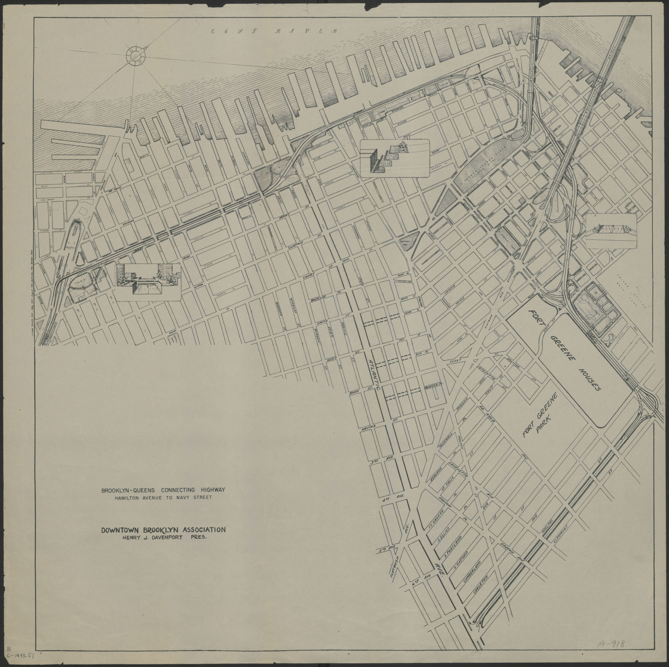
Creator
Downtown Brooklyn Association (New York, N.Y.),Publisher
Brooklyn Historical SocietyCitation
Brooklyn-Queens connecting highway: Hamilton Avenue to Navy Street: Downtown Brooklyn Association; [1943], Map Collection, B C-1943.Fl; Brooklyn Historical Society.Scale
Scale not givenLoading zoom image...