
Rand, McNally & Co.’s map of the main portion of Brooklyn [1895; 1895]
Map No. B A-1895a.Fl
Shows streets in modern-day neighborhoods in Brooklyn Heights, Downtown Brooklyn, Fort Greene, Clinton Hill, Williamsburg, Bedford-Stuyvesant, Crown Heights, Prospect Heights, Park Slope, Gowanus, Red Hook, Carroll Gardens, Boerum Hill, and Cobble Hill. Includes inset location map.
Subjects
Places
- Bedford-Stuyvesant (New York, N.Y.)
- Boerum Hill (New York, N.Y.)
- Brooklyn (New York, N.Y.)
- Brooklyn Heights (New York, N.Y.)
- Carroll Gardens (New York, N.Y.)
- Clinton Hill (New York, N.Y.)
- Cobble Hill (New York, N.Y.)
- Crown Heights (New York, N.Y.)
- Downtown Brooklyn (New York, N.Y.)
- Fort Greene (New York, N.Y.)
- Gowanus (New York, N.Y.)
- Park Slope (New York, N.Y.)
- Prospect Heights (New York, N.Y.)
- Red Hook (New York, N.Y.)
- Williamsburg (New York, N.Y.)
Map area shown
Genre
MapRelation
Full catalog recordSize
22 × 31 cmDownload
Low Resolution Image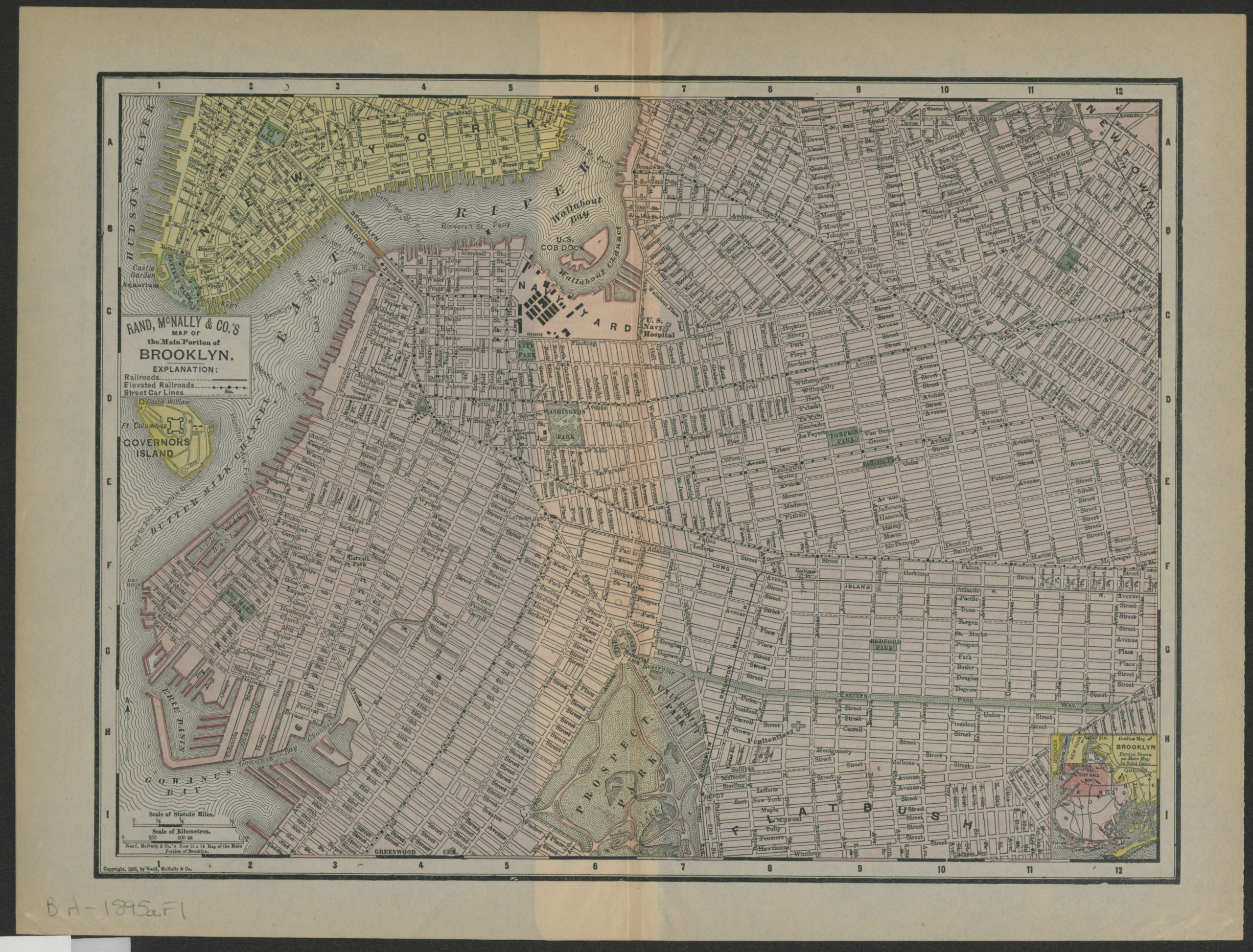
Creator
Rand McNally and Company,Publisher
Brooklyn Historical SocietyCitation
Rand, McNally & Co.’s map of the main portion of Brooklyn; [1895; 1895], Map Collection, B A-1895a.Fl; Brooklyn Historical Society.Scale
Scale approximately 1:27,Loading zoom image... 