Center for Brooklyn History
Map Collections
Search
About
Othmer Library & Archives
Submit search query
Refine 12 records
Clear filter
1
Location
Bedford-Stuyvesant (New York, N.Y.)
67
Boerum Hill (New York, N.Y.)
6
Brooklyn (New York, N.Y.)
891
Brooklyn Heights (New York, N.Y.)
76
Carroll Gardens (New York, N.Y.)
21
Clinton Hill (New York, N.Y.)
10
Cobble Hill (New York, N.Y.)
7
Crown Heights (New York, N.Y.)
25
Downtown Brooklyn (New York, N.Y.)
29
Fort Greene (New York, N.Y.)
22
Gowanus (New York, N.Y.)
12
Gowanus Canal (New York, N.Y.)
5
Greenpoint (New York, N.Y.)
38
Park Slope (New York, N.Y.)
16
Prospect Heights (New York, N.Y.)
16
Red Hook (New York, N.Y.)
19
Sunset Park (New York, N.Y.)
53
Williamsburg (New York, N.Y.)
36
Subject
Canals
15
Election districts
36
Land grants
12
Landowners
434
Real property
619
Riparian rights
13
Rivers
16
Roads
117
Streets
46
Submerged lands
17
Date
19th Century
945
20th Century
469
or enter range:
from
to
Genres
Blueprints (reprographic copies)
1
Cadastral maps
597
Manuscript maps
365
Map
191
Zoning maps
55
Sort by:
Date (earliest)
Date (most recent)
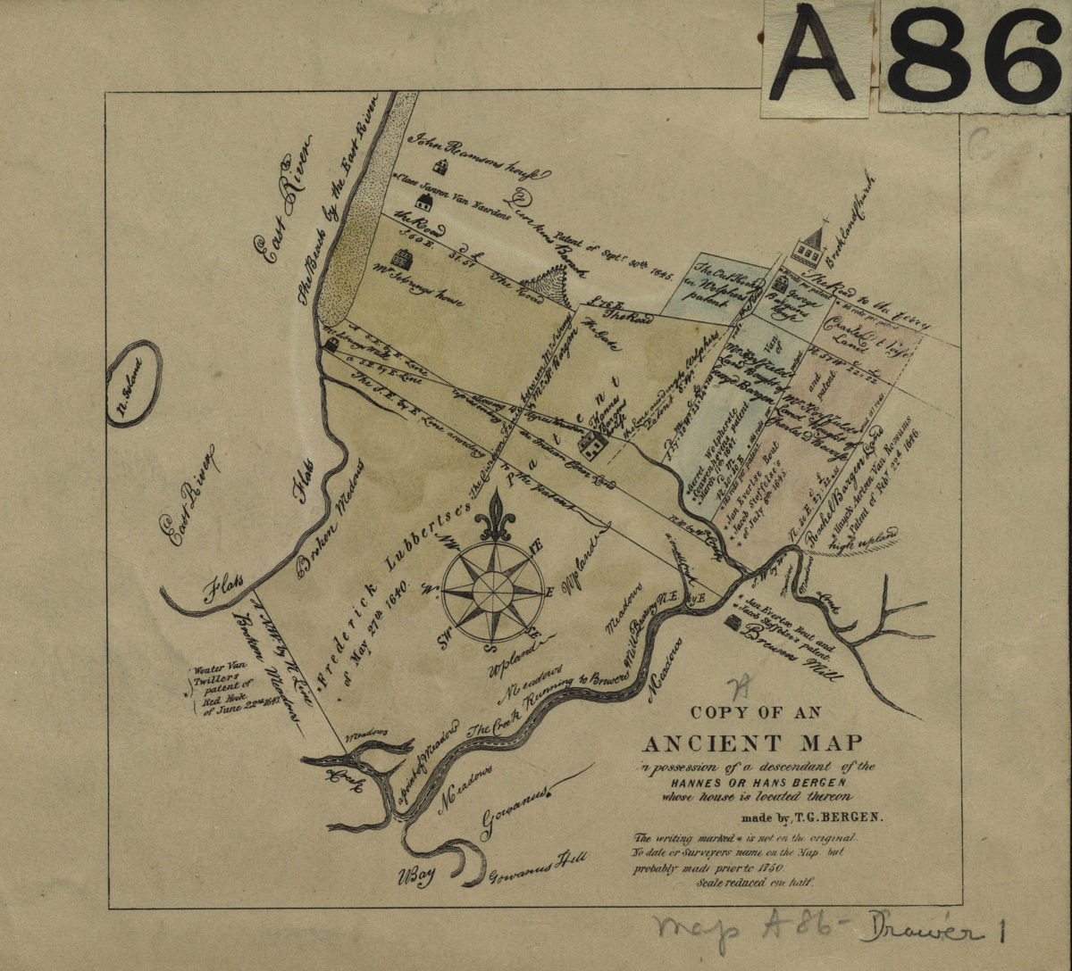
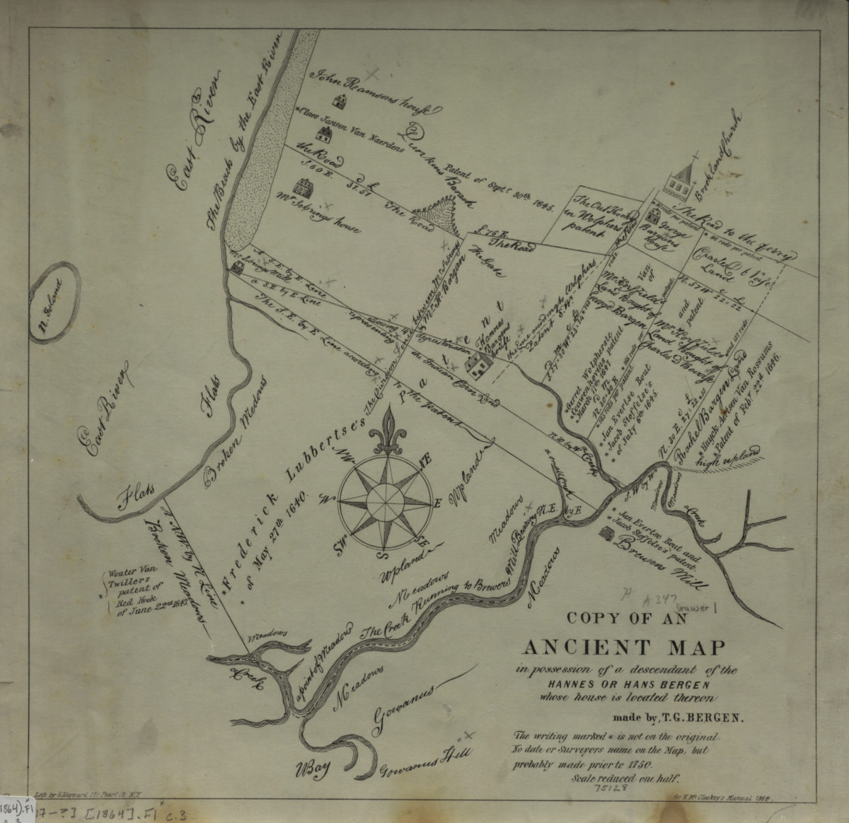
Copy of an ancient map in possession of a descendant of the Hannes or Han Bergen: whose house is located thereon: made by T. G. Bergen
Copy of an ancient map in possession of a descendant of the Hannes or Han Bergen: whose house is located thereon: made by T. G. Bergen
[18??]
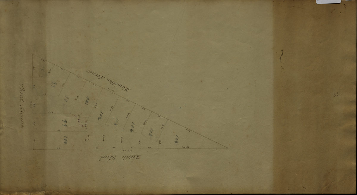
[Map of area bounded by Middle St., Hamilton Ave., and 3rd Ave.].
[Map of area bounded by Middle St., Hamilton Ave., and 3rd Ave.].
[18??]
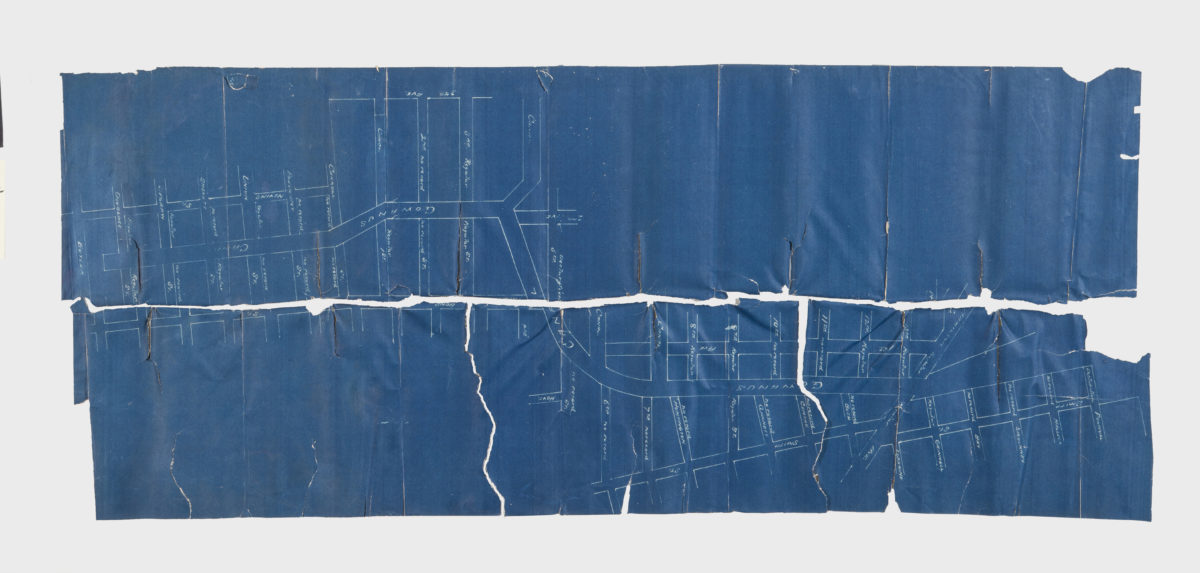
[Map showing the intersection of Gowanus Creek with Gowanus Canal, Brooklyn, N.Y.]
[Map showing the intersection of Gowanus Creek with Gowanus Canal, Brooklyn, N.Y.]
[18??]
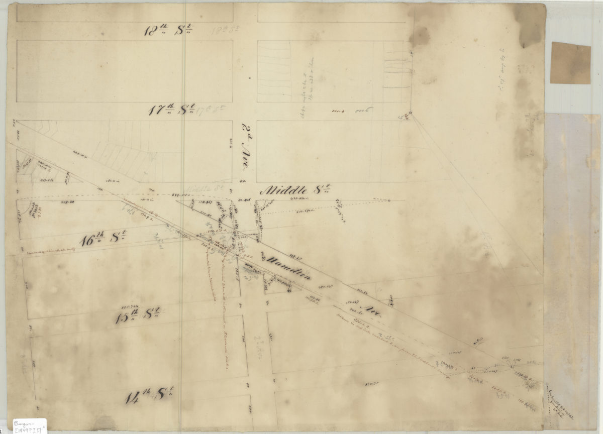
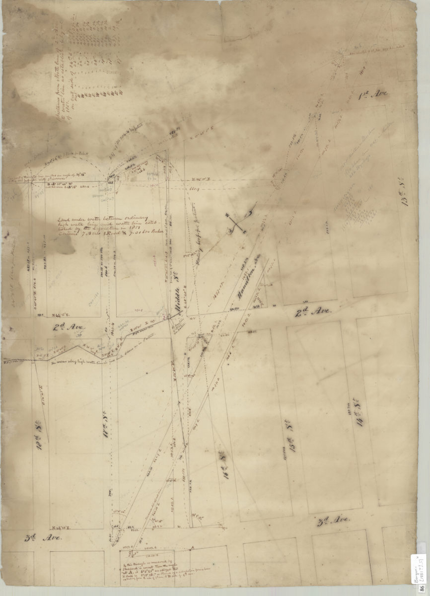
[Map of 2nd Ave. between 14th St. and 18th St.].
[Map of 2nd Ave. between 14th St. and 18th St.].
[1849]
Heirs of Peter Wyckoff, west of 3rd Ave
Heirs of Peter Wyckoff, west of 3rd Ave
[185?]
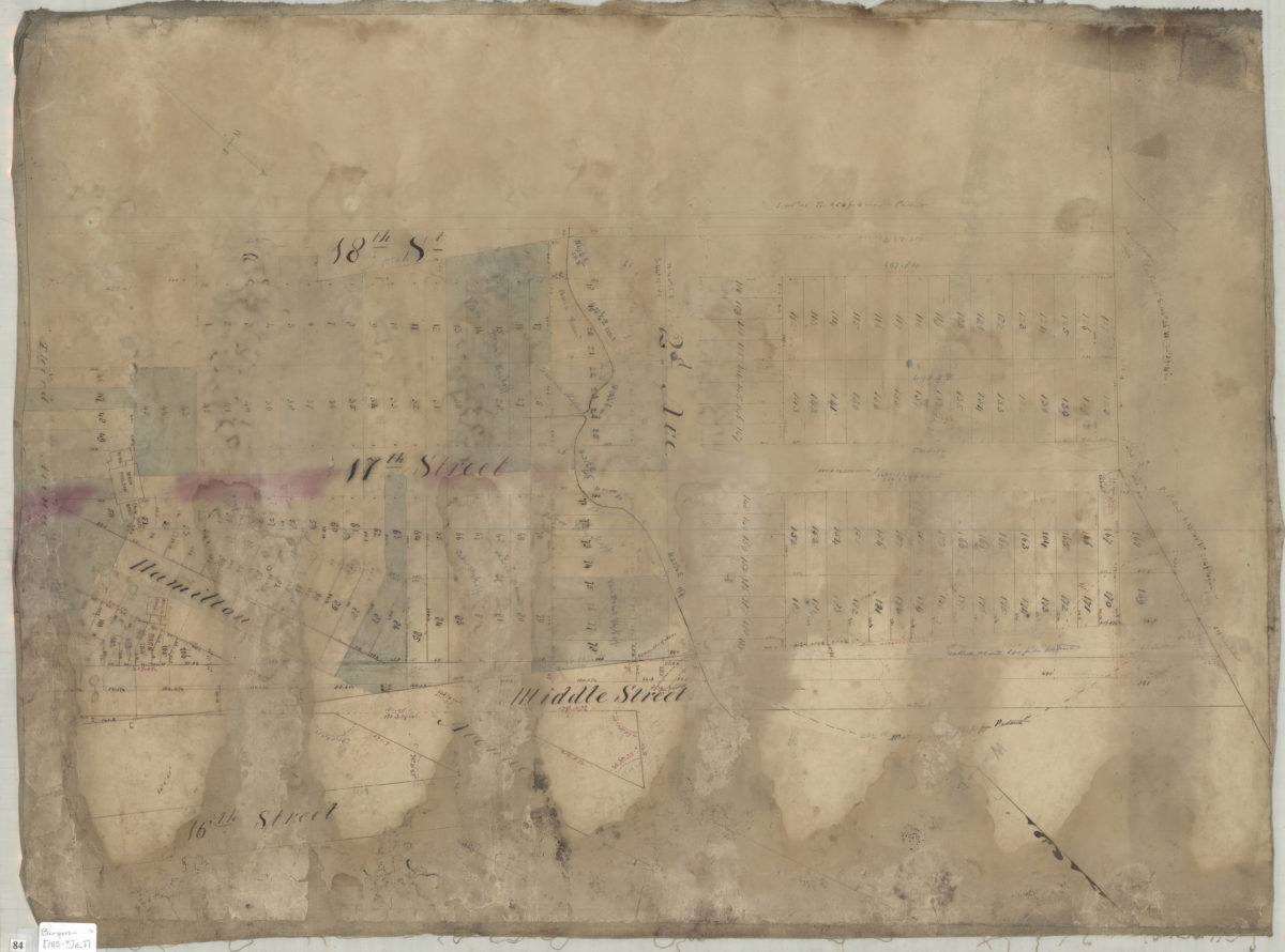
[Map of 2nd Ave. and 3rd Ave. between 14th St. and 18th St.].
[Map of 2nd Ave. and 3rd Ave. between 14th St. and 18th St.].
[1851]
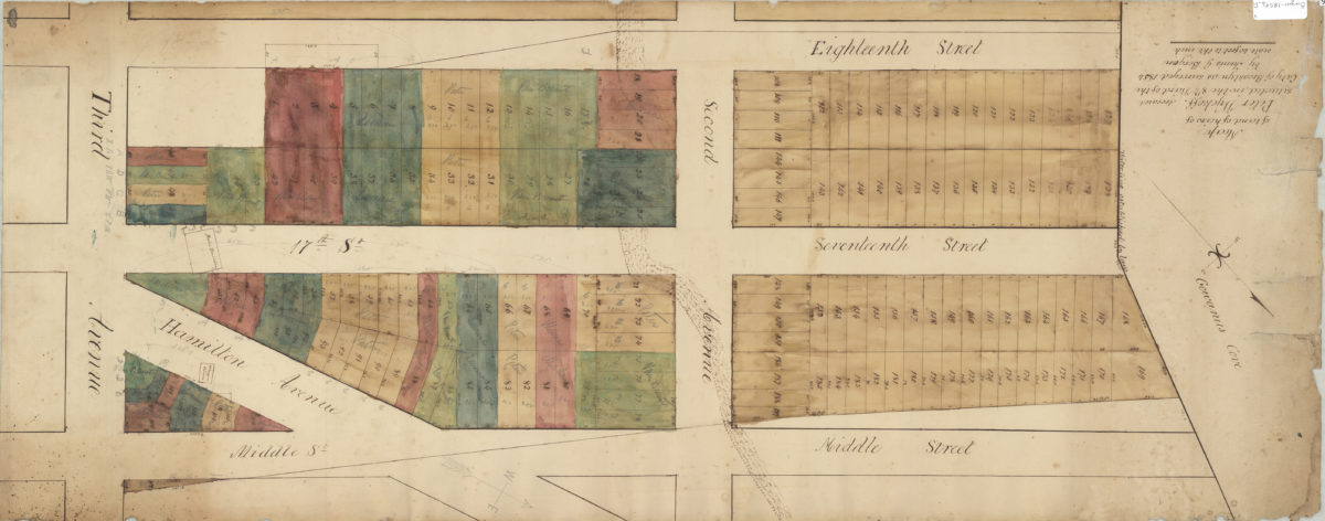
Map of land of heirs of Peter Wyckoff, deceased, situated in the 8th Ward of the city of Brooklyn, as surveyed 1854: by Tunis G. Bergen
Map of land of heirs of Peter Wyckoff, deceased, situated in the 8th Ward of the city of Brooklyn, as surveyed 1854: by Tunis G. Bergen
1854
Copy of an ancient map in possession of a descendant of the Hannes or Han Bergen: whose house is located thereon: made by T. G. Bergen
Copy of an ancient map in possession of a descendant of the Hannes or Han Bergen: whose house is located thereon: made by T. G. Bergen
[1864]
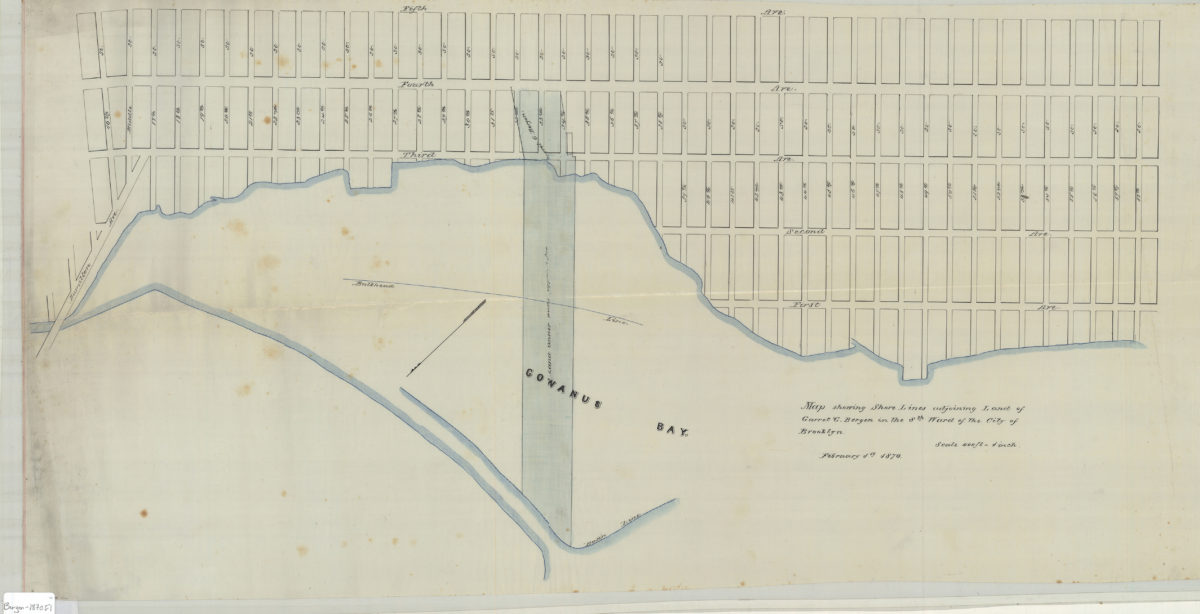
Map showing shore lines adjoining land of Garret G. Bergen in the 8th Ward of the city of Brooklyn
Map showing shore lines adjoining land of Garret G. Bergen in the 8th Ward of the city of Brooklyn
February 1, 1870
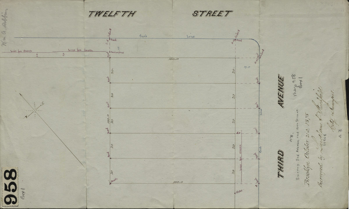
[Map of 3rd Ave. and 12th St.]: surveyed by Ludlam & Stuchfield, city surveyors
[Map of 3rd Ave. and 12th St.]: surveyed by Ludlam & Stuchfield, city surveyors
October 21, 1875
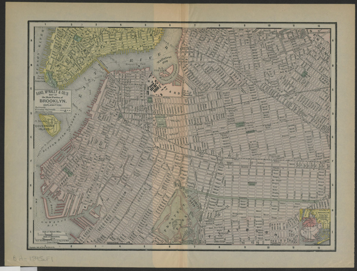
Rand, McNally & Co.’s map of the main portion of Brooklyn
Rand, McNally & Co.’s map of the main portion of Brooklyn
[1895; 1895]
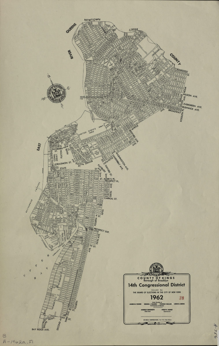
County of Kings, Borough of Brooklyn, 14th Congressional District: issued by the Board of Elections in the City of New York
County of Kings, Borough of Brooklyn, 14th Congressional District: issued by the Board of Elections in the City of New York
1962