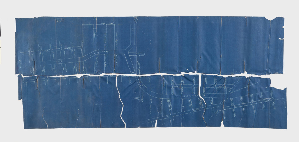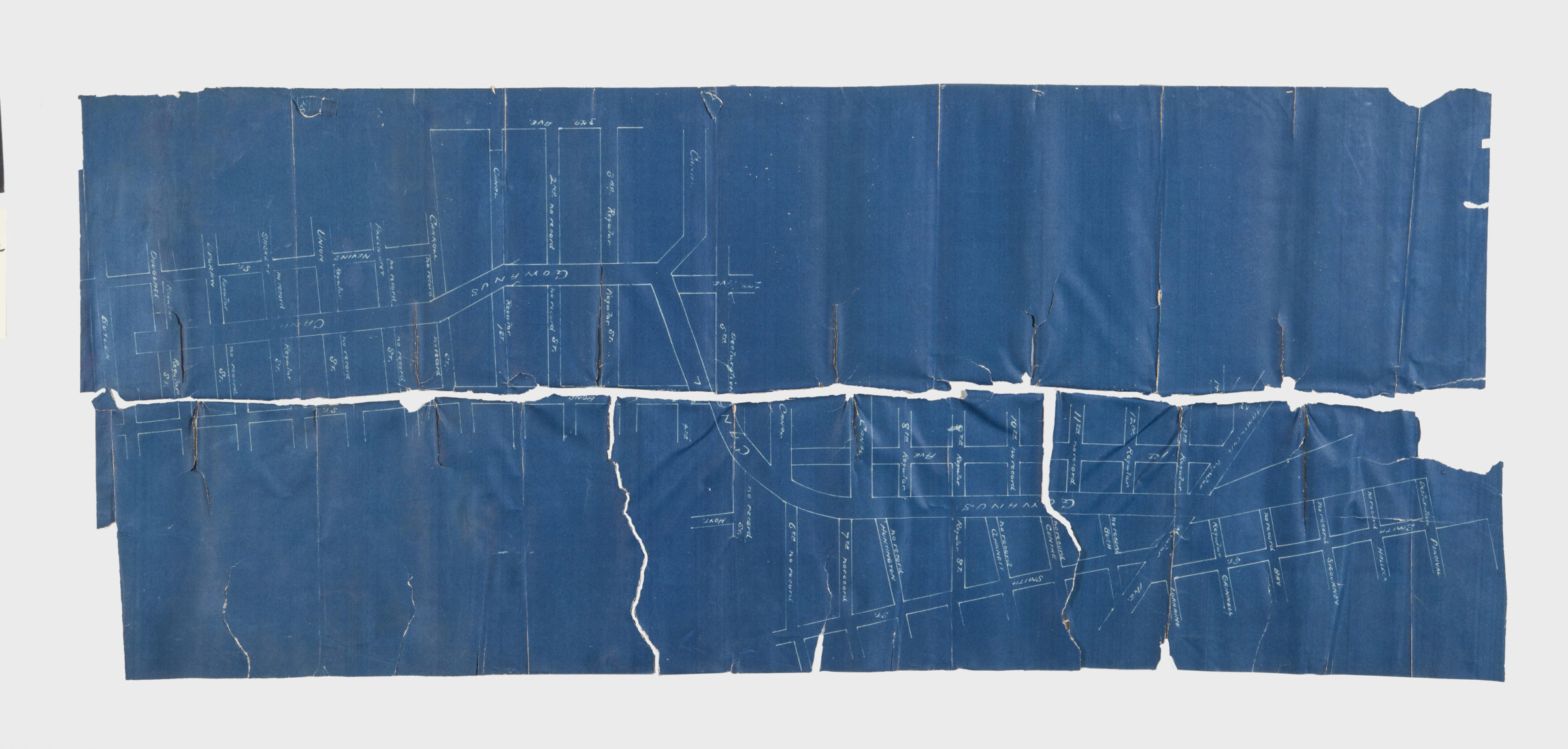
[Map showing the intersection of Gowanus Creek with Gowanus Canal, Brooklyn, N.Y.] [18??]
Map No. B A-[18--?]f.Fl
Map follows the routes of Gowanus canal and Gowanus Creek from Butler Street to Gravesend Bay in modern-day Gowanus. Title devised by cataloger. Blueprint. Oriented with north to the bottom. Map found among the Brooklyn, N.Y., Department of Law, Corporation Counsel records at Brooklyn Historical Society.
Subjects
Places
Map area shown
Relation
Full catalog recordSize
35 × 82 cmDownload
Low Resolution Image
Creator
Publisher
Brooklyn Historical SocietyCitation
[Map showing the intersection of Gowanus Creek with Gowanus Canal, Brooklyn, N.Y.]; [18??], Map Collection, B A-[18--?]f.Fl; Brooklyn Historical Society.Scale
Scale not givenLoading zoom image...