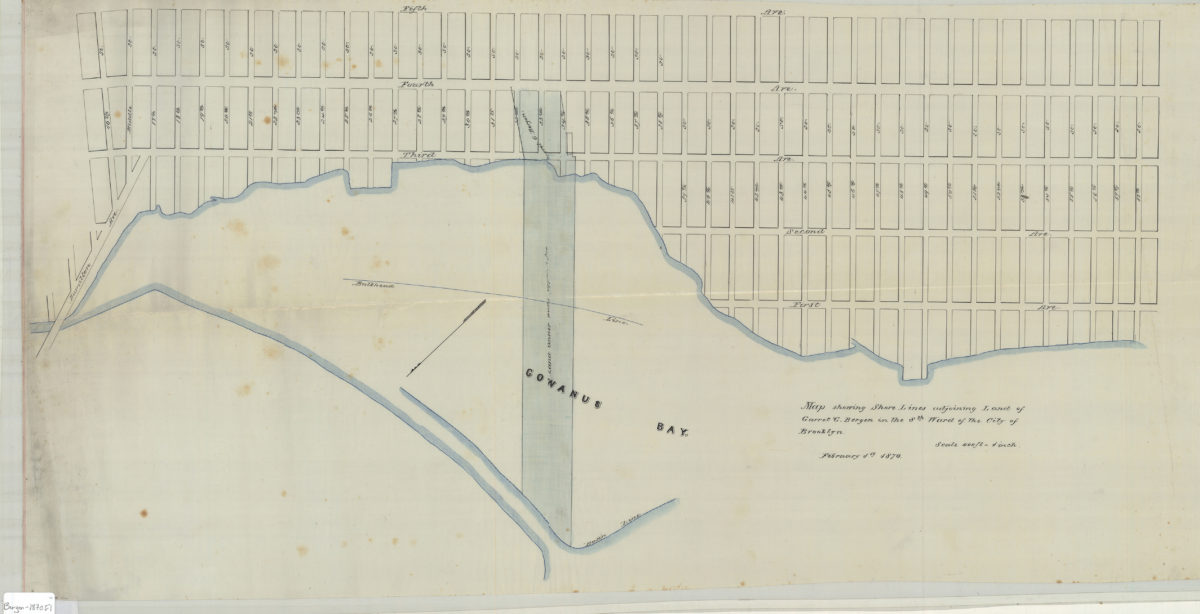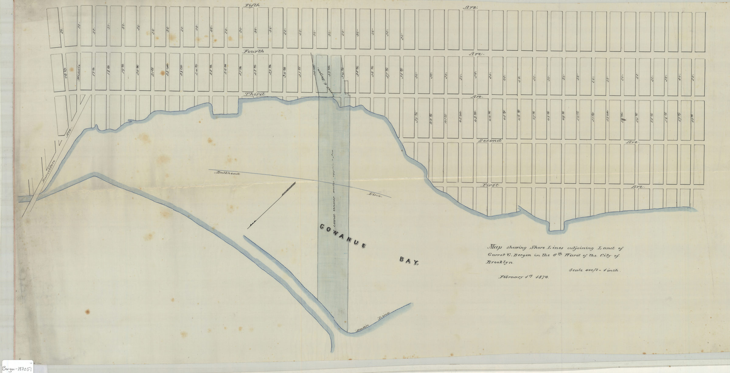
Map showing shore lines adjoining land of Garret G. Bergen in the 8th Ward of the city of Brooklyn February 1, 1870
Map No. Bergen-1870.Fl
Cadastral map covering area north from 58th St. to 16th St. and east from Gowanus Bay to 5th Ave. (modern day Gowanus and Sunset Park). Shows property, names of landowners, and bulkhead lines. Likely attributed to Van Brunt Bergen, based on handwriting on piece. Oriented with north to the lower left.
Subjects
Places
Map area shown
Relation
Full catalog recordSize
41 × 81 cmDownload
Low Resolution Image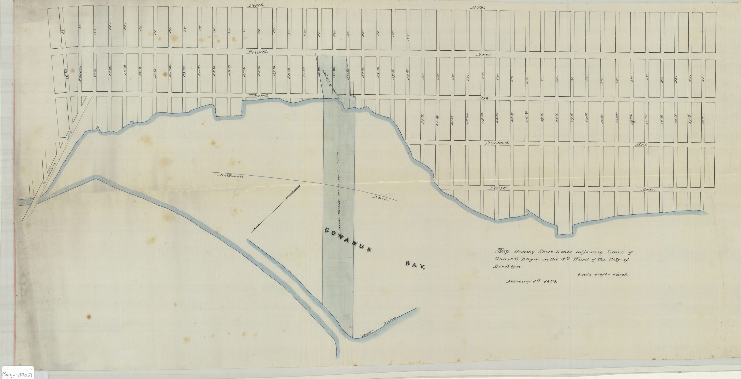
Creator
Bergen, Van Brunt,Publisher
Brooklyn Historical SocietyCitation
Map showing shore lines adjoining land of Garret G. Bergen in the 8th Ward of the city of Brooklyn; February 1, 1870, Map Collection, Bergen-1870.Fl; Brooklyn Historical Society.Scale
Scale [1:4,800] 1 in to 4Loading zoom image...