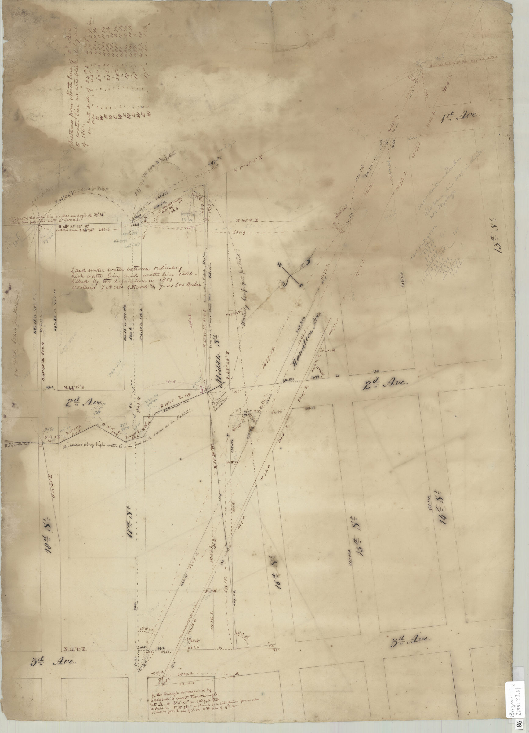
[Map of 2nd Ave. and 3rd Ave. between 14th St. and 18th St.]. [1851]
Map No. Bergen-[1851?].Fl
Survey map covering area in modern-day Gowanus and Sunset Park. Also shows land under water. Title devised by cataloger. Likely attributed to T.G. Bergen, based on handwriting on piece. Oriented with north to the lower right. Includes notes and calculations. On verso: Draft sketches unrelated to main map.
Subjects
Places
Map area shown
Genre
Manuscript mapsRelation
Full catalog recordSize
49 × 69 cmDownload
Low Resolution Image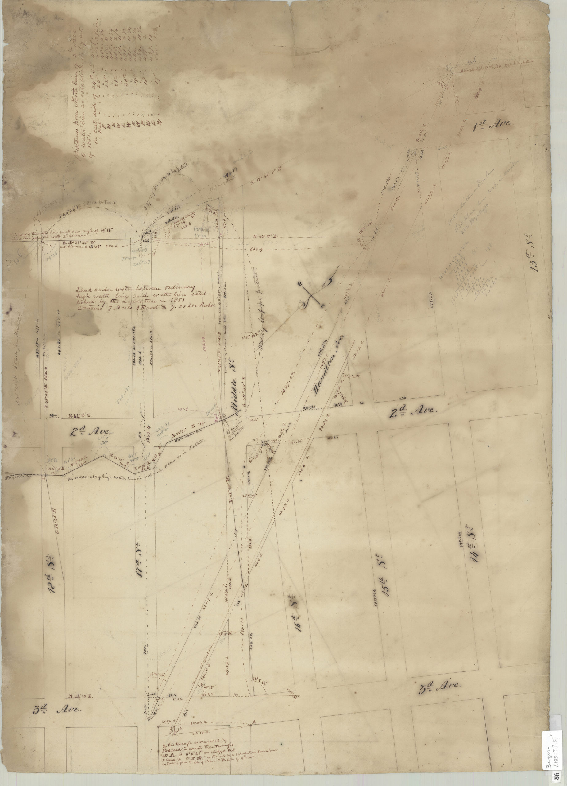
Creator
Bergen, Teunis G.,Publisher
Brooklyn Historical SocietyCitation
[Map of 2nd Ave. and 3rd Ave. between 14th St. and 18th St.].; [1851], Map Collection, Bergen-[1851?].Fl; Brooklyn Historical Society.Scale
Scale not givenLoading zoom image... 