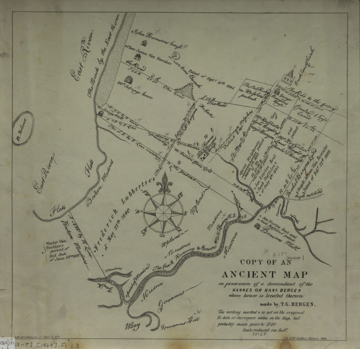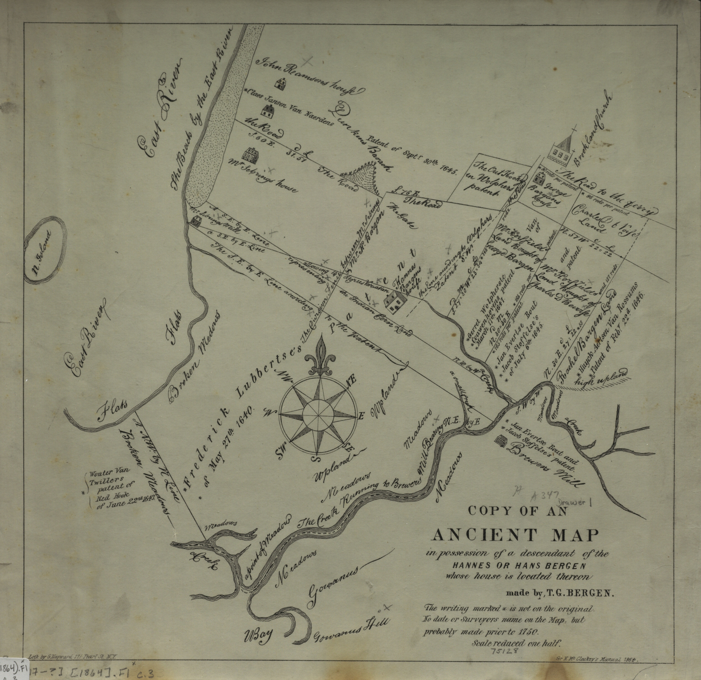
Copy of an ancient map in possession of a descendant of the Hannes or Han Bergen: whose house is located thereon: made by T. G. Bergen [1864]
Map No. B P-[17--?] (1864).Fl c.3;B P-[17--?] (1864).Fl c.2;B P-[17--?] (1864).Fl
Cadastral map depicting 17th century Brooklyn. Shows houses, churches, names of landowners, and landscape features. Also features the Gowanus area. Relief shown pictorially. Base map is reproduction of an undated manuscript map includes historical notes not found on original. “No date or surveyors name on the Map, but probably made prior to 1750.” “Scale reduced one half.” BHS has 3 copies.
Map area shown
Genre
Cadastral mapsRelation
Full catalog recordSize
31 × 32 cmDownload
Low Resolution ImageCreator
Bergen, Teunis G.,Publisher
Brooklyn Historical SocietyCitation
Copy of an ancient map in possession of a descendant of the Hannes or Han Bergen: whose house is located thereon: made by T. G. Bergen; [1864], Map Collection, B P-[17--?] (1864).Fl c.3;B P-[17--?] (1864).Fl c.2;B P-[17--?] (1864).Fl; Brooklyn Historical Society.Scale
Scale not givenLoading zoom image...