Center for Brooklyn History
Map Collections
Search
About
Othmer Library & Archives
Submit search query
Refine 25 records
Clear filter
1
Location
Bedford-Stuyvesant (New York, N.Y.)
67
Bergen Beach (New York, N.Y.)
3
Boerum Hill (New York, N.Y.)
6
Borough Park (New York, N.Y.)
23
Brooklyn (New York, N.Y.)
891
Brooklyn Heights (New York, N.Y.)
76
Brownsville (New York, N.Y.)
10
Canarsie (New York, N.Y.)
18
Carroll Gardens (New York, N.Y.)
21
Clinton Hill (New York, N.Y.)
10
Cobble Hill (New York, N.Y.)
7
Coney Island (New York, N.Y.)
22
Crown Heights (New York, N.Y.)
25
Ditmas Park (New York, N.Y.)
1
Downtown Brooklyn (New York, N.Y.)
29
East Flatbush (New York, N.Y.)
23
Flatbush (New York, N.Y.)
35
Flatlands (New York, N.Y.)
19
Fort Greene (New York, N.Y.)
22
Gowanus (New York, N.Y.)
12
Grand Army Plaza (Brooklyn, New York, N.Y.)
1
Kensington (New York, N.Y.)
11
Mill Basin (New York, N.Y.)
3
Park Slope (New York, N.Y.)
16
Prospect Heights (New York, N.Y.)
16
Prospect Lefferts Gardens (Brooklyn, New York, N.Y.)
16
Prospect Park (New York, N.Y.)
25
Prospect Park South (New York, N.Y.)
8
Red Hook (New York, N.Y.)
19
Williamsburg (New York, N.Y.)
36
Windsor Terrace (New York, N.Y.)
10
Show 11 more
Subject
Auctions
32
Election districts
36
Landowners
434
Prisons
1
Real property
619
Roads
117
Streets
46
Date
19th Century
945
20th Century
469
21th Century
66
or enter range:
from
to
Genres
Advertisements
30
Broadsides
33
Cadastral maps
597
Manuscript maps
365
Map
191
Tourist maps
55
Zoning maps
55
Sort by:
Date (earliest)
Date (most recent)
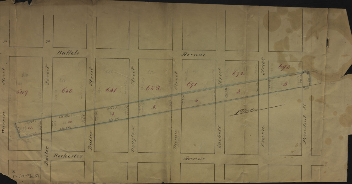
[Map of area bounded by Buffalo Ave., Warren St., Rochester Ave., and President St.].
[Map of area bounded by Buffalo Ave., Warren St., Rochester Ave., and President St.].
[18??]
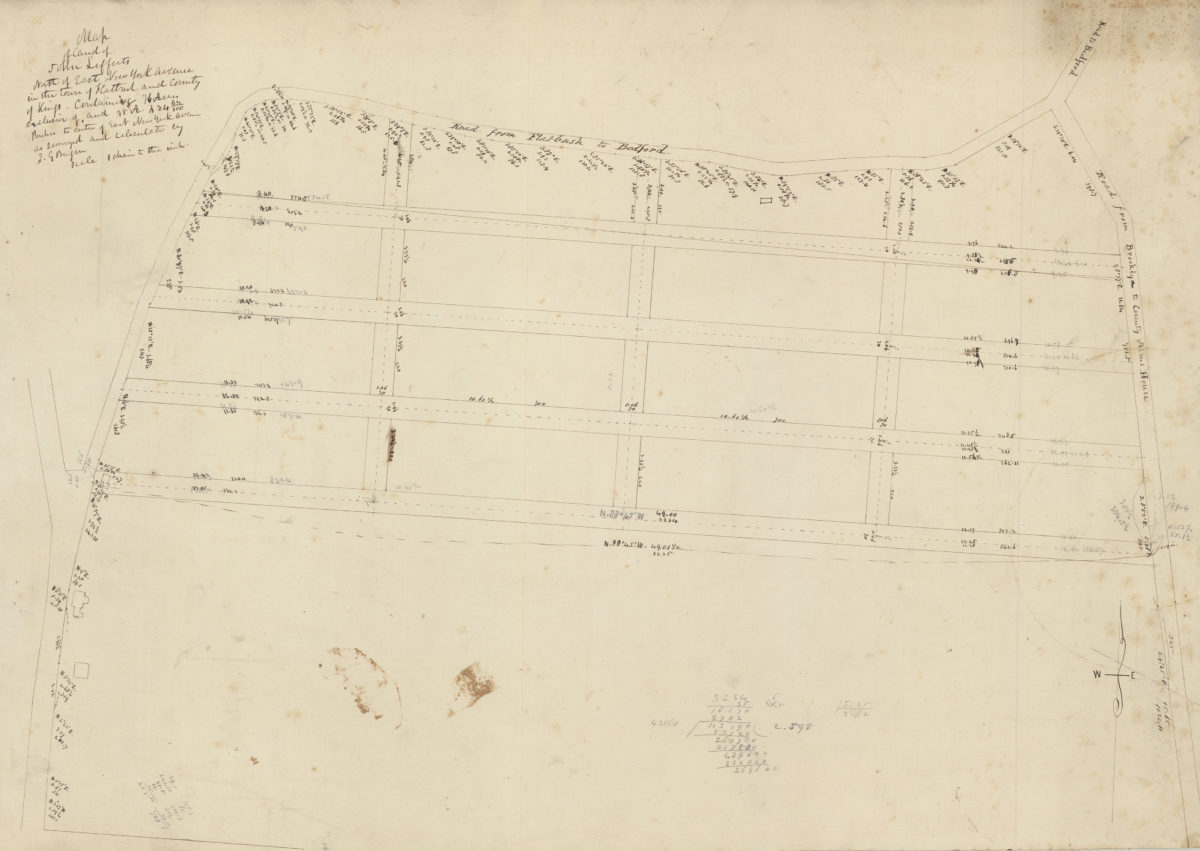
Map of land of John Lefferts, north of East New York Avenue in the town of Flatbush and county of Kings: containing 76 acres exclusive of, and 78 A. 234 64/100 perches to centre of East New York Avenue, as surveyed and calculated: by T.G. Bergen
Map of land of John Lefferts, north of East New York Avenue in the town of Flatbush and county of Kings: containing 76 acres exclusive of, and 78 A. 234 64/100 perches to centre of East New York Avenue, as surveyed and calculated: by T.G. Bergen
[18??]
[Map of area bounded by Franklin Ave., Sullivan Pl., Albany Ave., and Eastern Pkwy]
[Map of area bounded by Franklin Ave., Sullivan Pl., Albany Ave., and Eastern Pkwy]
[18??]
[Map covering area east from Greenwood Cemetery to Howard Ave. and north from Ave G. to Eastern Pkwy]
[Map covering area east from Greenwood Cemetery to Howard Ave. and north from Ave G. to Eastern Pkwy]
[18??]
[Survey maps of Kings County Penitentiary Grounds and Vanderveer encroachment onto Clarendon property]
[Survey maps of Kings County Penitentiary Grounds and Vanderveer encroachment onto Clarendon property]
[18??]
[Land of John Lott at Flatbush Avenue and Montgomery Street]
[Land of John Lott at Flatbush Avenue and Montgomery Street]
[18??]
Map of 241 valuable lots in & adjoining the 9th Ward of the city of Brooklyn, to be sold at auction by Stone & Sother on Tuesday, 27th Novr., 1849, at 12 o’clock at the Merchants’ Exchange, N.Y.
Map of 241 valuable lots in & adjoining the 9th Ward of the city of Brooklyn, to be sold at auction by Stone & Sother on Tuesday, 27th Novr., 1849, at 12 o’clock at the Merchants’ Exchange, N.Y.
1849
Penetentiary, lunatic asylum plans, exchange with … [text illegible]
Penetentiary, lunatic asylum plans, exchange with … [text illegible]
[185?]
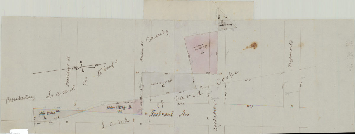
[Map of Nostrand Ave. between President St. and Degraw St.].
[Map of Nostrand Ave. between President St. and Degraw St.].
[185?]
Map of part of the town of Flatbush, made for the commissioners for assessing expenses on the opening of Flatbush Avenue: by T.G. Bergen
Map of part of the town of Flatbush, made for the commissioners for assessing expenses on the opening of Flatbush Avenue: by T.G. Bergen
July 1855
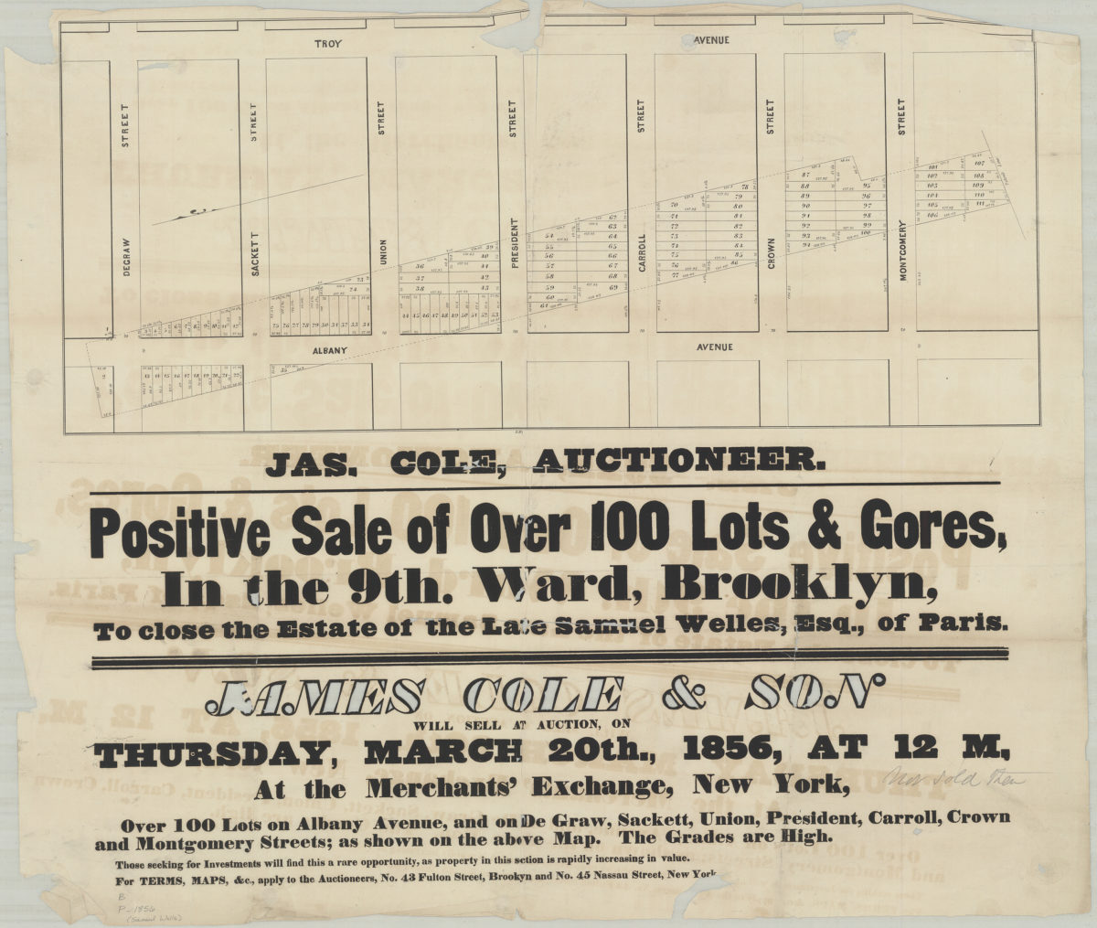
Positive sale of over 100 lots & gores in the 9th Ward, Brooklyn, to close the estate of the late Samuel Welles, Esq., of Paris
Positive sale of over 100 lots & gores in the 9th Ward, Brooklyn, to close the estate of the late Samuel Welles, Esq., of Paris
[1856]
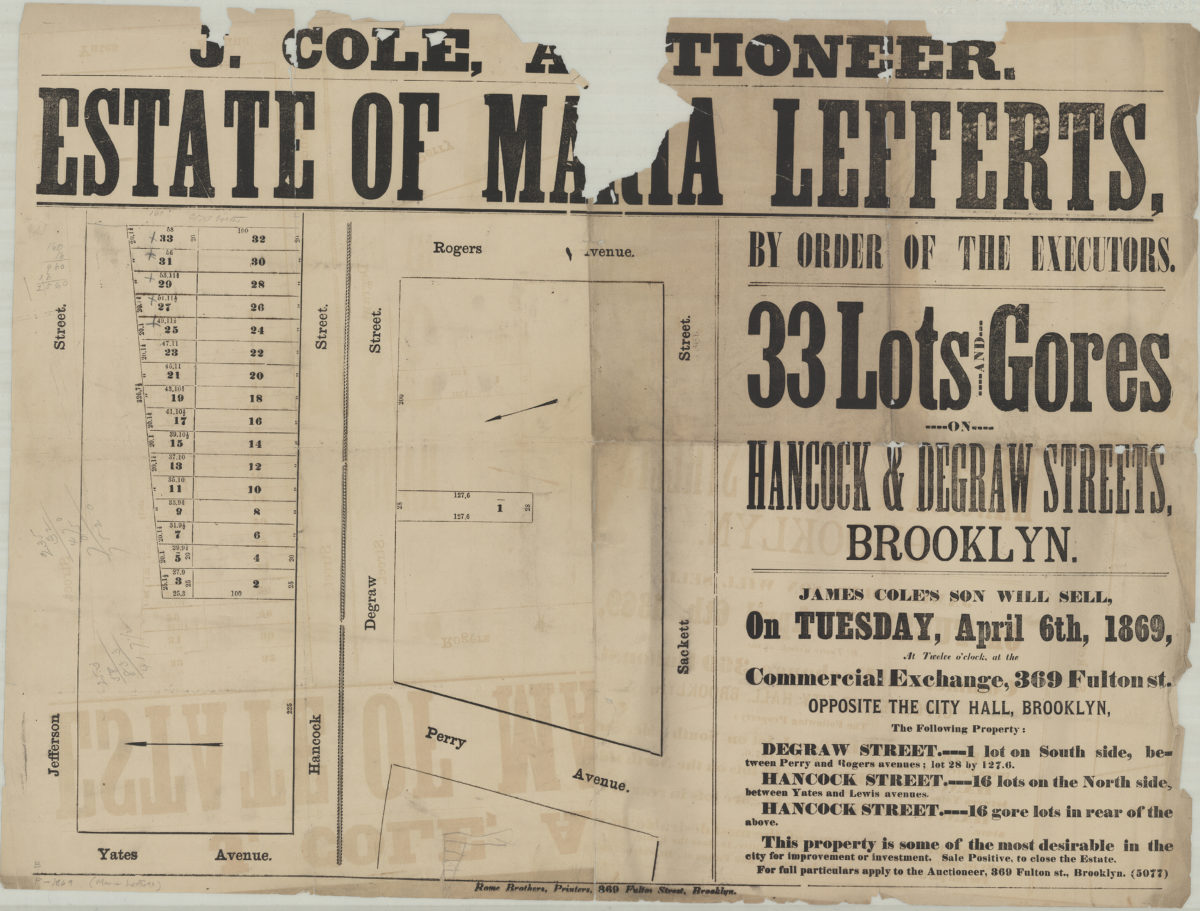
Estate of Maria Lefferts, by order of the executors, 33 lots and gores on Hancock & Degraw Streets, Brooklyn
Estate of Maria Lefferts, by order of the executors, 33 lots and gores on Hancock & Degraw Streets, Brooklyn
[1869]
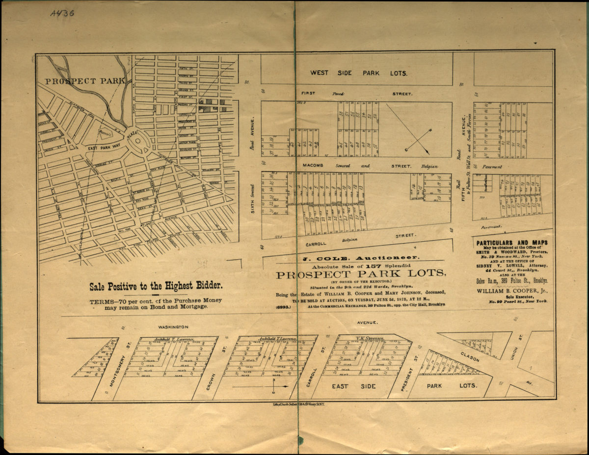
Absolute sale of 157 splendid Prospect Park lots (by order of the executor), situated in the 9th and 22nd Wards, Brooklyn, being the estate of William B. Cooper and Mary Johnson, deceased, to be sold at auction on Tuesday, June 3d, 1873
Absolute sale of 157 splendid Prospect Park lots (by order of the executor), situated in the 9th and 22nd Wards, Brooklyn, being the estate of William B. Cooper and Mary Johnson, deceased, to be sold at auction on Tuesday, June 3d, 1873
[1873]
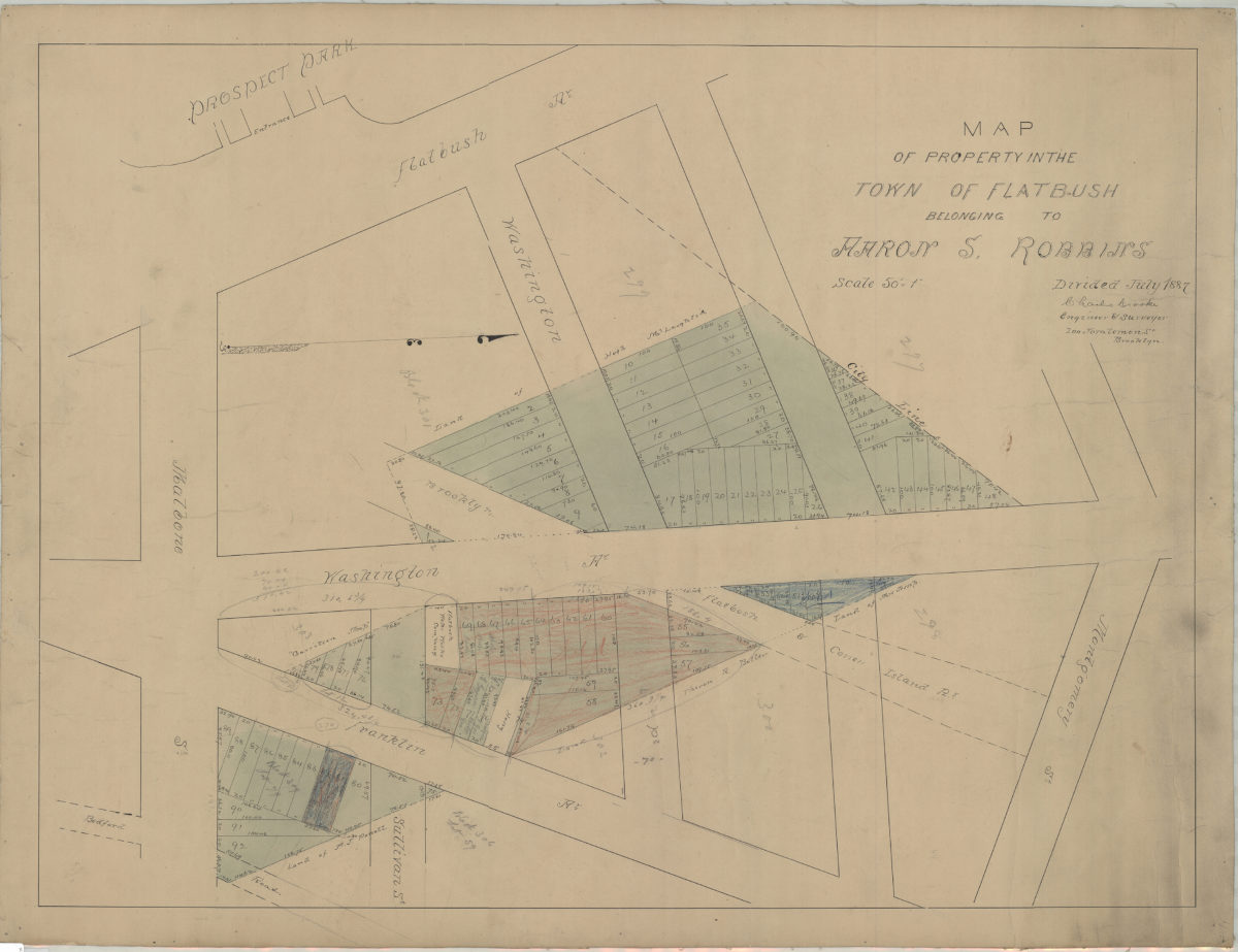
Map of property in the town of Flatbush belonging to Aaron S. Robbins: divided July 1887: Charles Crooke, engineer & surveyor
Map of property in the town of Flatbush belonging to Aaron S. Robbins: divided July 1887: Charles Crooke, engineer & surveyor
[1887]
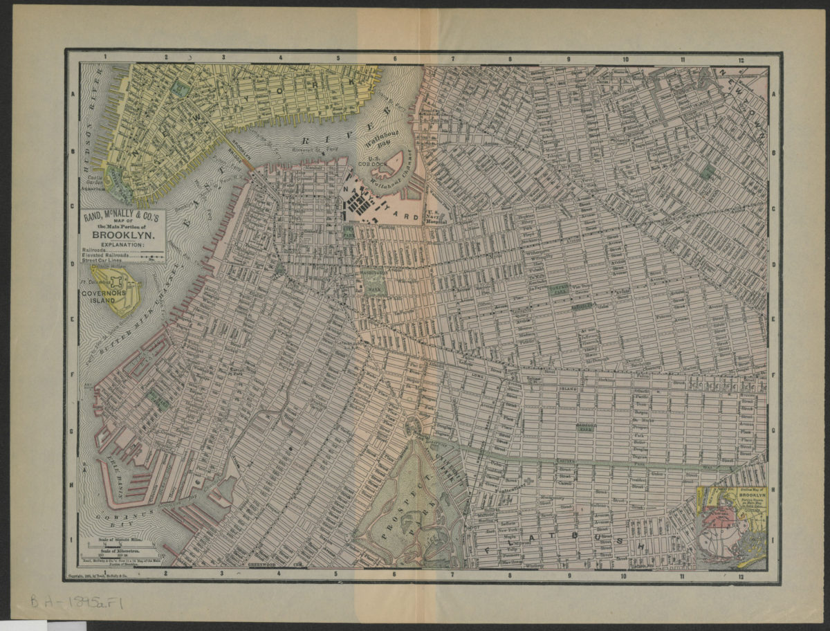
Rand, McNally & Co.’s map of the main portion of Brooklyn
Rand, McNally & Co.’s map of the main portion of Brooklyn
[1895; 1895]
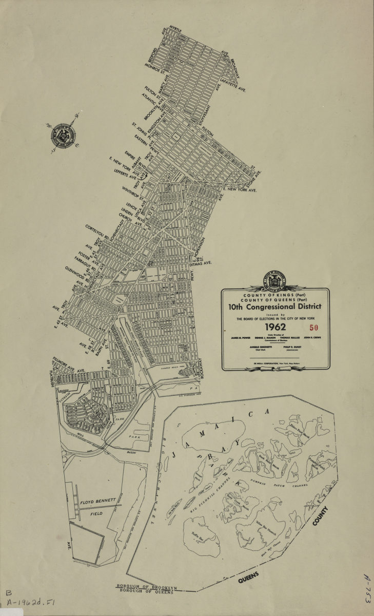
County of Kings, Borough of Brooklyn, 10th Congressional District: issued by the Board of Elections in the City of New York
County of Kings, Borough of Brooklyn, 10th Congressional District: issued by the Board of Elections in the City of New York
1962
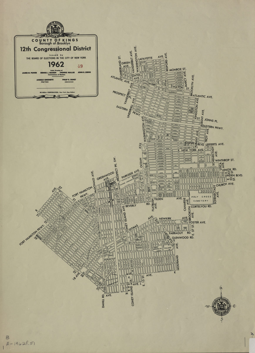
County of Kings, Borough of Brooklyn, 12th Congressional District: issued by the Board of Elections in the City of New York
County of Kings, Borough of Brooklyn, 12th Congressional District: issued by the Board of Elections in the City of New York
1962
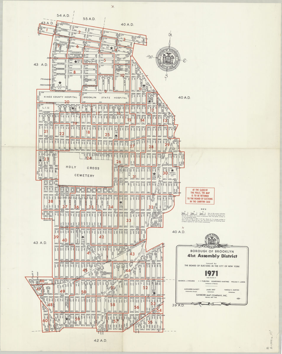
Borough of Brooklyn 41st Assembly District, 1971: issued by the Board of Elections in the City of New York
Borough of Brooklyn 41st Assembly District, 1971: issued by the Board of Elections in the City of New York
1971
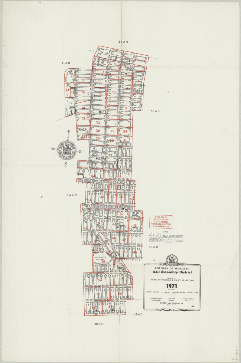
Borough of Brooklyn 43rd Assembly District, 1971: issued by the Board of Elections in the City of New York
Borough of Brooklyn 43rd Assembly District, 1971: issued by the Board of Elections in the City of New York
1971
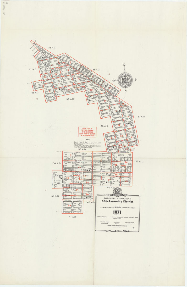
Borough of Brooklyn 55th Assembly District, 1971: issued by the Board of Elections in the City of New York
Borough of Brooklyn 55th Assembly District, 1971: issued by the Board of Elections in the City of New York
1971
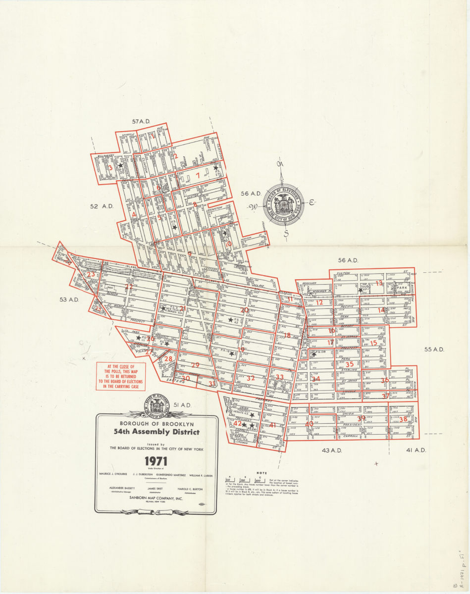
Borough of Brooklyn 54th Assembly District, 1971: issued by the Board of Elections in the City of New York
Borough of Brooklyn 54th Assembly District, 1971: issued by the Board of Elections in the City of New York
1971
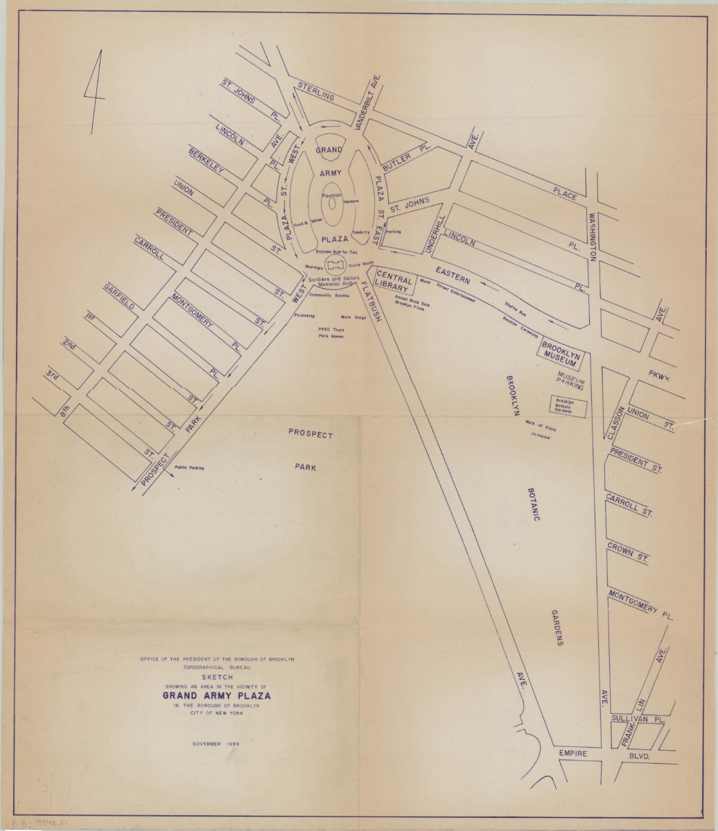
Sketch showing an area in the vicinity of Grand Army Plaza in the Borough of Brooklyn, City of New York
Sketch showing an area in the vicinity of Grand Army Plaza in the Borough of Brooklyn, City of New York
Nov-84
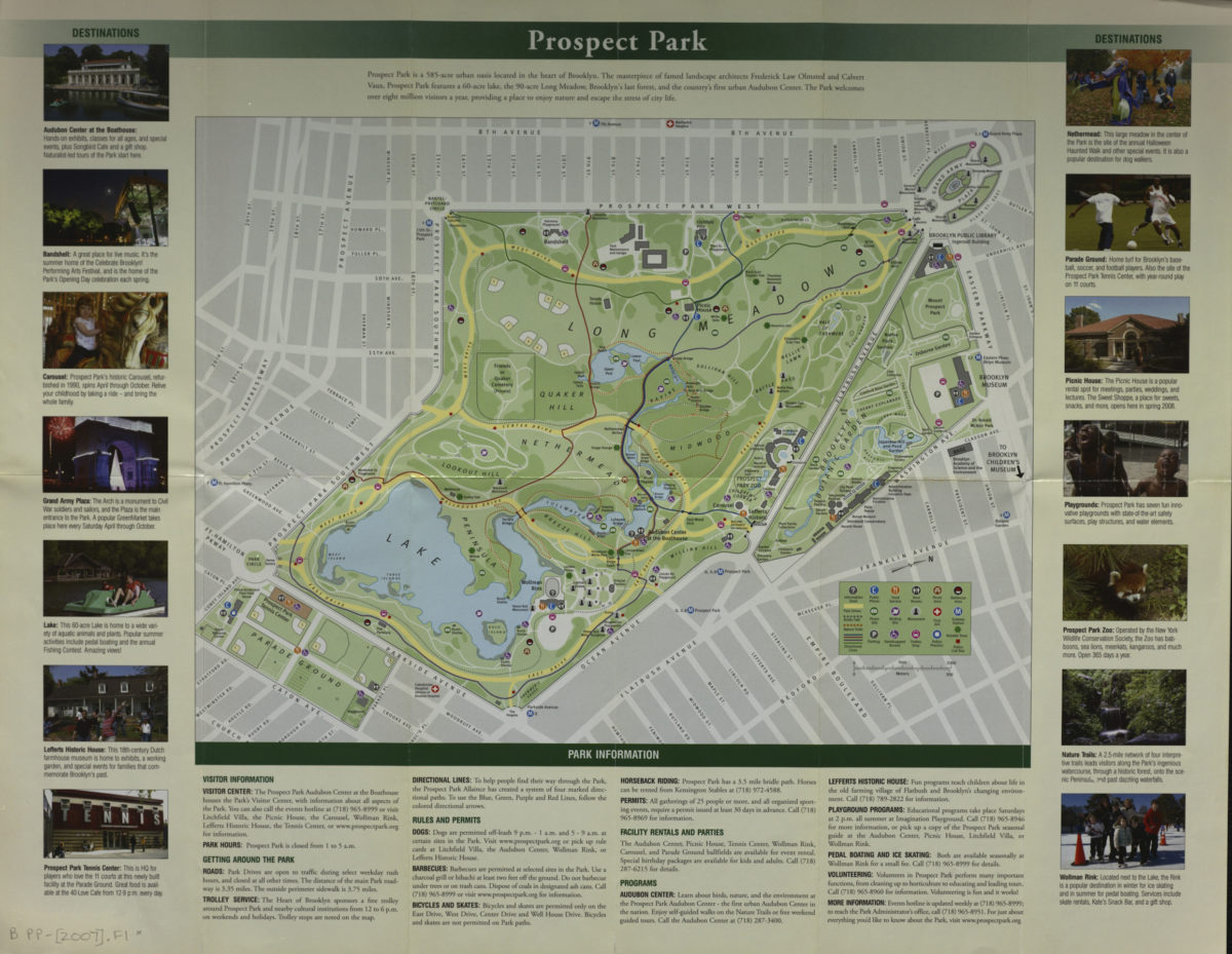
Prospect Park map
Prospect Park map
[2007]
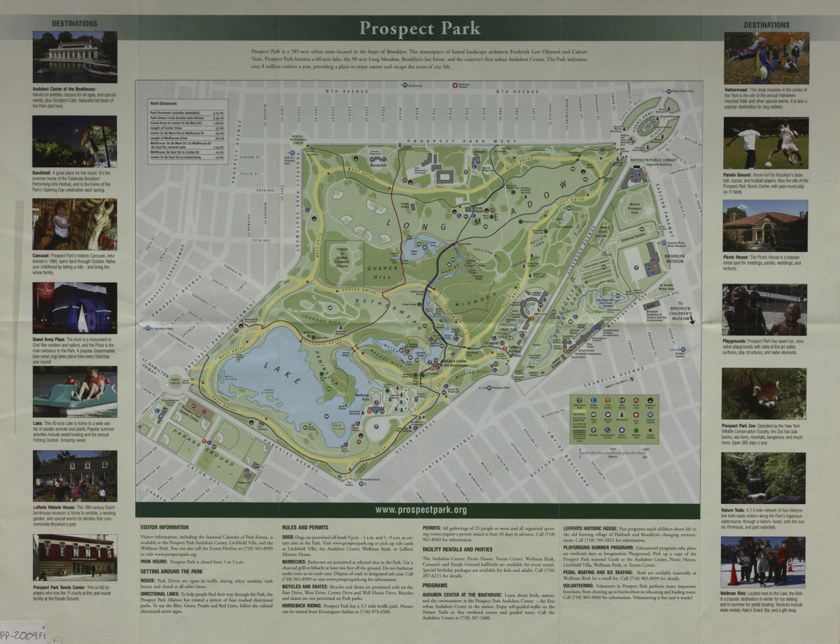
Prospect Park map
Prospect Park map
2009
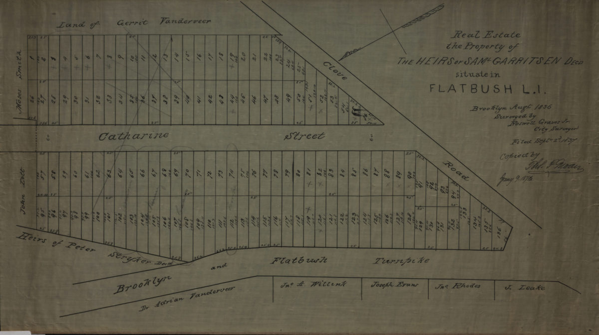
Real estate, the property of the heirs of Saml. Garritsen, decd., situate[d] in Flatbush, L.I.: surveyed by Roswell Graves Jr., city surveyor ; copied by … [text illegible], Jany. 9, 1874
Real estate, the property of the heirs of Saml. Garritsen, decd., situate[d] in Flatbush, L.I.: surveyed by Roswell Graves Jr., city surveyor ; copied by … [text illegible], Jany. 9, 1874
Jan, -9251