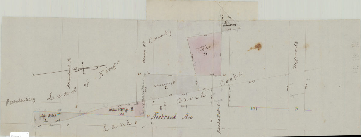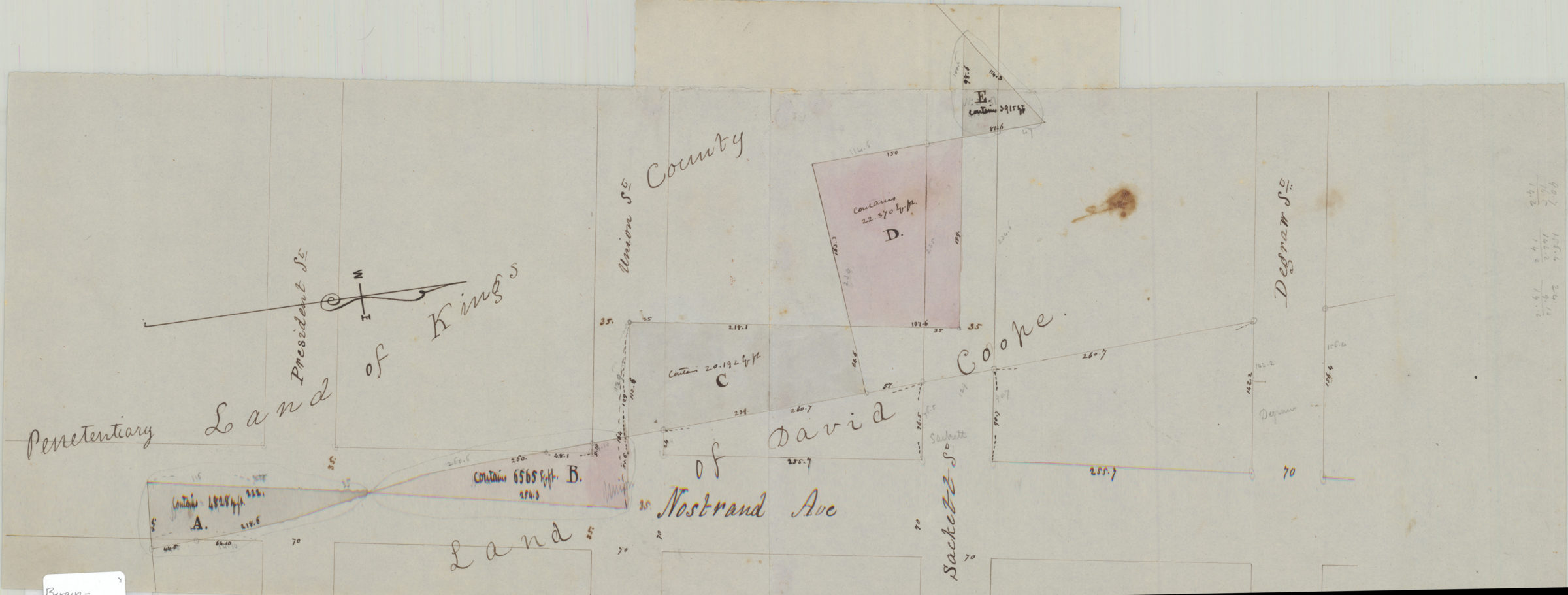
[Map of Nostrand Ave. between President St. and Degraw St.]. [185?]
Map No. Bergen-[185-?]g.Fl
Cadastral map covering area in modern-day Crown Heights. Shows property (including dimensions), names of landowners, and penetentiary lands. Title devised by cataloger. Likely attributed to T.G. Bergen, based on handwriting on piece. Oriented with north to the right. Irregularly shaped. Keyed to index no index present.
Map area shown
Relation
Full catalog recordSize
24 × 66 cmDownload
Low Resolution Image
Creator
Bergen, Teunis G.,Publisher
Brooklyn Historical SocietyCitation
[Map of Nostrand Ave. between President St. and Degraw St.].; [185?], Map Collection, Bergen-[185-?]g.Fl; Brooklyn Historical Society.Scale
Scale not givenLoading zoom image...