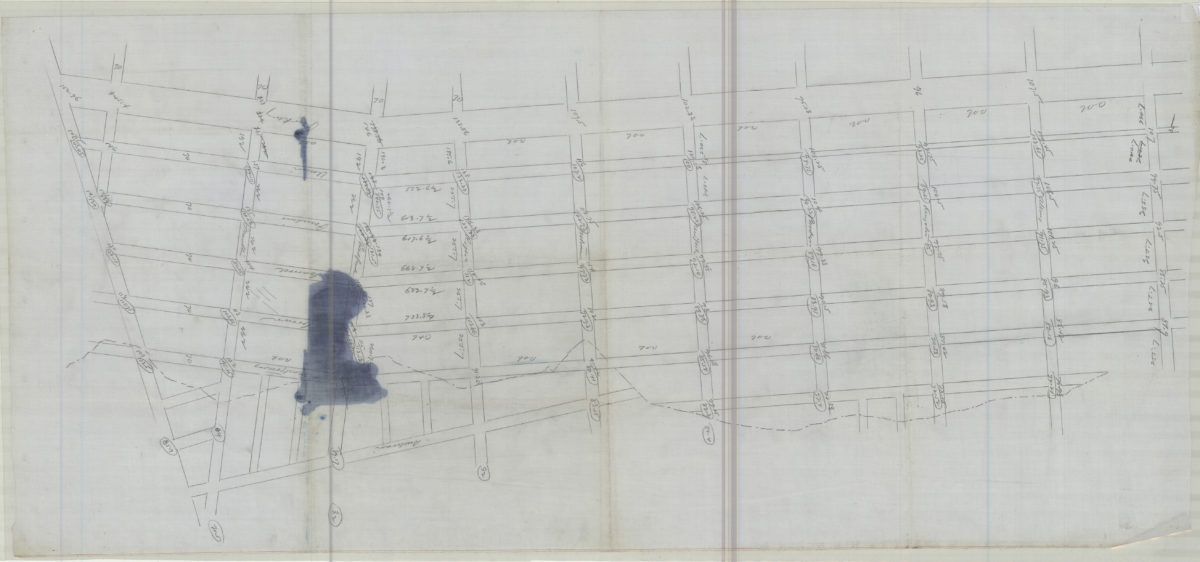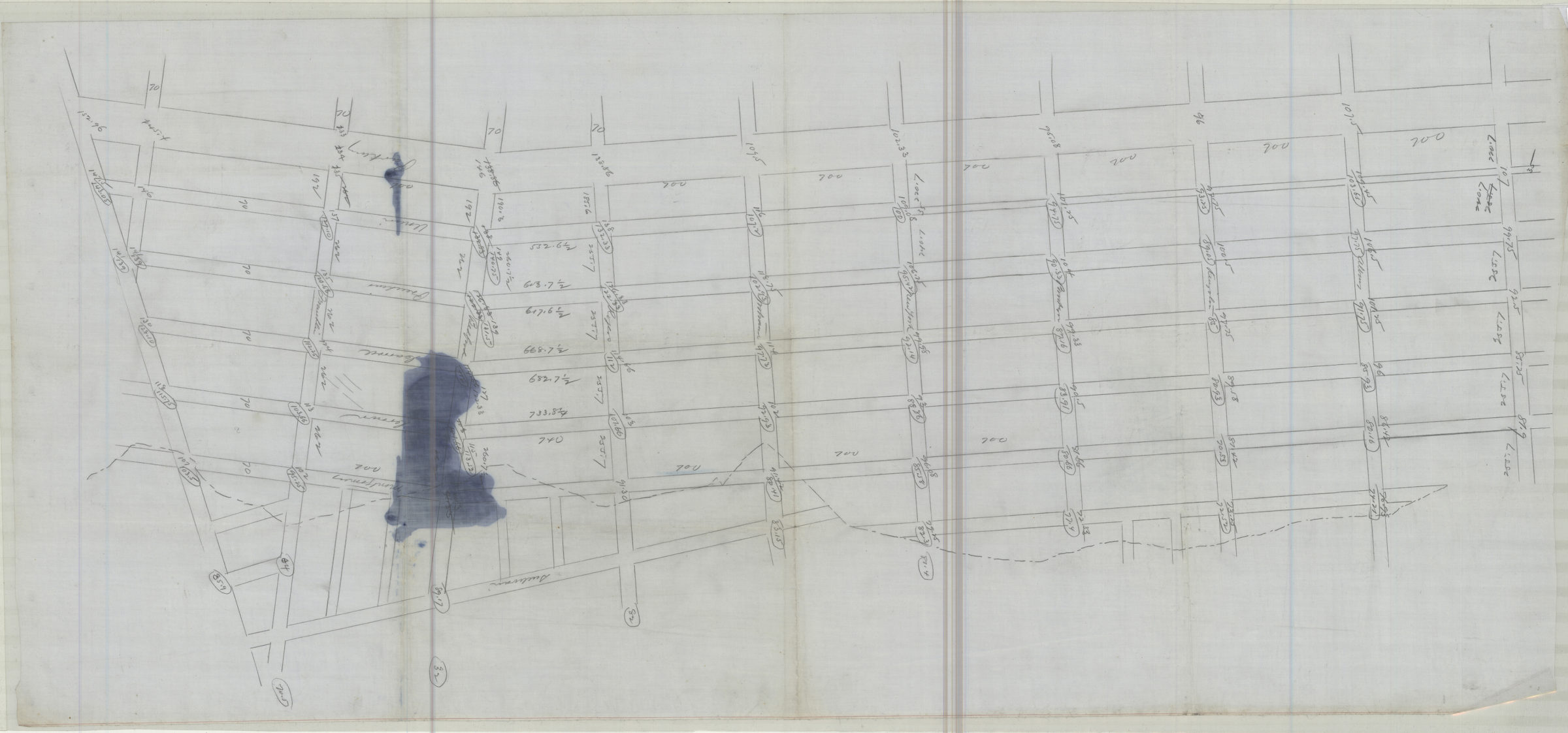

[Map of area bounded by Franklin Ave., Sullivan Pl., Albany Ave., and Eastern Pkwy] [18??]
Map No. B A-[18--?].Fl.Folio
Survey map covering area in modern-day Crown Heights. Title devised by cataloger. Oriented with north to the bottom. Includes calculations.
Map area shown
Genre
Manuscript mapsRelation
Full catalog recordSize
45 × 102 cmDownload
Low Resolution Image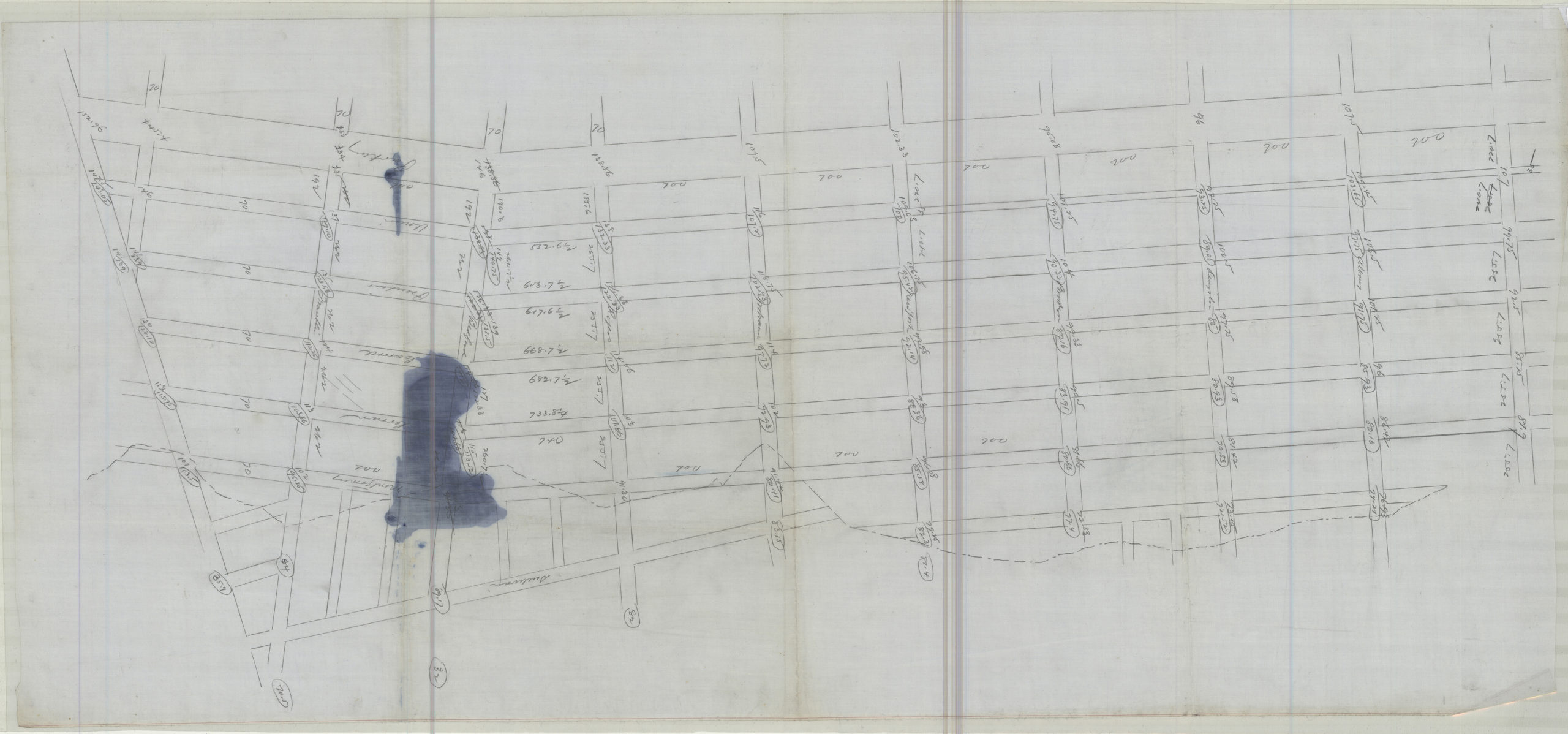
Creator
Publisher
Brooklyn Historical Society, Brooklyn Historical SocietyCitation
[Map of area bounded by Franklin Ave., Sullivan Pl., Albany Ave., and Eastern Pkwy]; [18??], Map Collection, B A-[18--?].Fl.Folio; Brooklyn Historical Society.Scale
Scale not givenLoading zoom image...