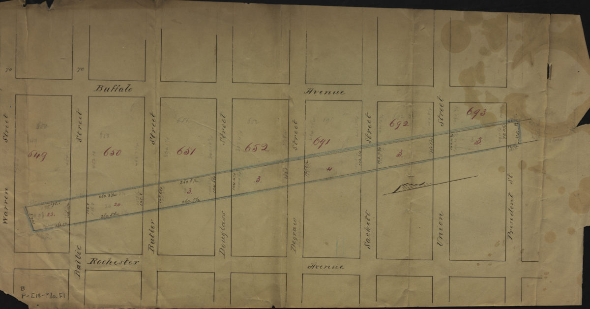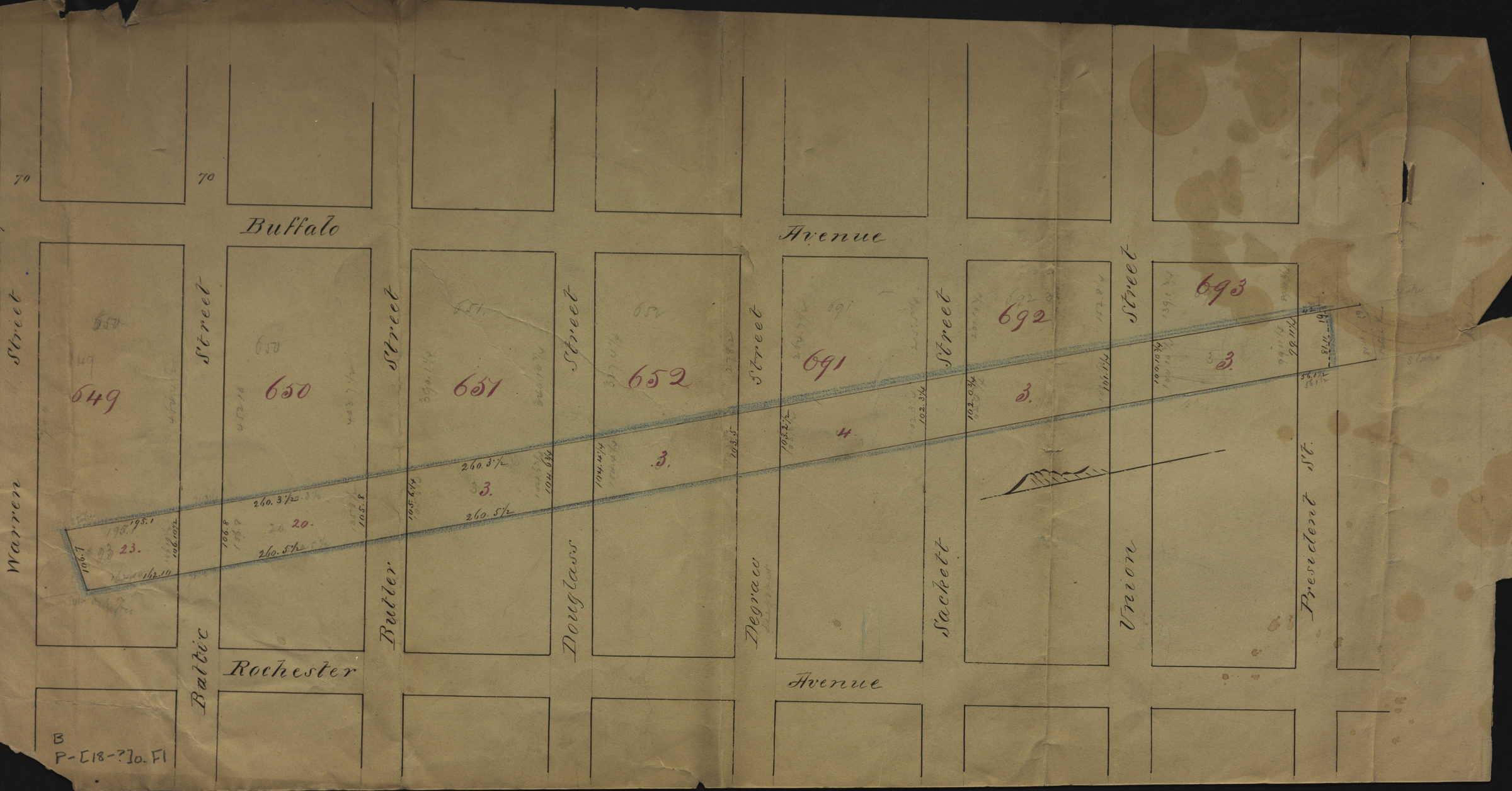
[Map of area bounded by Buffalo Ave., Warren St., Rochester Ave., and President St.]. [18??]
Map No. B P-[18--?]h.Fl
Cadastral map covering area in modern-day Crown Heights and Bedford-Stuyvesant. Shows property (including block numbers and dimensions). Title devised by cataloger. Orientated with north to the lower left.
Subjects
Places
Map area shown
Relation
Full catalog recordSize
29 × 56 cmDownload
Low Resolution Image
Creator
Publisher
Brooklyn Historical SocietyCitation
[Map of area bounded by Buffalo Ave., Warren St., Rochester Ave., and President St.].; [18??], Map Collection, B P-[18--?]h.Fl; Brooklyn Historical Society.Scale
Scale not givenLoading zoom image...