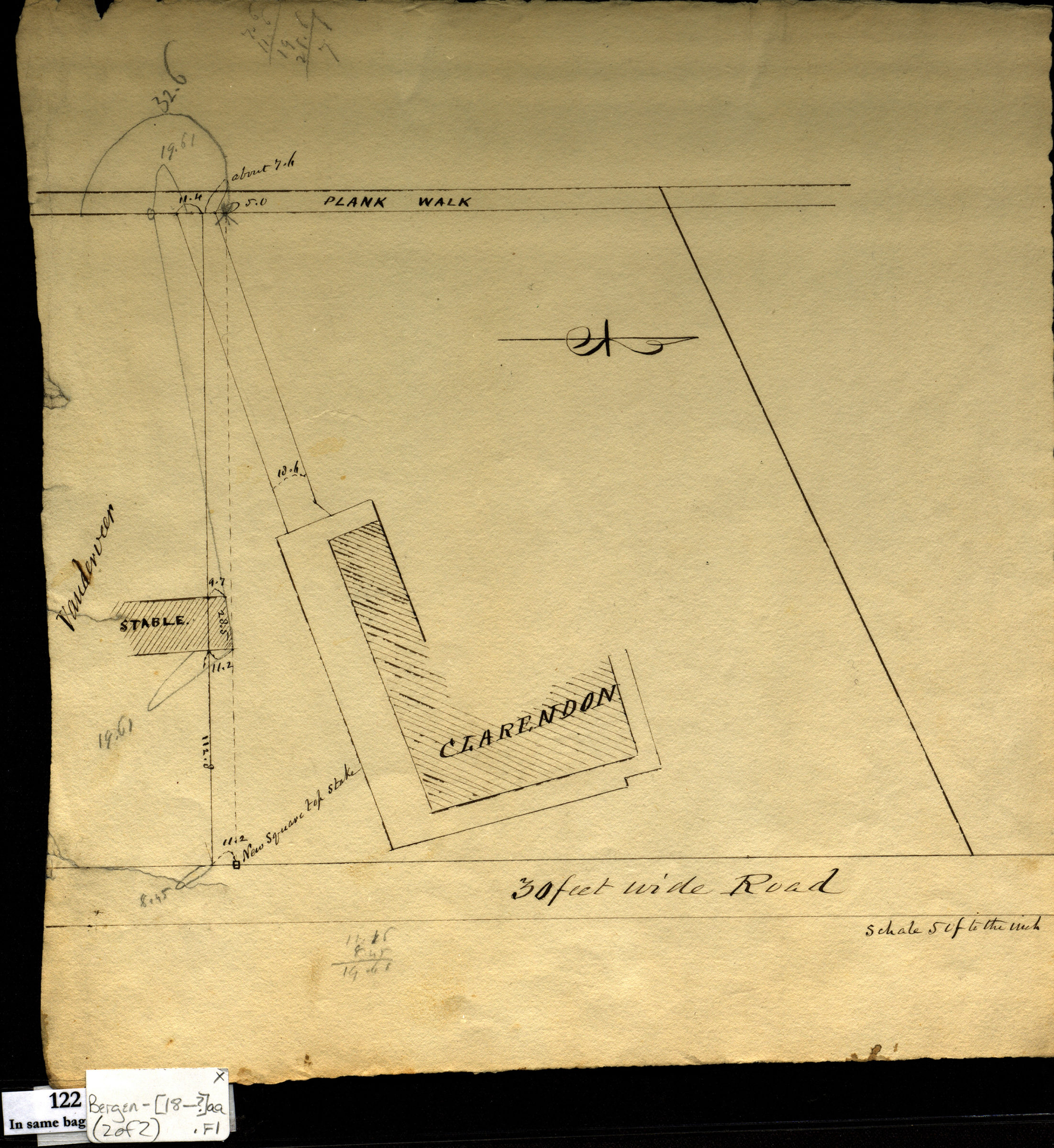

[Survey maps of Kings County Penitentiary Grounds and Vanderveer encroachment onto Clarendon property] [18??]
Map No. Bergen-[18--?]aa.Fl
Cadastral survey map covering area in modern-day Crown Heights. Shows streets and building. Cadastral survey map covering area in modern-day Coney Island. Shows buildings and names of landowners. Title devised by cataloger. Map covers area identical to: Map 3 of [Survey maps of roads in Brooklyn] (Bergen-[18–?]dd.Fl) also held by BHS. Maps found rolled together in BHS archives and cataloged as a unit to preserve context. Penitentiary grounds. Vanderveer enchroachment [onto Clarendon property], Coney Island.
Subjects
Places
Map area shown
Relation
Full catalog recordSize
31 × 39 cmDownload
Low Resolution Image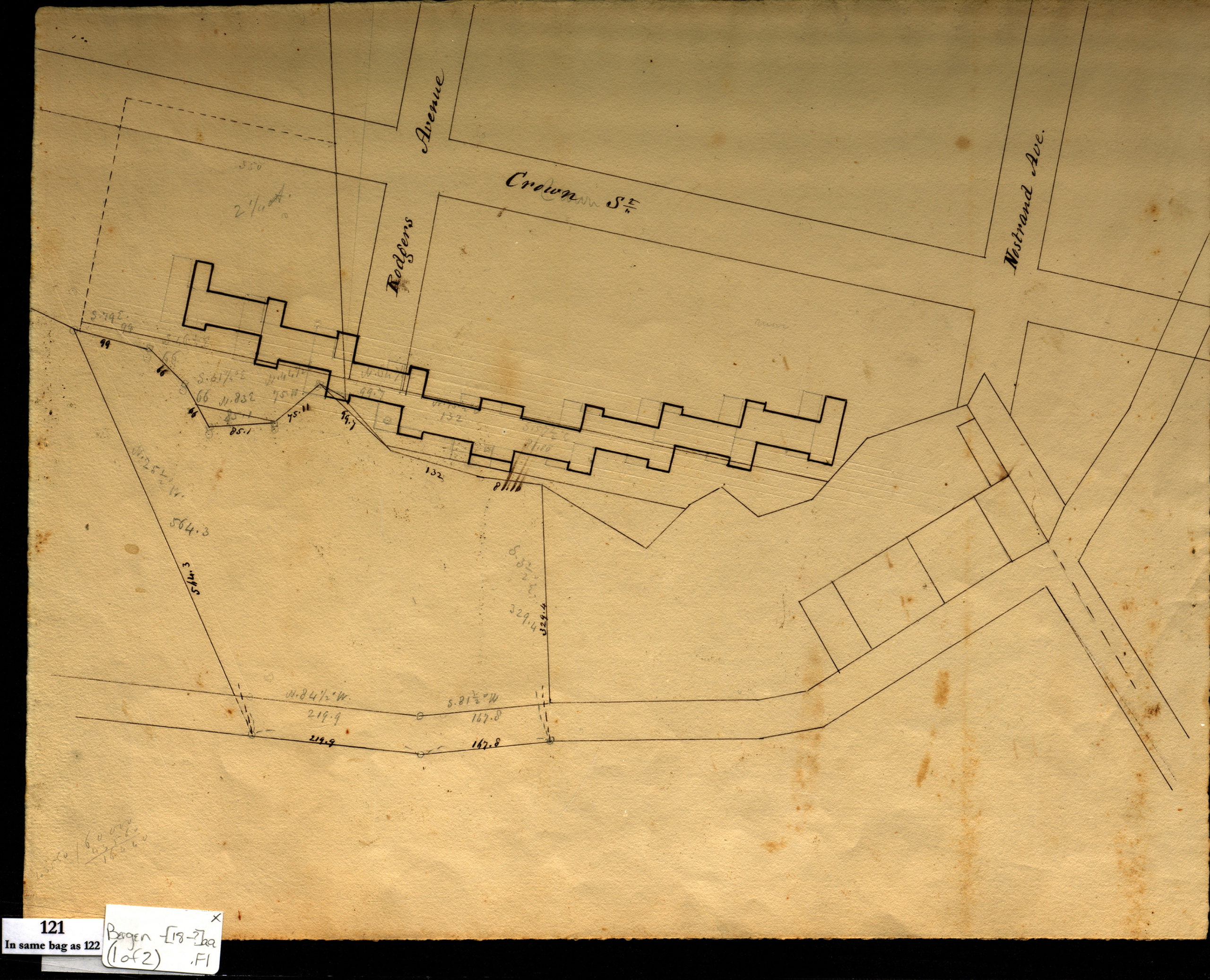
Creator
Bergen, Teunis G.,Publisher
Brooklyn Historical SocietyCitation
[Survey maps of Kings County Penitentiary Grounds and Vanderveer encroachment onto Clarendon property]; [18??], Map Collection, Bergen-[18--?]aa.Fl; Brooklyn Historical Society.Scale
Scales differLoading zoom image... 