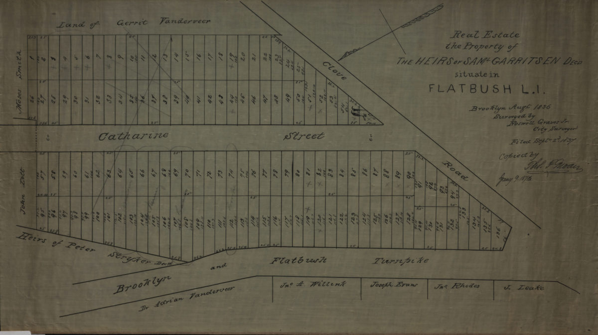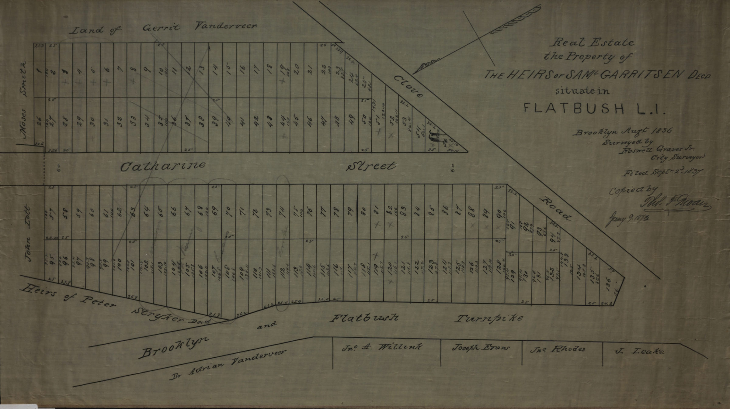
Real estate, the property of the heirs of Saml. Garritsen, decd., situate[d] in Flatbush, L.I.: surveyed by Roswell Graves Jr., city surveyor ; copied by … [text illegible], Jany. 9, 1874 Jan, -9251
Map No. B P-1837 (1874).Fl
Cadastral map covering the Brooklyn and Flatbush Turnpike at Clove Rd. (modern-day Crown Heights and Prospect Lefferts Gardens). Shows property (including lot numbers and dimensions), and names of landowners. Original map created: Brooklyn Augt. 1836. Filed Septr. 2d. 1837. Oriented with north to the lower left.
Subjects
Places
Map area shown
Relation
Full catalog recordSize
32 × 58 cmDownload
Low Resolution Image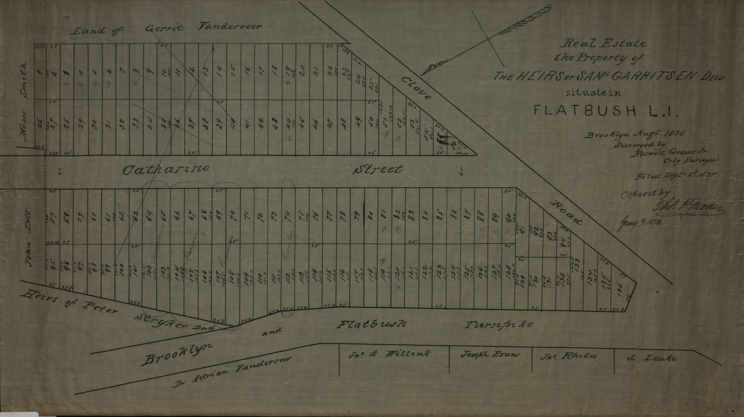
Creator
Graves, Rosewell, Graves, Rosewell,Publisher
Brooklyn Historical Society, Brooklyn Historical SocietyCitation
Real estate, the property of the heirs of Saml. Garritsen, decd., situate[d] in Flatbush, L.I.: surveyed by Roswell Graves Jr., city surveyor ; copied by … [text illegible], Jany. 9, 1874; Jan, -9251, Map Collection, B P-1837 (1874).Fl; Brooklyn Historical Society.Scale
Scale not givenLoading zoom image...