Prospect Park map 2009
Map No. B PP-2009.Fl
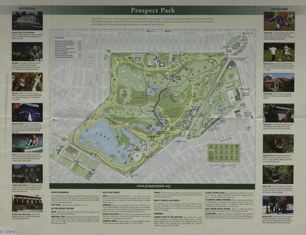
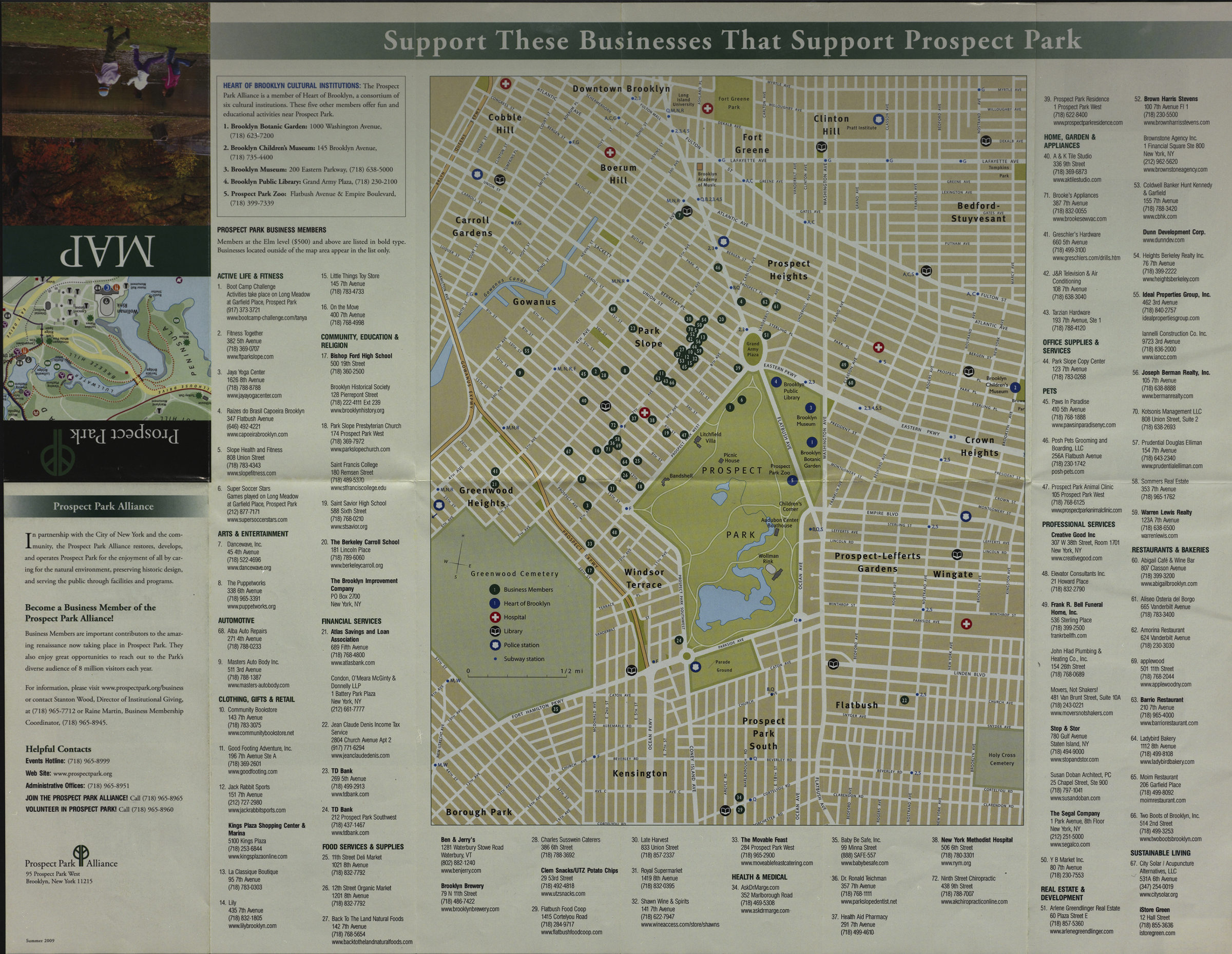
Map shows roads, paths, lakes, ponds, location of public buildings, and amenities in Prospect Park. Street map shows location of businesses supporting Prospect Park in surrounding neighborhoods of Cobble Hill, Downtown Brooklyn, Bedford-Stuyvesant, Prospect Heights, Carroll Gardens, Gowanus, Park Slope, Crown Heights, Prospect-Lefferts Gardens, Windsor Terrace, Borough Park, Kensington, Prospect Park South, and Flatbush. Includes text, color illustrations, index and directory to major cultural institutions and local businesses. Prospect Park. Support these businesses that support Prospect Park.
Places
- Bedford-Stuyvesant (New York, N.Y.)
- Borough Park (New York, N.Y.)
- Brooklyn (New York, N.Y.)
- Carroll Gardens (New York, N.Y.)
- Cobble Hill (New York, N.Y.)
- Crown Heights (New York, N.Y.)
- Downtown Brooklyn (New York, N.Y.)
- Flatbush (New York, N.Y.)
- Kensington (New York, N.Y.)
- Park Slope (New York, N.Y.)
- Prospect Heights (New York, N.Y.)
- Prospect Lefferts Gardens (Brooklyn, New York, N.Y.)
- Prospect Park (New York, N.Y.)
- Prospect Park South (New York, N.Y.)
- Windsor Terrace (New York, N.Y.)
Map area shown
Genre
Tourist mapsRelation
Full catalog recordSize
44 × 56 cmDownload
Low Resolution Image
Creator
Prospect Park Alliance,Publisher
Brooklyn Historical SocietyCitation
Prospect Park map; 2009, Map Collection, B PP-2009.Fl; Brooklyn Historical Society.Scale
Scales differLoading zoom image...