Borough of Brooklyn 52nd Assembly District, 1971: issued by the Board of Elections in the City of New York 1971
Map No. B A-1971a.Fl.Folio
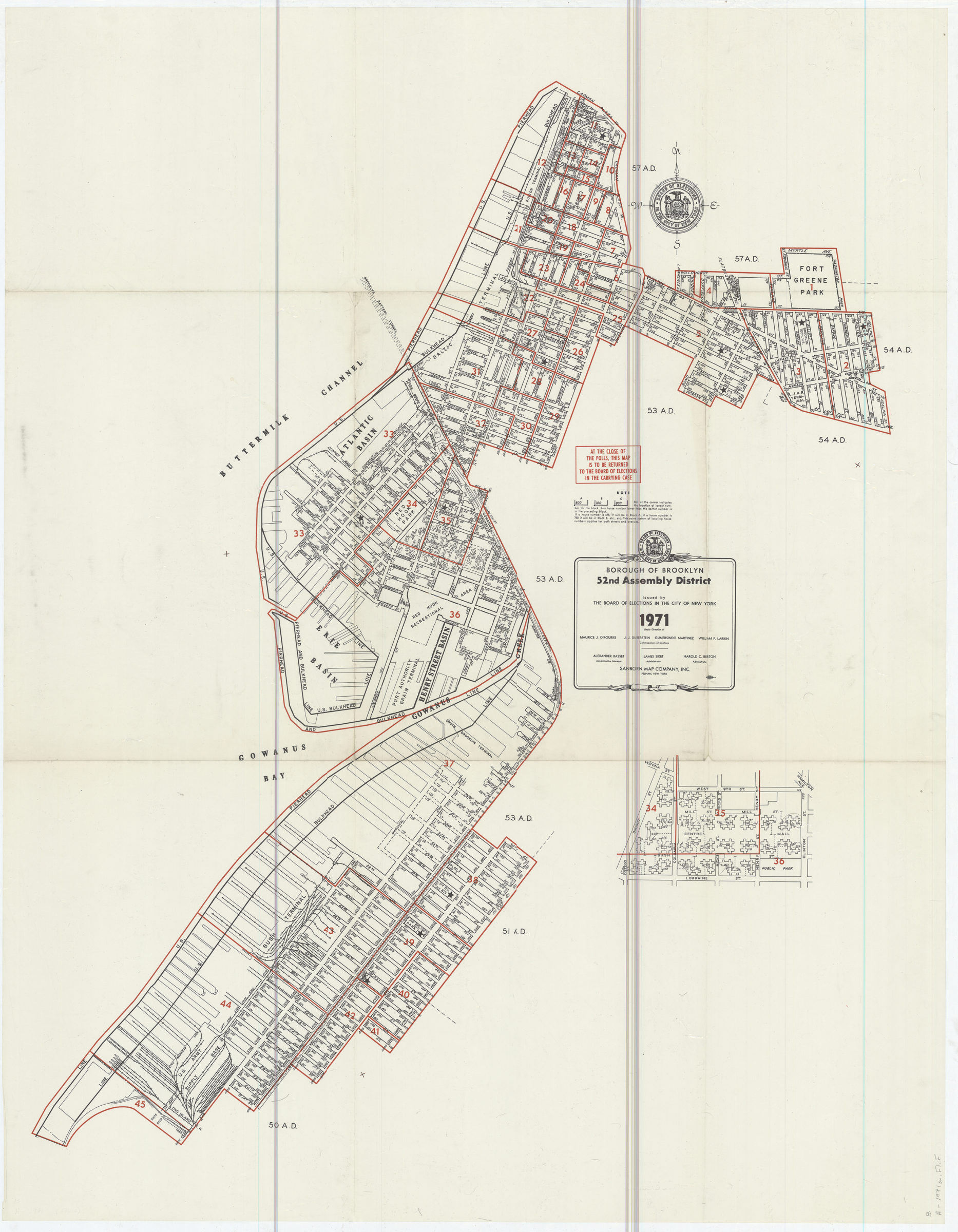
The 52nd Assembly District encompassed parts of the Sunset Park, Red Hook, Carroll Gardens, Cobble Hill, Brooklyn Heights, Boerum Hill and Fort Greene neighborhoods. Election districts outlined in red. Includes inset map of Red Hook I (East) Houses.
Subjects
Places
Map area shown
Genre
MapRelation
Full catalog recordSize
114 × 90 cmDownload
Low Resolution Image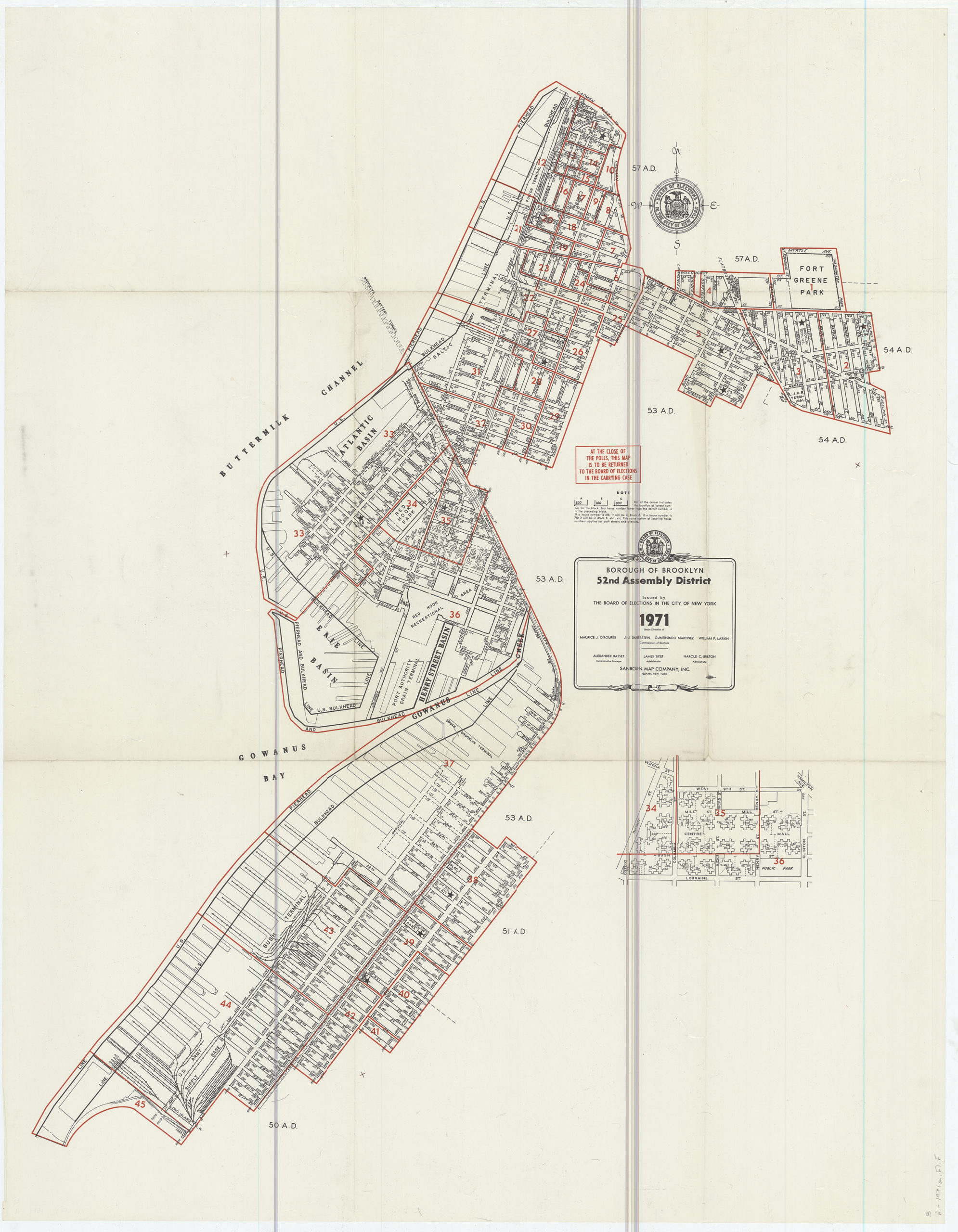
Creator
New York (N.Y.).; Board of Elections,Publisher
Brooklyn Historical SocietyCitation
Borough of Brooklyn 52nd Assembly District, 1971: issued by the Board of Elections in the City of New York; 1971, Map Collection, B A-1971a.Fl.Folio; Brooklyn Historical Society.Scale
Scale not givenLoading zoom image... 