Map of New York and vicinity [1886-1894]
Map No. M-[1886?].Fl
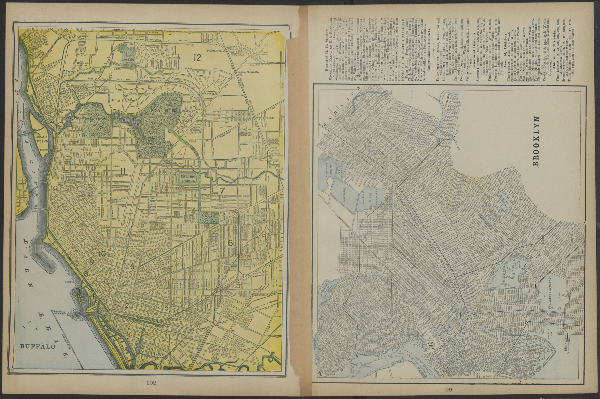
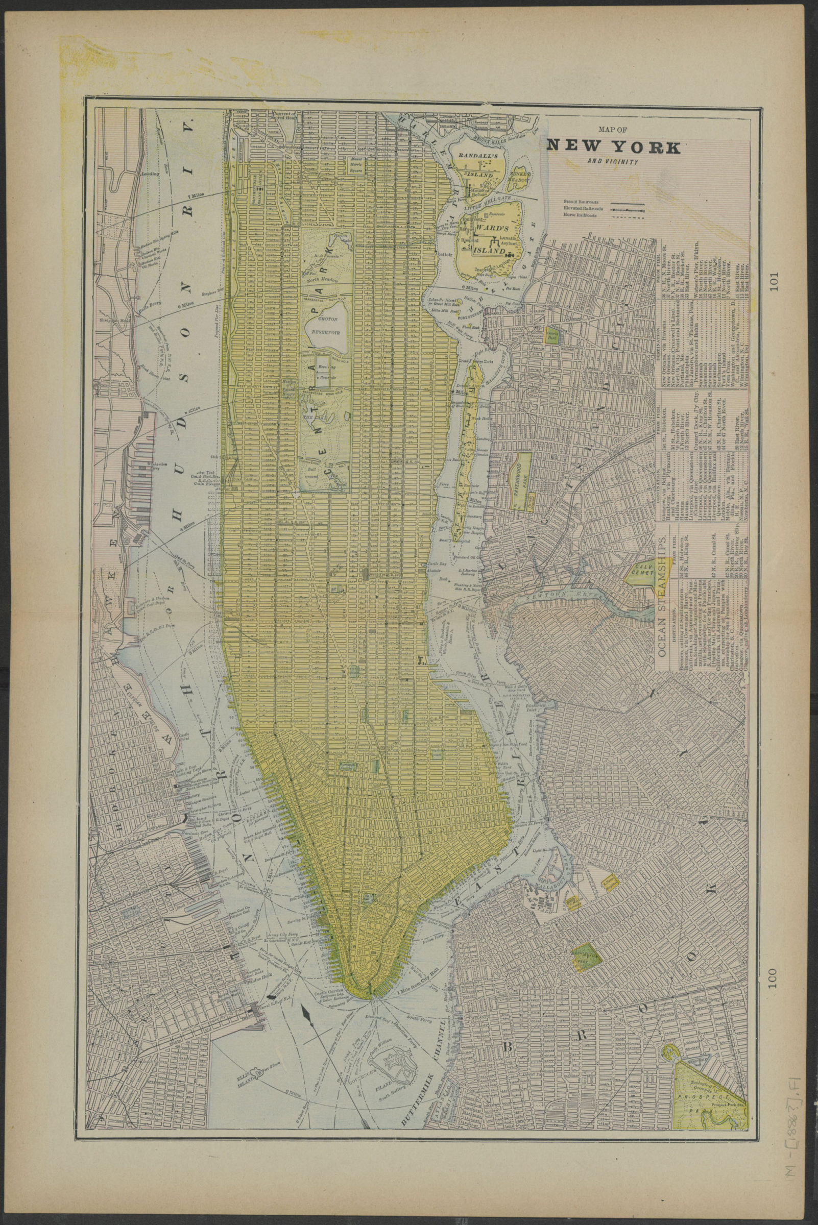
Map of New York and vicinity covers Manhattan Island south of 132nd Street, portions of New Jersey, Queens, and Brooklyn. Shows steam, elevated, and horse railroads. Includes a directory of ocean steamships. Map of Brooklyn covers the City of Brooklyn circa 1886. Shows streets and railroad lines. Includes text for elevated railroad station, Congressional Districts, Senatorial Districts, Assembly Districts, and Aldermanic Districts. Map of Buffalo shows streets. Extracted from an unidentified atlas. On verso: maps of Brooklyn and Buffalo.
Map area shown
Relation
Full catalog recordSize
37 × 56 cmDownload
Low Resolution Image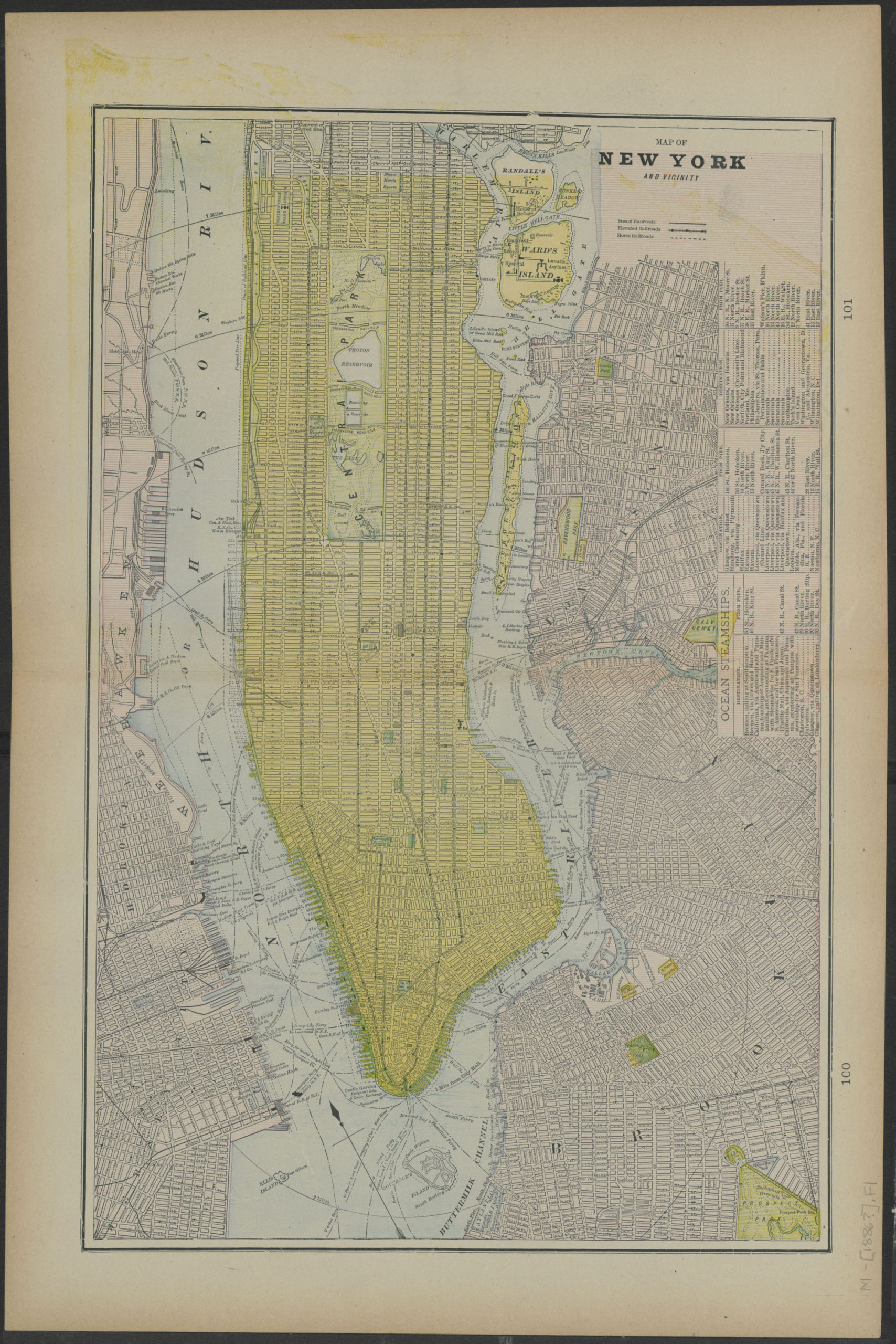
Creator
Publisher
Brooklyn Historical SocietyCitation
Map of New York and vicinity; [1886-1894], Map Collection, M-[1886?].Fl; Brooklyn Historical Society.Scale
Scale not givenLoading zoom image... 