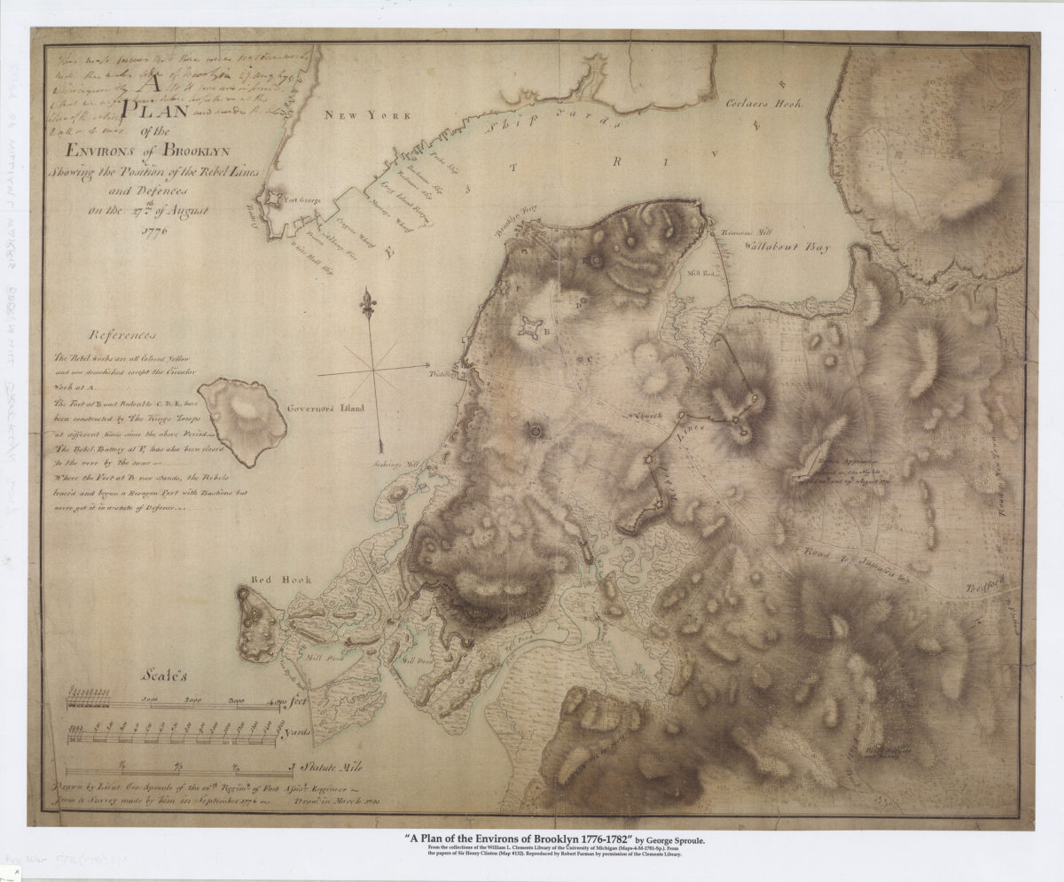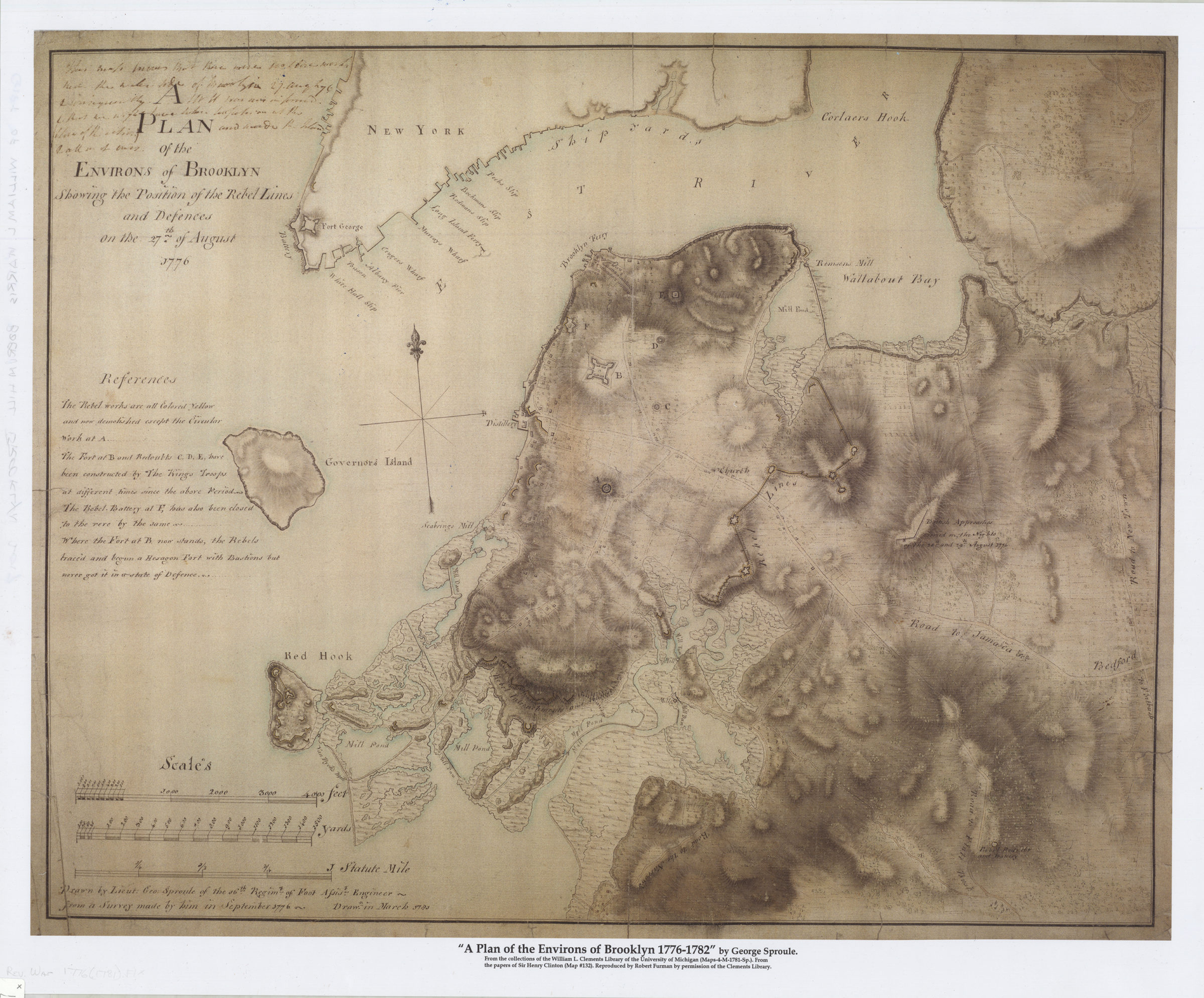
A plan of the environs of Brooklyn showing the position of the rebel lines and defences on the 27th of August 1776 [2017]
Map No. Rev. War-1776 (1781).Fl
Below scale bars at lower left: Drawn by Lieut: Geo: Sproule of the 16th Regimt. of Foot assist. engineer from a survey made by him in September 1776. Drawn in March 1781. Finished, colored, topographical map giving details of the American defenses in Brooklyn and showing the outline of the Manhattan shoreline of the East River. Table of references provides furher information and details of individual fortifications. Notation added by General Henry Clinton at upper left regarding the absence of American fortifications on the water side of Brooklyn.j Facsimile created at a larger scale than the original. Original version is part of the Henry Clinton papers. BHS copy donated by William L. Harris.
Map area shown
Genre
Manuscript mapsRelation
Full catalog recordSize
56 × 70 cmDownload
Low Resolution Image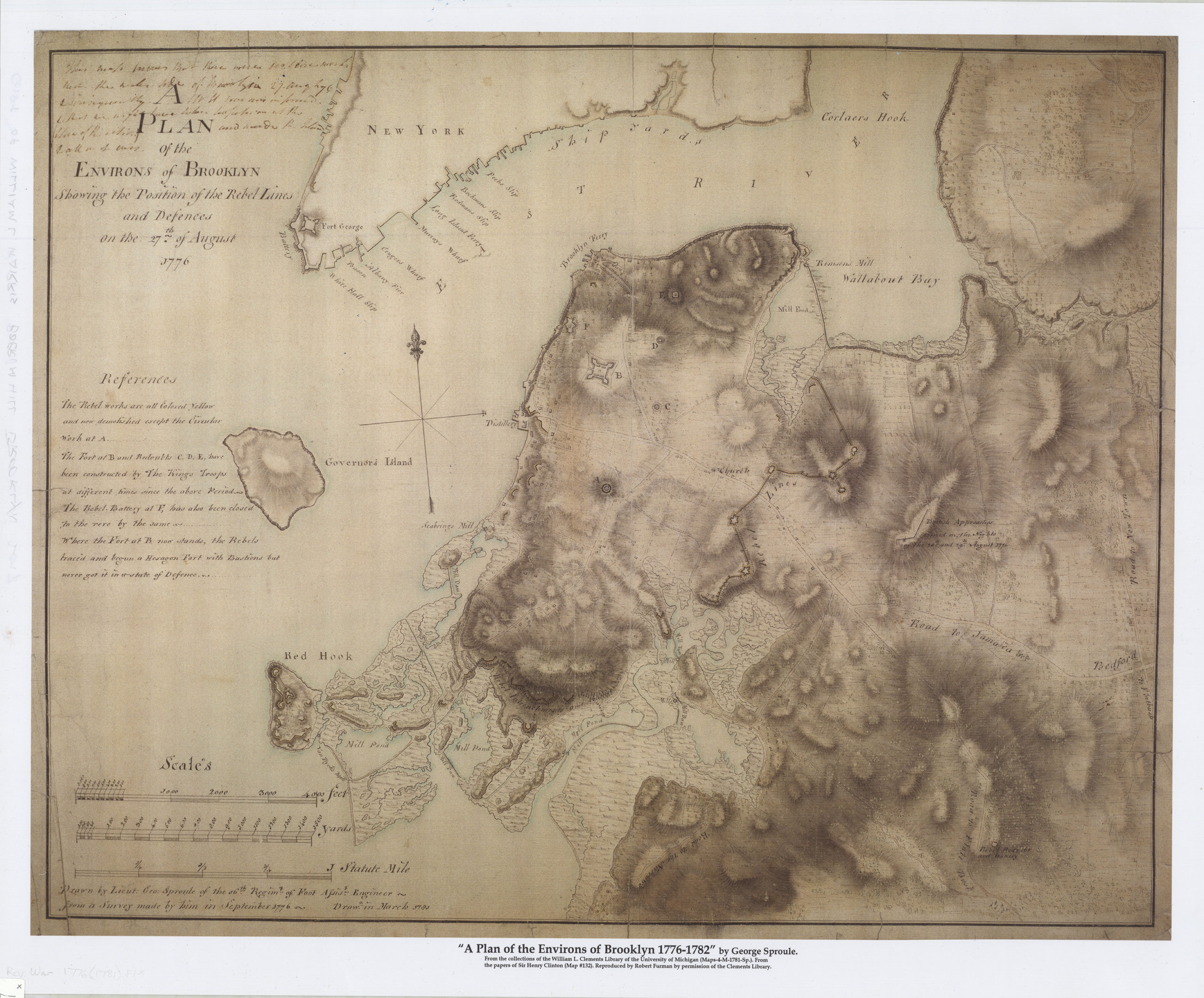
Creator
Sproule, Geo. F.,Publisher
Brooklyn Historical SocietyCitation
A plan of the environs of Brooklyn showing the position of the rebel lines and defences on the 27th of August 1776; [2017], Map Collection, Rev. War-1776 (1781).Fl; Brooklyn Historical Society.Scale
Scale 1:12,000Loading zoom image...