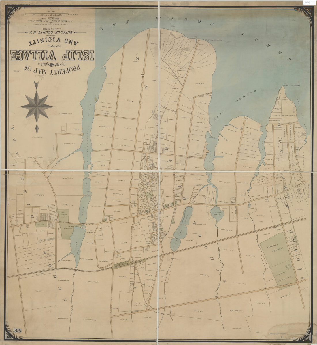
Property map of Islip Village and vicinity: Suffolk County, N.Y.: made from original surveys by Eugene R. Smith, civil engineer, Islip, Suffolk Co. N.Y. [1887]
Map No. L.I.-[1887?].Fl
Cadastral map covering Islip east from Penatayuil Creek to Carlton Ave. and north to approximately Saint Patrick’s Cemetery. Shows property divisions, names of property owners, churches, cemeteries, school districts, and a portion of the Long Island Railroad, Montauk Division. “Corrected to 1887.”
Map area shown
Genre
Cadastral mapsRelation
Full catalog recordSize
97 × 89 cmDownload
Low Resolution Image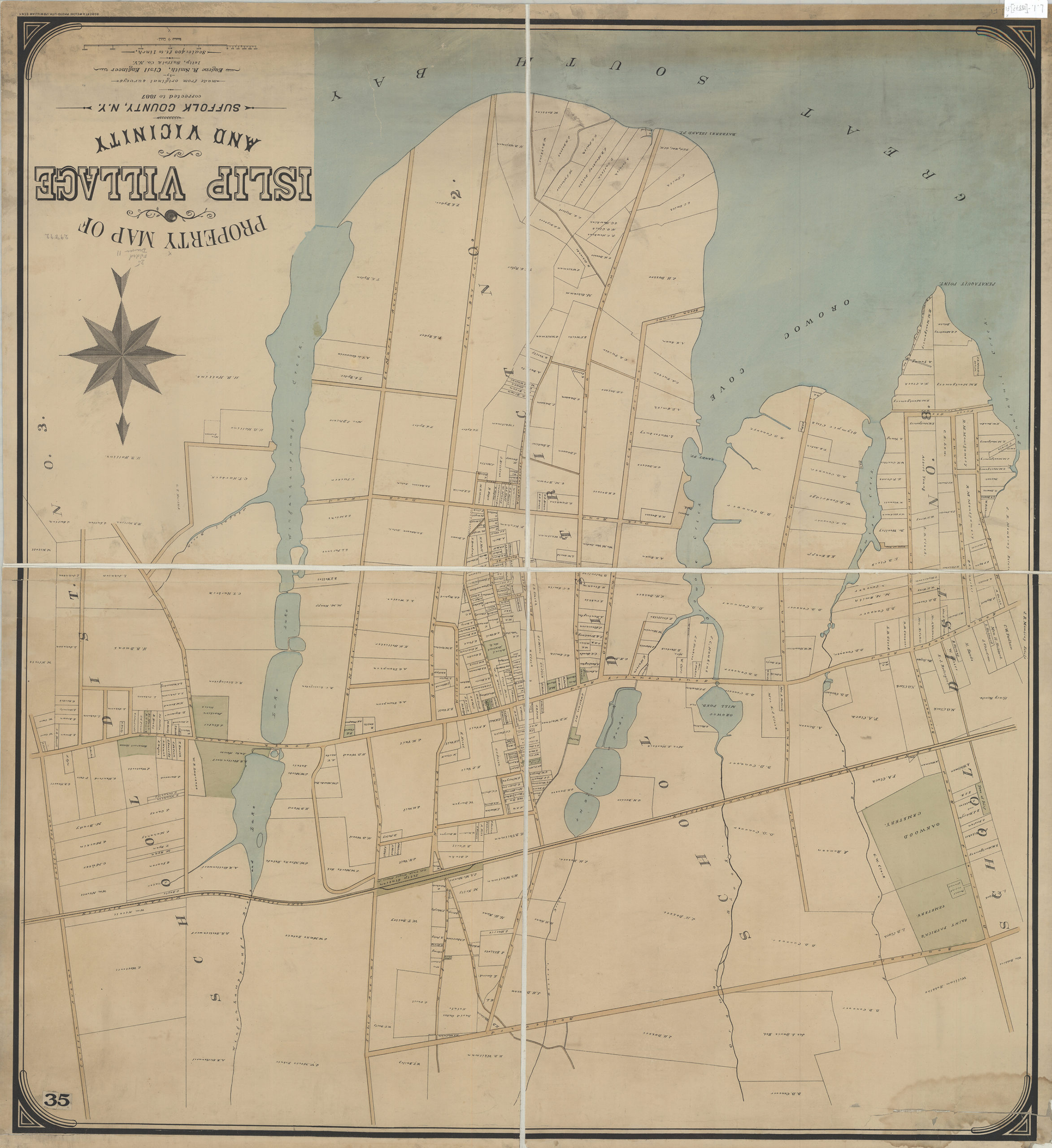
Creator
Smith, Eugene R.,Publisher
Brooklyn Historical SocietyCitation
Property map of Islip Village and vicinity: Suffolk County, N.Y.: made from original surveys by Eugene R. Smith, civil engineer, Islip, Suffolk Co. N.Y.; [1887], Map Collection, L.I.-[1887?].Fl; Brooklyn Historical Society.Scale
Scale [1:4,800] 1 in to 4Loading zoom image...