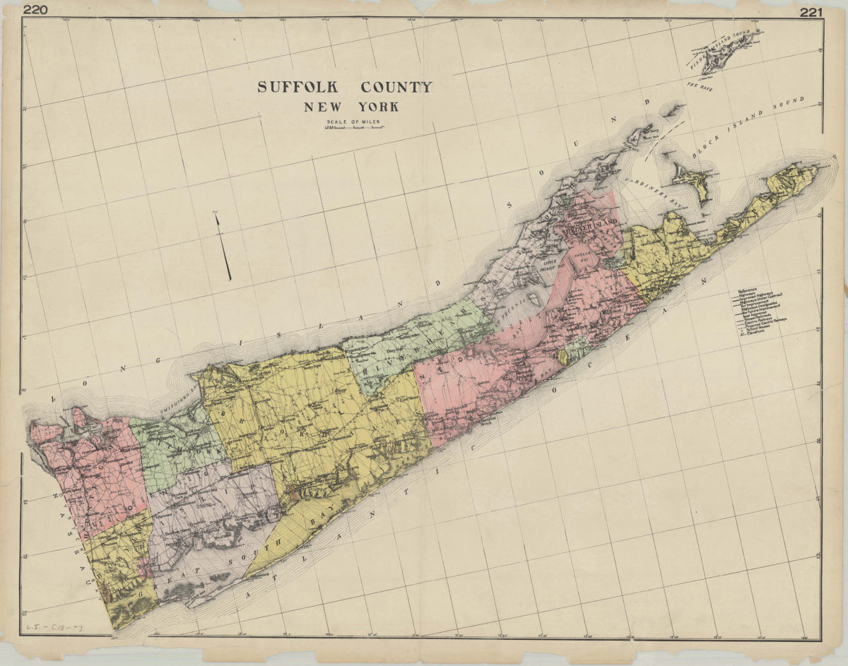
Suffolk County, New York [189?]
Map No. L.I.-[189-?].Fl
Shows highways, steam railroads, electric railways, schools, and hospitals. Relief shown by spot heights.
Map area shown
Genre
MapRelation
Full catalog recordSize
56 × 72 cmDownload
Low Resolution Image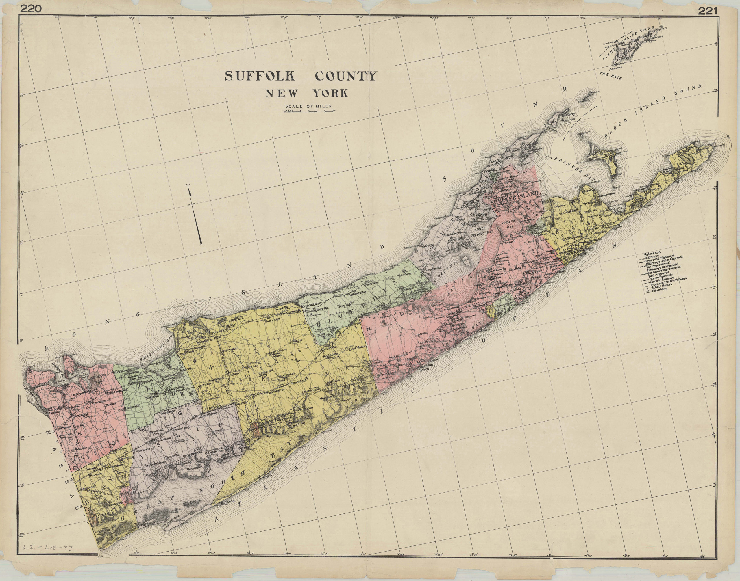
Creator
Publisher
Brooklyn Historical SocietyCitation
Suffolk County, New York; [189?], Map Collection, L.I.-[189-?].Fl; Brooklyn Historical Society.Scale
Scale [ca. 1:187,733]Loading zoom image...