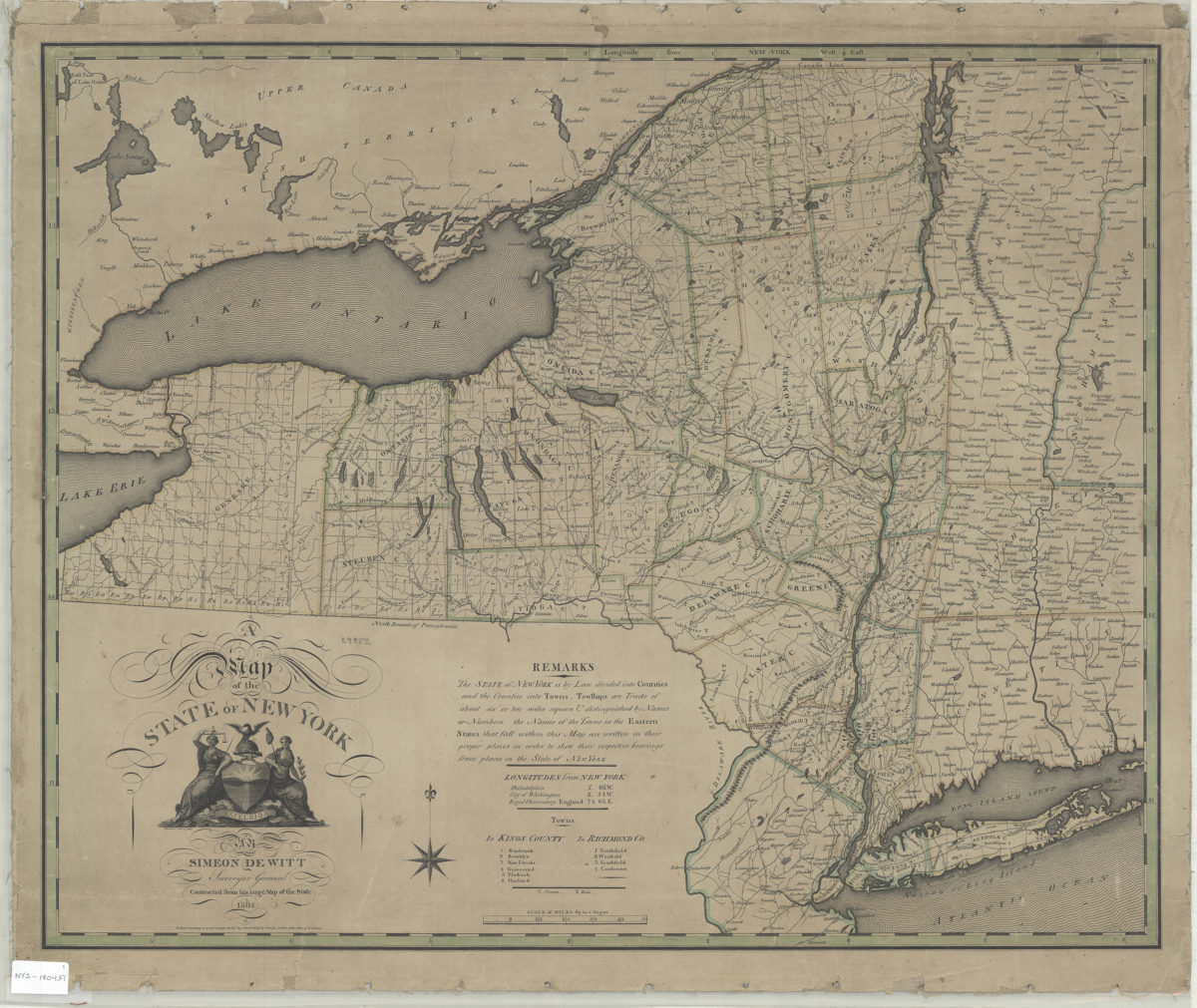
A map of the state of New York: Simeon DeWitt, surveyor general 1804
Map No. NYS-1804.Fl
Shows county and town boundaries. Relief shown pictorially. “Contracted from his large map of the state.” “Entered according to Act of Congress the 19th day March 1804 by Simeon DeWitt of the state of New York.” Includes text, decorative cartouche, longitudes from New York, and index to towns in Kings and Richmond counties. BHS copy mounted on linen.
Places
Map area shown
Genre
MapRelation
Full catalog recordSize
57 × 70 cmDownload
Low Resolution Image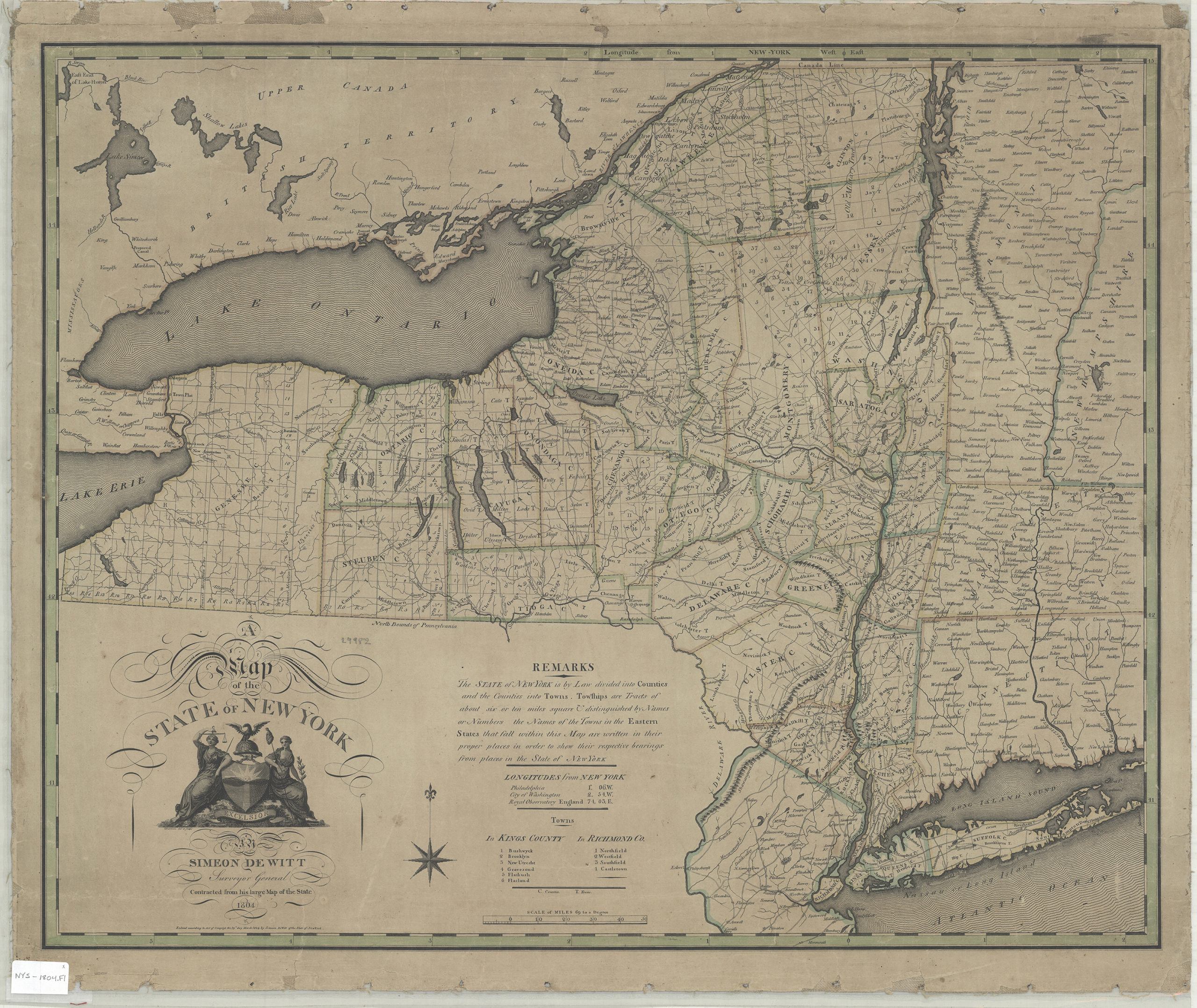
Creator
De Witt, Simeon,Publisher
Brooklyn Historical SocietyCitation
A map of the state of New York: Simeon DeWitt, surveyor general; 1804, Map Collection, NYS-1804.Fl; Brooklyn Historical Society.Scale
Scale [1:950,000] 69 to aLoading zoom image...