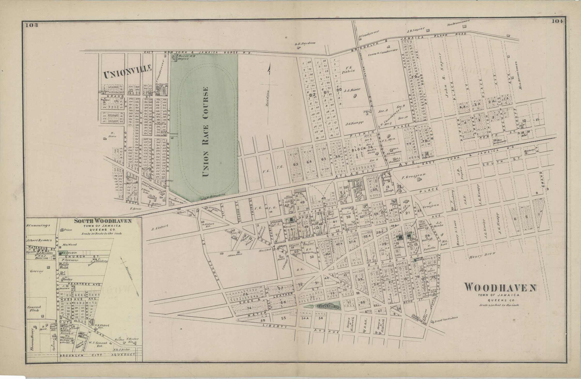
Woodhaven, town of Jamaica, Queens Co [1873]
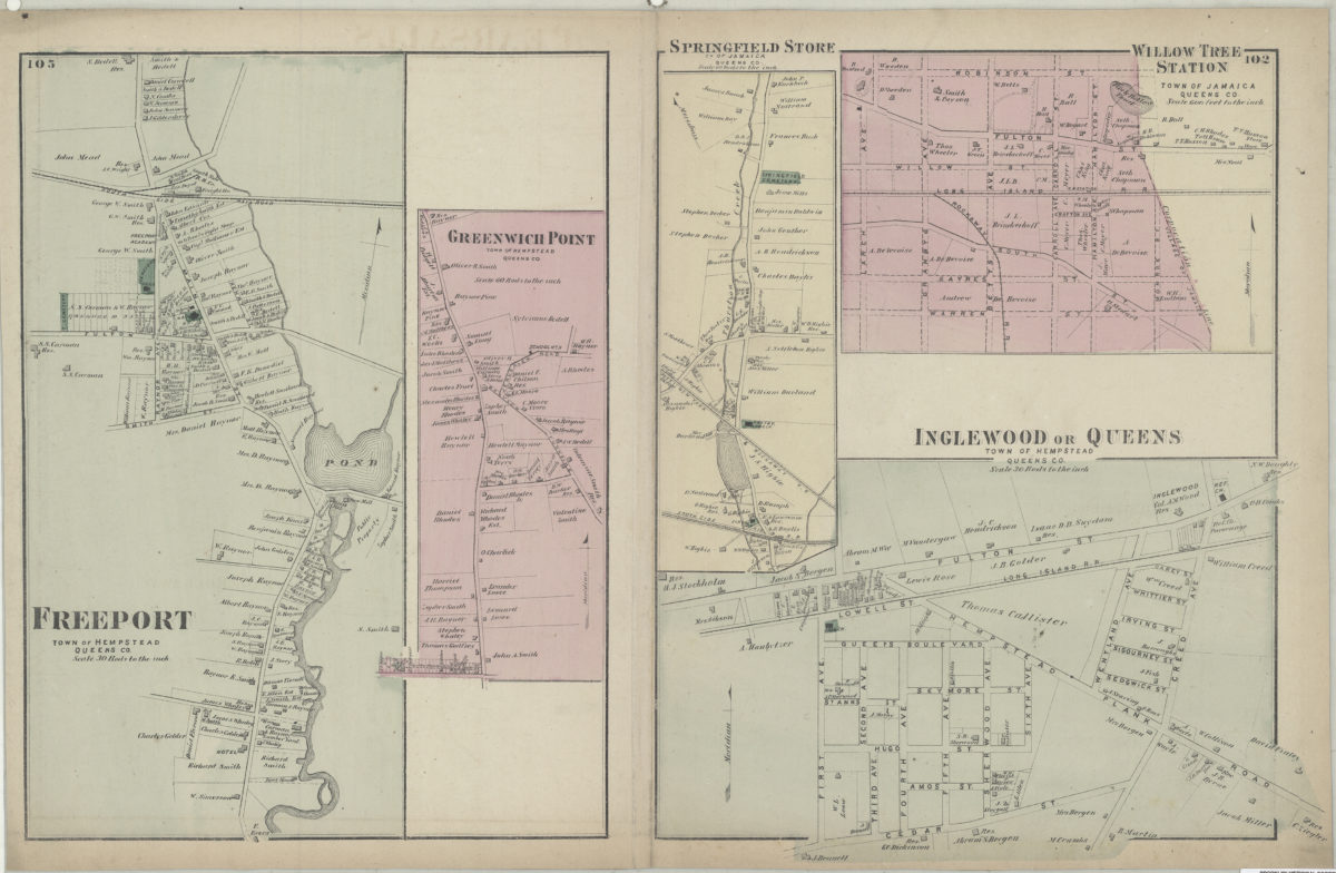
Cadastral map. Covers area north from Liberty Ave. to the Brooklyn & Jamaica Plank Rd. and east from Grand St. to Wyckoff Ave. Shows property (including lot numbers and buildings), names of landowners, schools, churches, railroads, and the Union Race Course. Extracted from: Atlas of Long Island, New York. New York : Beers, Comstock & Cline, 1873, p. 102-105. Includes inset. Inset: South Woodhaven, town of Jamaica, Queens Co. (Scale [1:5,940]. 30 rods to the in.). On verso: 5 ancillary maps. Ancillary maps: Freeport, town of Hempstead, Queens Co. (Scale [1:5,940]. 30 rods to the in.) — Greenwich Point, town of Hempstead, Queens Co. (Scale [1:11,880]. 60 rods to the in.) — Springfield Store, tn. of Jamaica, Queens Co. (Scale [1:11,880]. 60 rods to the in.) — Willow Tree Station, town of Jamaica, Queens Co. (Scale [1:7,200]. 600 ft. to the in.) — Inglewood or Queens, town of Hempstead, Queens Co. (Scale [1:5,940]. 30 rods to the in.).
Subjects
Places
Map area shown
Genre
Cadastral mapsRelation
Full catalog recordSize
34 × 54 cmDownload
Low Resolution Image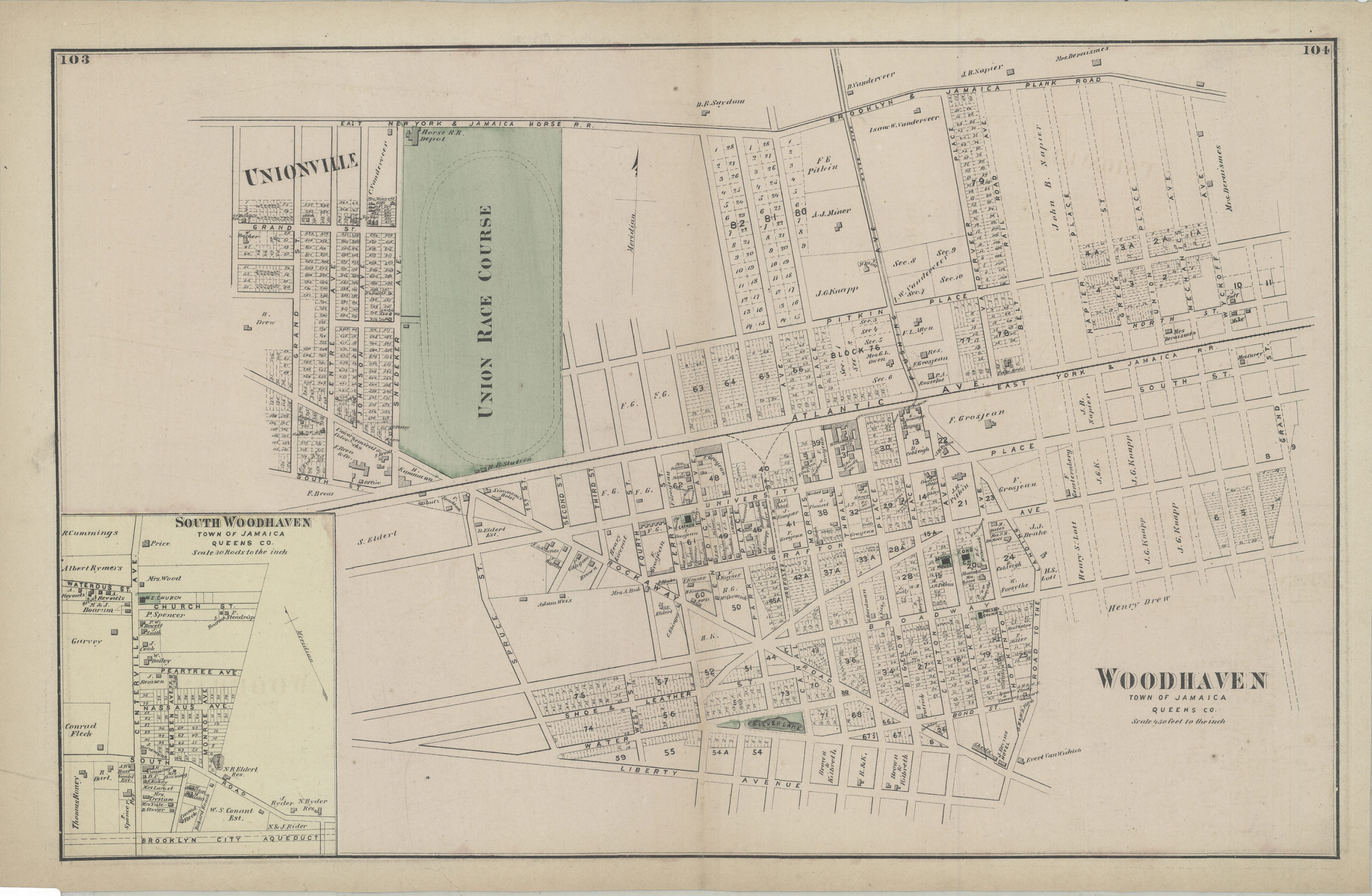
Creator
Beers, F. W.; Beers, Comstock & Cline,Publisher
Brooklyn Historical SocietyCitation
Woodhaven, town of Jamaica, Queens Co; [1873], Map Collection, Q-[1873]g.Fl; Brooklyn Historical Society.Scale
Scale [1:5,400] 1 in to 4