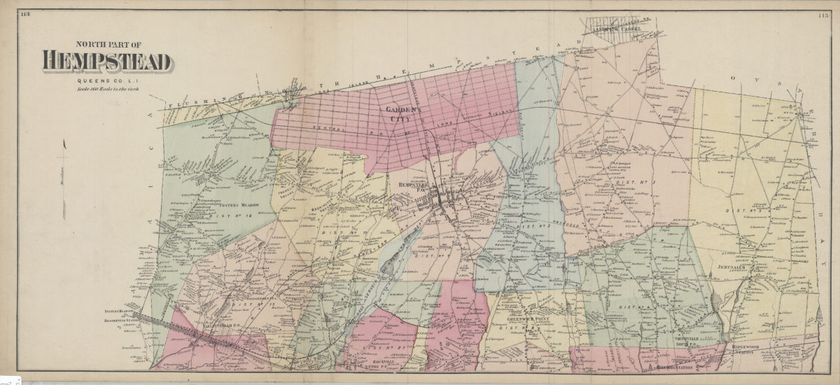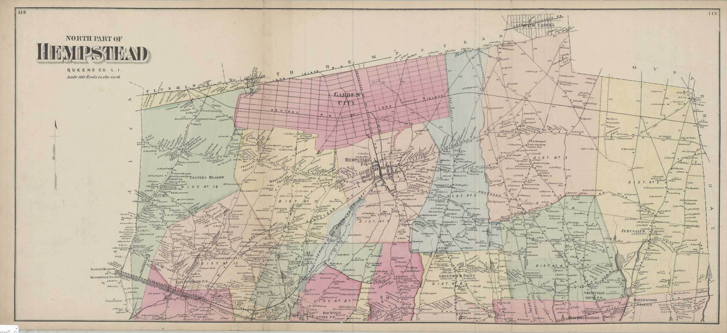

North part of Hempstead, Queens Co., L.I. [1873]
Map No. L.I.-[1873]c.Fl
Covers area north from Ridgewood Station to New Cassel and east from Brookfield Station to Oyster Bay (modern-day Nassau County, not Queens County). Shows names of landowners, railroads, and the Ridgewood Aqueduct. Extracted from: Atlas of Long Island, New York. New York : Beers, Comstock & Cline, 1873. “113”–Upper left corner. “115”–Upper right corner.
Map area shown
Genre
MapRelation
Full catalog recordSize
35 × 78 cmDownload
Low Resolution Image
Creator
Beers, F. W.; Beers, Comstock & Cline,Publisher
Brooklyn Historical SocietyCitation
North part of Hempstead, Queens Co., L.I.; [1873], Map Collection, L.I.-[1873]c.Fl; Brooklyn Historical Society.Scale
Scale [1:31,680] 1 in toLoading zoom image...