Center for Brooklyn History
Map Collections
Search
About
Othmer Library & Archives
Submit search query
Refine 8 records
Clear filters
3
Location
Fairfield County (Conn.)
5
Hempstead (N.Y.)
13
Long Island (N.Y.)
197
Nassau County (N.Y.)
24
New York (State)
95
North Hempstead (N.Y. : Town)
4
Oyster Bay (N.Y.)
9
Queens (New York, N.Y.)
83
Westchester County (N.Y.)
11
Subject
Date
20th Century
469
or enter range:
from
to
Genres
Bathymetric maps
94
Topographic maps
70
Sort by:
Date (earliest)
Date (most recent)
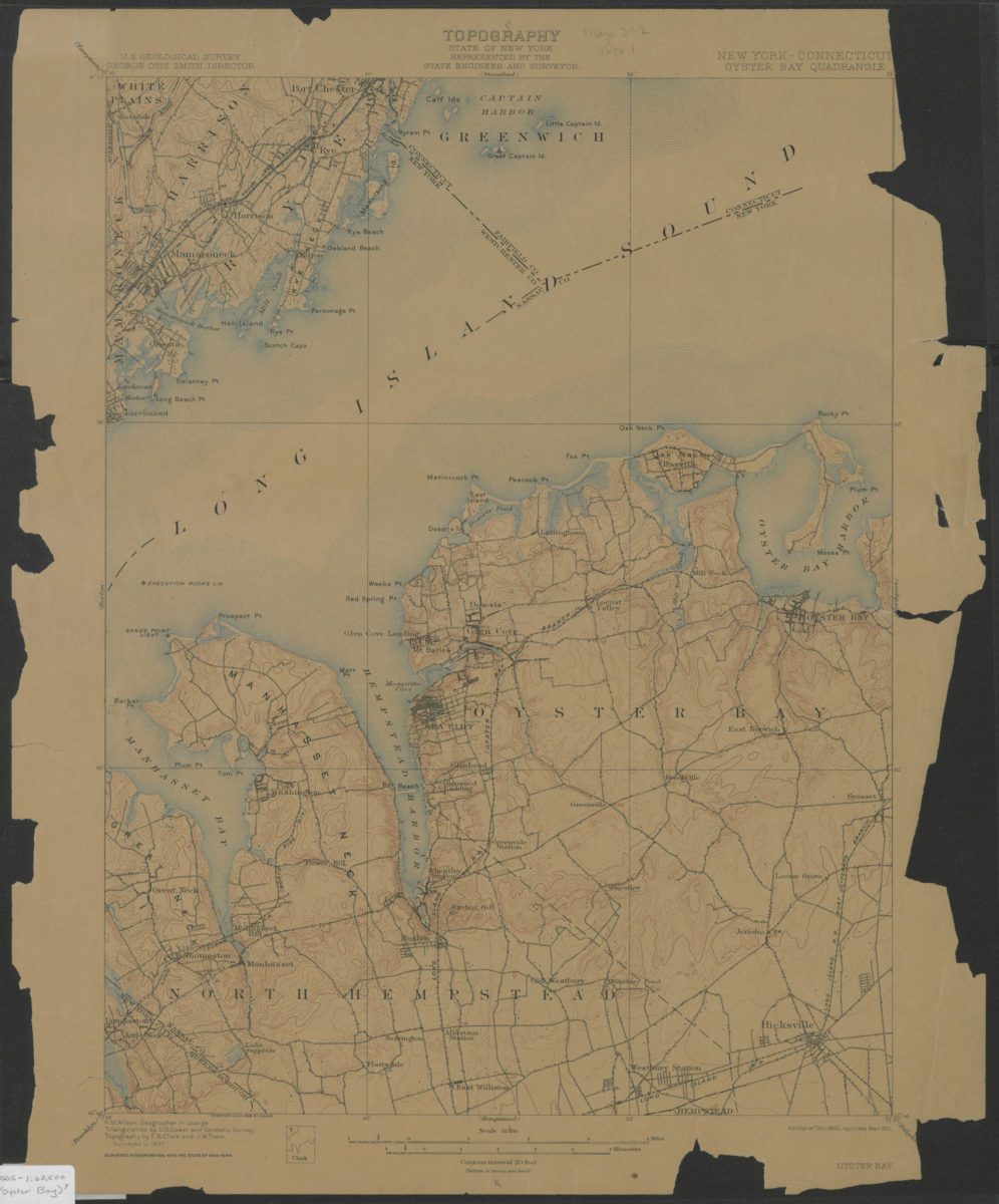
Oyster Bay quadrangle, New York – Connecticut: U.S. Geological Survey
Oyster Bay quadrangle, New York – Connecticut: U.S. Geological Survey
1900; 1911
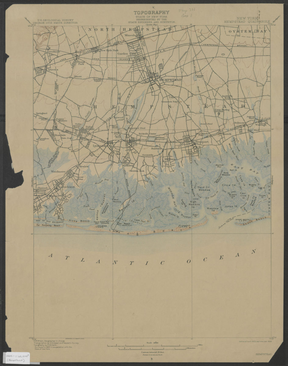
Hempstead quadrangle, New York: U.S. Geological Survey
Hempstead quadrangle, New York: U.S. Geological Survey
1903; 1909
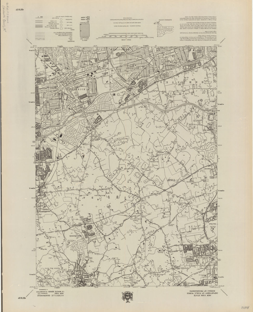
Hicksville quadrangle, New York–Nassau Co
Hicksville quadrangle, New York–Nassau Co
[1966]
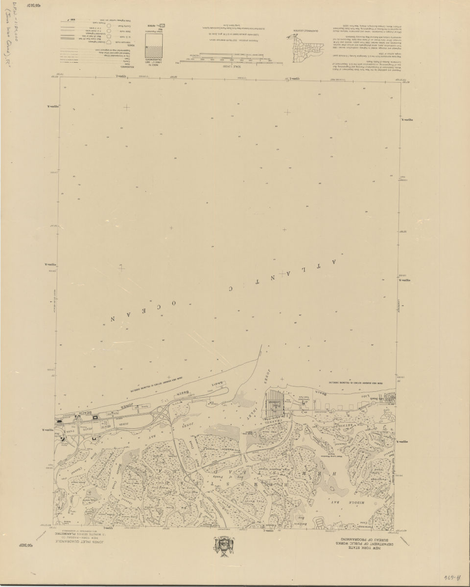
Jones Inlet quadrangle, New York–Nassau Co
Jones Inlet quadrangle, New York–Nassau Co
[1966]
Lawrence quadrangle, New York
Lawrence quadrangle, New York
[1966]
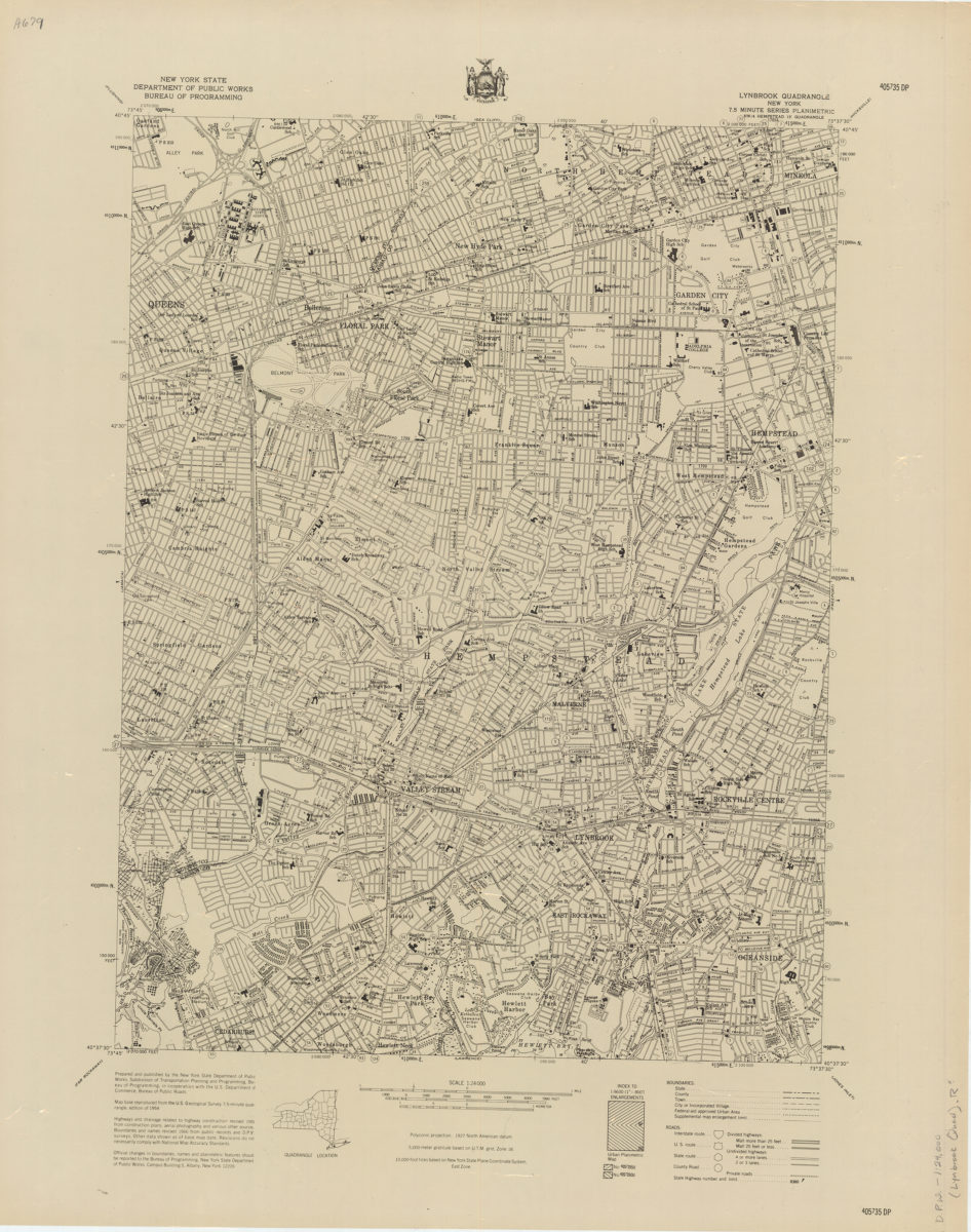
Lynbrook quadrangle, New York
Lynbrook quadrangle, New York
[1966]
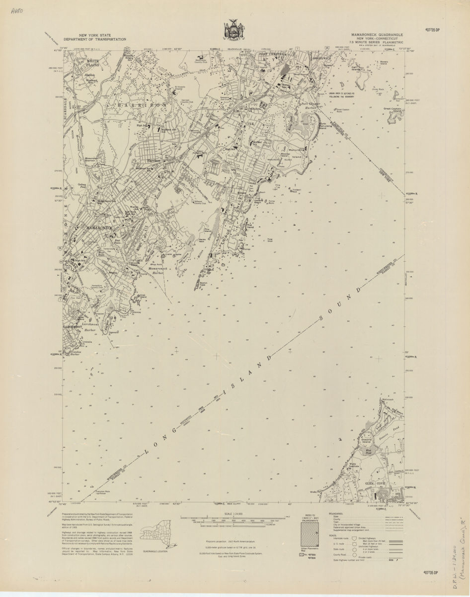
Mamaroneck quadrangle, New York–Connecticut
Mamaroneck quadrangle, New York–Connecticut
[1968]
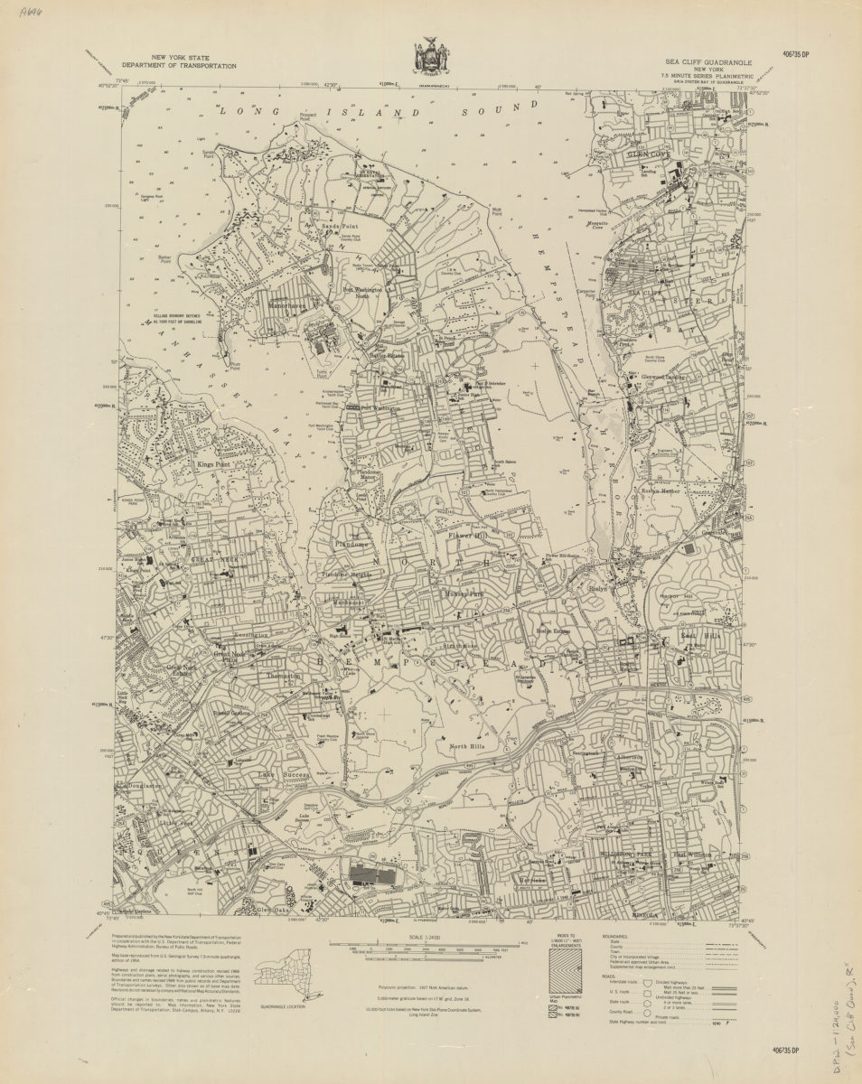
Sea Cliff quadrangle, New York
Sea Cliff quadrangle, New York
[1968]