Center for Brooklyn History
Map Collections
Search
About
Othmer Library & Archives
Submit search query
Refine 3 records
Clear filters
2
Location
Bensonhurst (New York, N.Y.)
17
Brighton Beach (New York, N.Y.)
4
Brooklyn (New York, N.Y.)
891
Coney Island (New York, N.Y.)
22
Gravesend (New York, N.Y.)
25
Manhattan Beach (New York, N.Y.)
2
Midwood (New York, N.Y.)
9
Sea Gate (New York, N.Y.)
7
Sheepshead Bay (New York, N.Y.)
13
Subject
Election districts
36
Landowners
434
Real property
619
Date
20th Century
469
or enter range:
from
to
Genres
Cadastral maps
597
Zoning maps
55
Sort by:
Date (earliest)
Date (most recent)
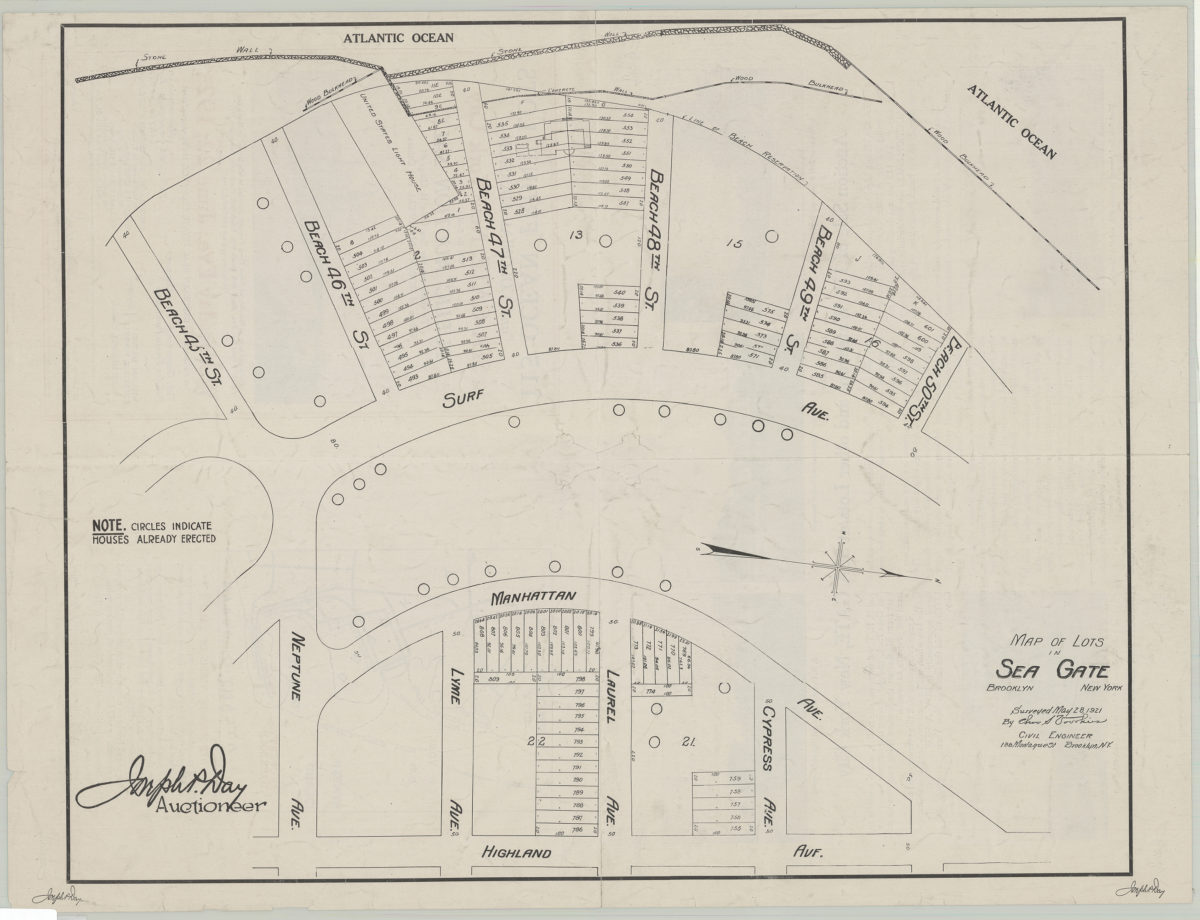
Map of lots in Sea Gate: surveyed May 28, 1921 by Cha[rle]s S. Voorhies
Map of lots in Sea Gate: surveyed May 28, 1921 by Cha[rle]s S. Voorhies
1921
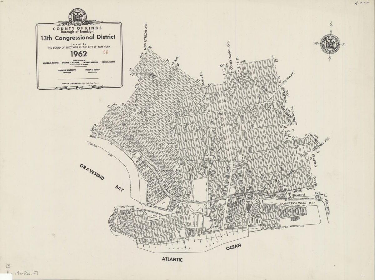
County of Kings, Borough of Brooklyn, 13th Congressional District: issued by the Board of Elections in the City of New York
County of Kings, Borough of Brooklyn, 13th Congressional District: issued by the Board of Elections in the City of New York
1962
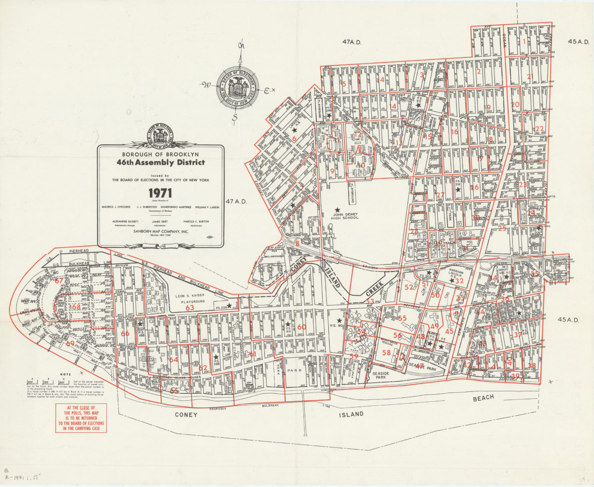
Borough of Brooklyn 46th Assembly District, 1971: issued by the Board of Elections in the City of New York
Borough of Brooklyn 46th Assembly District, 1971: issued by the Board of Elections in the City of New York
1971