Center for Brooklyn History
Map Collections
Search
About
Othmer Library & Archives
Submit search query
Refine 4 records
Clear filters
5
Location
Bay Ridge (New York, N.Y.)
108
Brooklyn (New York, N.Y.)
891
Flatbush (New York, N.Y.)
35
New Utrecht (New York, N.Y.)
9
Prospect Lefferts Gardens (Brooklyn, New York, N.Y.)
16
Prospect Park South (New York, N.Y.)
8
Subject
Landowners
434
Real property
619
Date
19th Century
945
20th Century
469
or enter range:
from
to
Genres
Cadastral maps
597
Manuscript maps
365
Sort by:
Date (earliest)
Date (most recent)
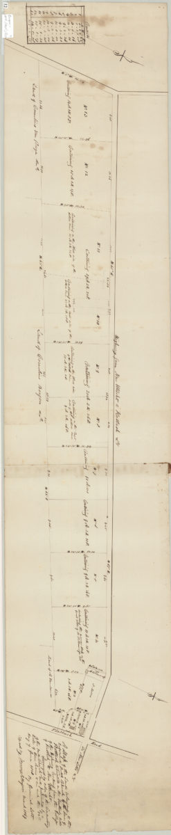
A map of the land belonging to the Reformed Dutch Church by the … [text illegible] of Flatbush, situated in the southerly side of the highway leading from the village of Flatbush to New Utrecht: 12th day of June 1828:
A map of the land belonging to the Reformed Dutch Church by the … [text illegible] of Flatbush, situated in the southerly side of the highway leading from the village of Flatbush to New Utrecht: 12th day of June 1828:
March 1869
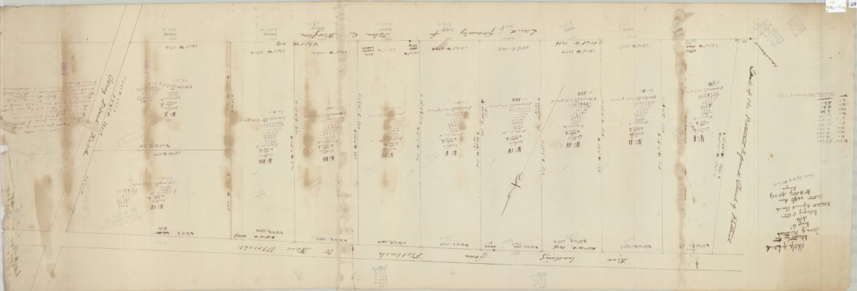
Map of land situated in the town of Flatbush, Kings Co. belonging to the Protestant Reformed Church contains 44 46/100 acres: Wm. H. Story, Apl. 1869, surveyor [drawn by T.G. Bergen]
Map of land situated in the town of Flatbush, Kings Co. belonging to the Protestant Reformed Church contains 44 46/100 acres: Wm. H. Story, Apl. 1869, surveyor [drawn by T.G. Bergen]
1869
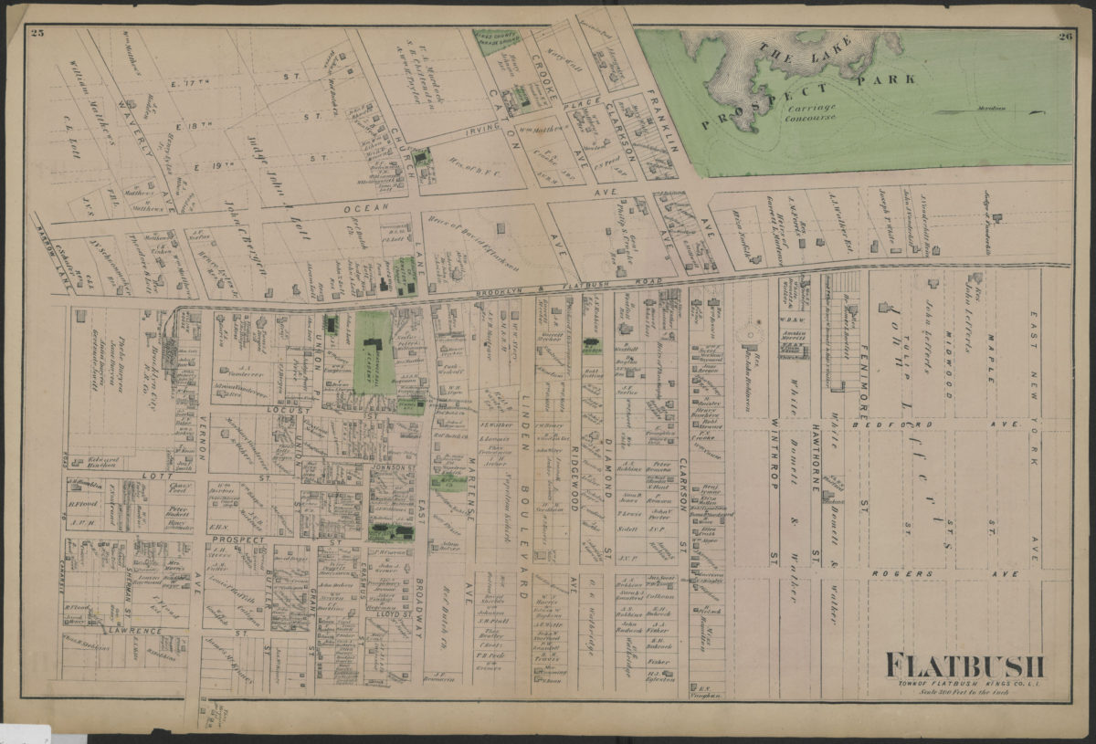
Flatbush, town of Flatbush, Kings Co., L.I.
Flatbush, town of Flatbush, Kings Co., L.I.
[1873]
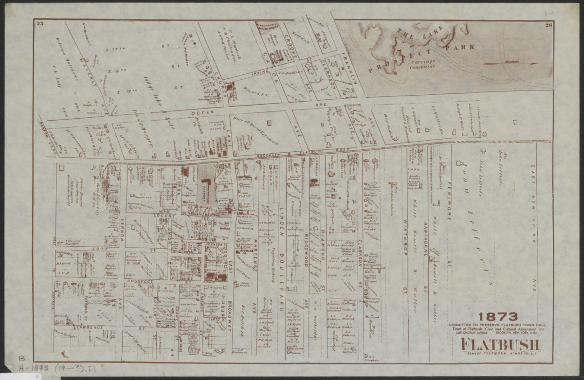
Flatbush, town of Flatbush, Kings Co., L.I.
Flatbush, town of Flatbush, Kings Co., L.I.
[19??]