Center for Brooklyn History
Map Collections
Search
About
Othmer Library & Archives
Submit search query
Refine 4 records
Clear filters
3
Location
Brooklyn (New York, N.Y.)
891
Bushwick (New York, N.Y.)
20
Ridgewood (New York, N.Y.)
2
Subject
Landowners
434
Real property
619
Roads
117
Date
19th Century
945
or enter range:
from
to
Genres
Cadastral maps
597
Manuscript maps
365
Sort by:
Date (earliest)
Date (most recent)
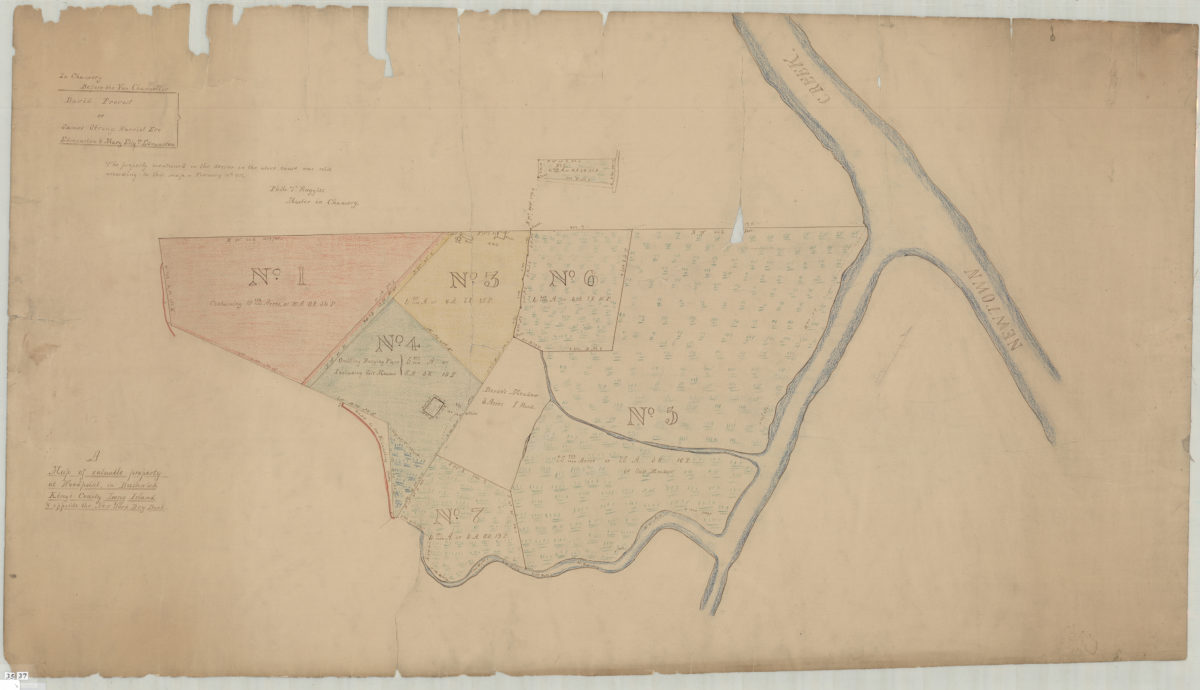
A map of valuable property at Woodpoint, in Bushwick, Kings County, Long Island & opposite the New York Dry Dock
A map of valuable property at Woodpoint, in Bushwick, Kings County, Long Island & opposite the New York Dry Dock
[1836]
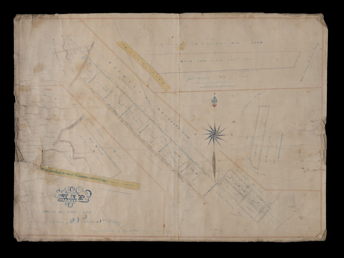
Map of farm and other pieces of land belonging to the estate of Nicholas N. Wyckoff: surveyed and delineated by Benjamn. F. Willets, Flushings [sic], L.I. surveyor
Map of farm and other pieces of land belonging to the estate of Nicholas N. Wyckoff: surveyed and delineated by Benjamn. F. Willets, Flushings [sic], L.I. surveyor
December 1847
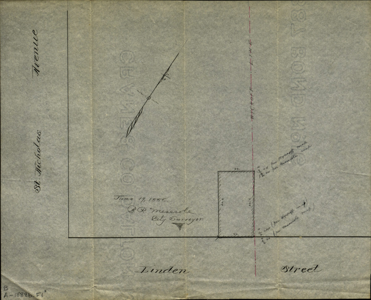
[Map of corner of Linden Street and St. Nicholas Avenue]
[Map of corner of Linden Street and St. Nicholas Avenue]
1888
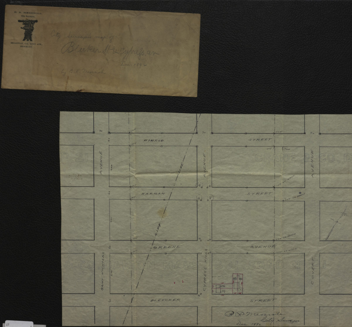
City surveyor’s map of Bleeker [i.e. Bleecker] St. & Cypress Av.: B.R. Meserole city surveyor
City surveyor’s map of Bleeker [i.e. Bleecker] St. & Cypress Av.: B.R. Meserole city surveyor
December 1892