Center for Brooklyn History
Map Collections
Search
About
Othmer Library & Archives
Submit search query
Refine 1 records
Clear filters
7
Location
Brooklyn (New York, N.Y.)
891
Williamsburg (New York, N.Y.)
36
Subject
Landowners
434
Real property
619
Streets
46
Date
19th Century
945
or enter range:
from
to
Genres
Cadastral maps
597
Manuscript maps
365
Sort by:
Date (earliest)
Date (most recent)
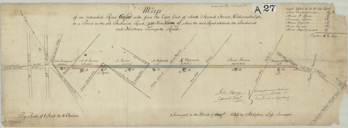
Map of an intended road 60 feet wide, from the east end of South Second Street, Williamsburgh, to a point on the old Bushwick Road, 940 feet north of where the said road interesects the Bushwick and Newtown Turnpike Road: surveyed by Adolphus Lofs
Map of an intended road 60 feet wide, from the east end of South Second Street, Williamsburgh, to a point on the old Bushwick Road, 940 feet north of where the said road interesects the Bushwick and Newtown Turnpike Road: surveyed by Adolphus Lofs
August 1830