Center for Brooklyn History
Map Collections
Search
About
Othmer Library & Archives
Submit search query
Refine 3 records
Clear filter
1
Location
Atlantic Coast (North America)
6
Block Island (R.I. : Island)
2
Gardiners Bay (N.Y.)
1
Long Island Sound (N.Y. and Conn.)
12
Subject
Coasts
4
Date
20th Century
469
or enter range:
from
to
Genres
Bathymetric maps
94
Loran charts
3
Nautical charts
30
Sort by:
Date (earliest)
Date (most recent)
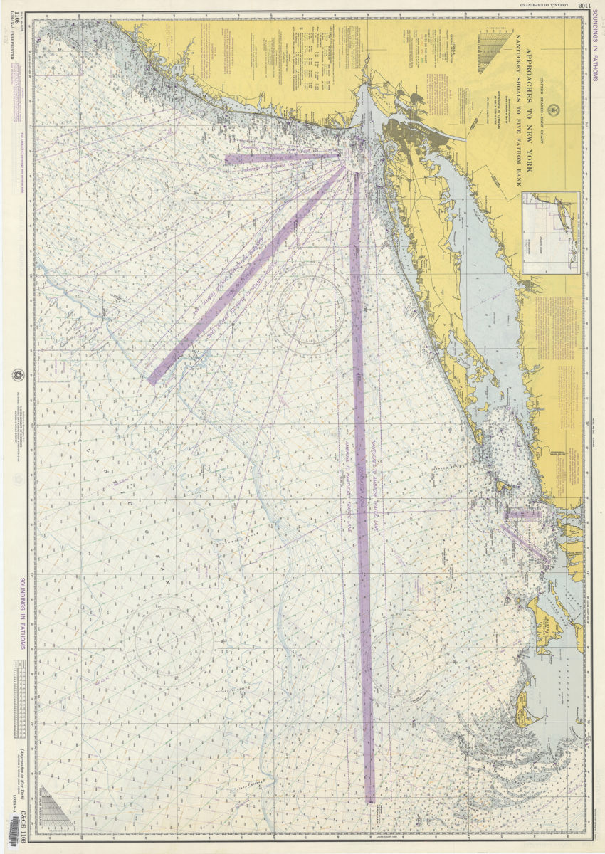
United States–east coast, approaches to New York, Nantucket Shoals to Five Fathom Bank: National Ocean Survey
United States–east coast, approaches to New York, Nantucket Shoals to Five Fathom Bank: National Ocean Survey
1974
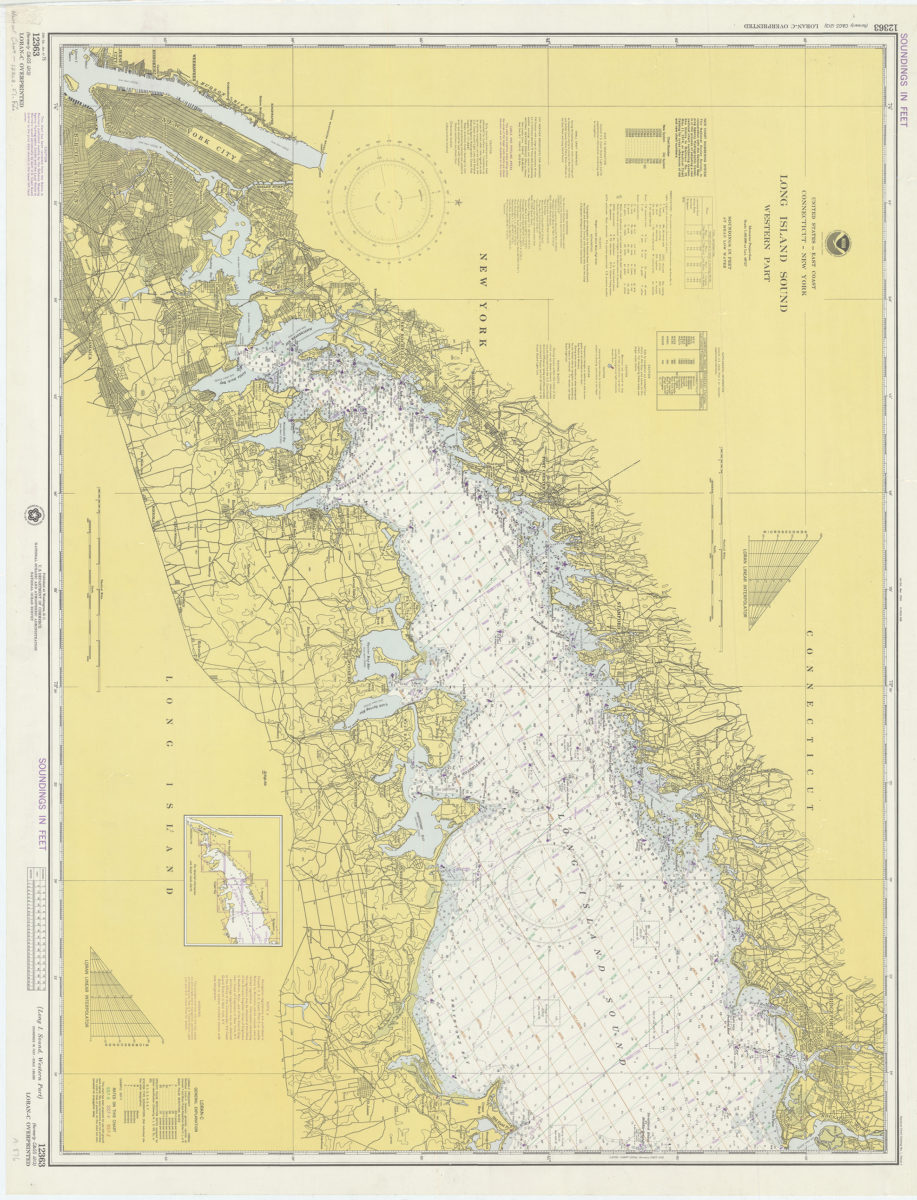
United States–east coast, Connecticut–New York, Long Island Sound – western part: National Ocean Survey
United States–east coast, Connecticut–New York, Long Island Sound – western part: National Ocean Survey
1974
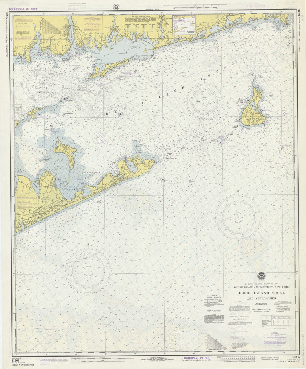
United States–east coast, Rhode Island–Connecticut–New York, Block Island Sound and approaches: National Ocean Survey
United States–east coast, Rhode Island–Connecticut–New York, Block Island Sound and approaches: National Ocean Survey
1974