Center for Brooklyn History
Map Collections
Search
About
Othmer Library & Archives
Submit search query
Refine 2 records
Clear filters
3
Location
Manhattan (New York, N.Y.)
120
New York (N.Y.)
164
Subject
Landowners
434
Real property
619
Date
19th Century
945
20th Century
469
or enter range:
from
to
Genres
Cadastral maps
597
Historical maps
53
Manuscript maps
365
Sort by:
Date (earliest)
Date (most recent)
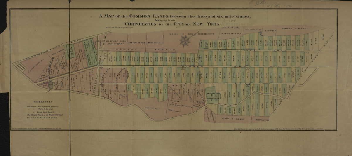
A map of the common lands between the three and six mile stones, belonging to the corporation of the city of New York: Casimer Th. Goerck, city surveyor
A map of the common lands between the three and six mile stones, belonging to the corporation of the city of New York: Casimer Th. Goerck, city surveyor
[1861]
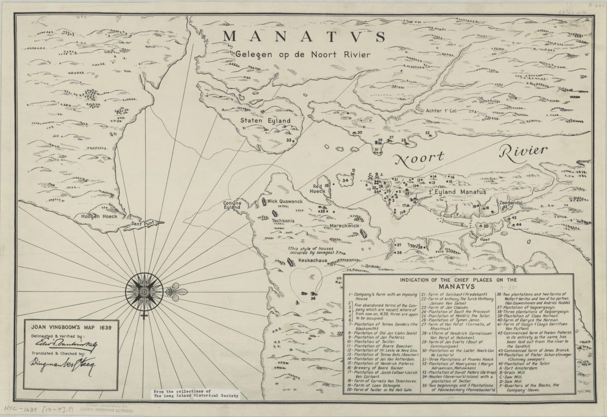
Joan Vingboom’s map 1639
Joan Vingboom’s map 1639
[19??]